Snowfall Report:
The snow showers on Tuesday dropped 2 inches of fresh snow on the upper mountain. That brings the February snowfall total to 49 inches so far, and the season total to 175 inches.
Wednesday System:
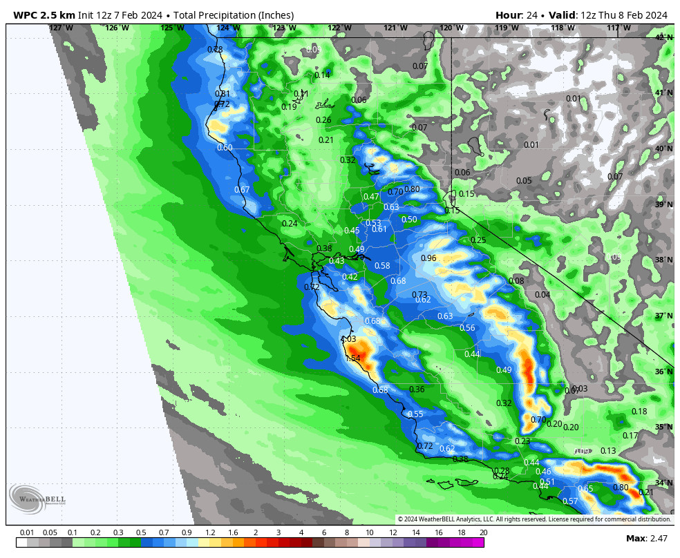
The next system will move down the CA coast on Wednesday with the Sierra on the east side. We will see snow showers through the day and into Wednesday evening before clearing overnight. Highs in the 20s on the upper mountain and near freezing at the base. Ridgetop winds from the west gusting up to 40-50+ mph.
It’s a colder system with snow levels staying below the base and falling below 4000 ft. by Wednesday evening. That will bring snow ratios of around 15:1 on the upper mountains which is some lighter-density snow. We could see 1-4 inches of new snow on the lower mountain and 2-5 inches on the upper mountain by early Thursday morning.
Thursday – Friday Weather:
Two more waves drop into the trough on Thursday and Friday but they are moisture-starved. We will likely see partly sunny skies on both days with a few scattered snow showers possible. But not expecting more than a dusting of snow on both days for most areas. Highs in the 30s for the lower elevations and 20s for the upper mountain.
The Weekend:
High pressure starts to build in over the weekend. We should see mostly sunny skies with highs in the 30s. That should make for beautiful weekend weather, and the conditions are much better with all of the new snow that has fallen this week.
Long-Range Forecast:
High pressure is forecast to remain over the region through the week of the 12th. It is on the weaker side over CA so a few models try to sneak it some light showers during the week. But overall it looks like we will stay dry through at least the end of next week. Highs in the 30s on the mountain and getting into the low 40s for the lower elevations near the base.
The start of President’s weekend looks dry right now but the pattern is changing over the weekend of the 17th-19th. Storms could reach CA by the 19th with a stormier pattern expected for the week of the 19th. So we’ll have to watch closely as return travel from the holiday weekend could be impacted.
The long-range models suggest that the storm door could remain open into the last week of February. They continue to show above-average precipitation for most of CA starting around the 19th through at least the 23rd.
This is a similar pattern as the one we saw during the 3rd week of January and the first week of February, so we will likely see milder storms tracking straight in off of the Pacific and tapping some subtropical moisture at times. That means dealing with snow level issues like we’ve had to do most of the season. We’ll continue to watch the trends closely as we get closer…
BA


