Monday – Friday Weather:
We will have mostly sunny days with highs into the 50s through Friday and even breaking 60 degrees down near the base by Thursday – Friday.
Saturday Storm:
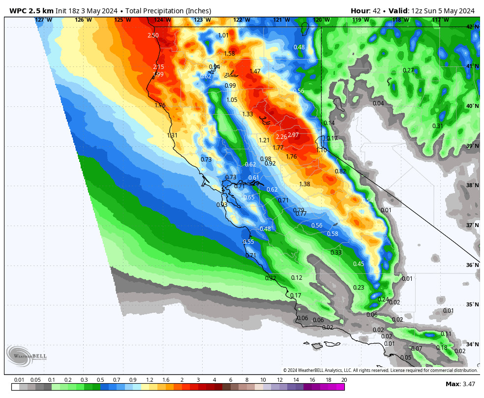
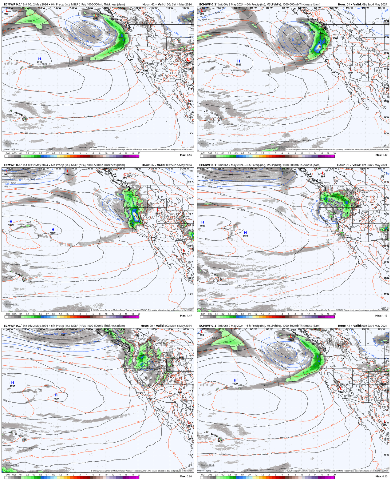
In my last post on Friday, I talked about the cold trough digging in again for the upcoming weekend opening the storm door, but there were no storms showing up yet. That changed over the weekend as the GFS and Canadian models are now dropping a low-pressure system south into CA on Saturday.
Today was supposed to be my last forecast post of the ski season, but this storm is interesting enough for me to update again later this week if this storm takes a track more toward the GFS model.
If it stays north then snow levels likely stay above 7000-7500 ft. with a few rain and high-elevation snow showers. If the center of the low drops south down the West side of the Sierra it could bring a period of heavier snow Saturday night with snow levels falling below the base, and a few-several inches of snow for the mountain.
It will be cooler on Saturday with highs in the 40s on the mountains and 50s for the lower elevations, and the winds could crank up from the south-southwest with ridgetop gusts up to 70-80+ mph, so the upper mountain lifts may be closed on Saturday.
Long-Range Forecast:
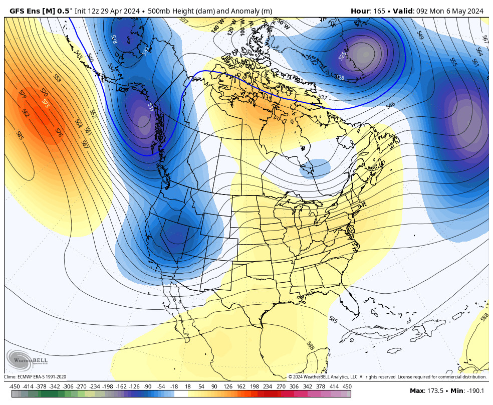
The storm is forecast to clear out on Sunday with a drier pattern forecast for the week of the 6th. The trough is still around the West so highs may not warm too much right away.
The long-range models show high-pressure building in over CA during the 2nd week of May, which may continue the dry pattern along with allowing temperatures to warm even more.
BA


