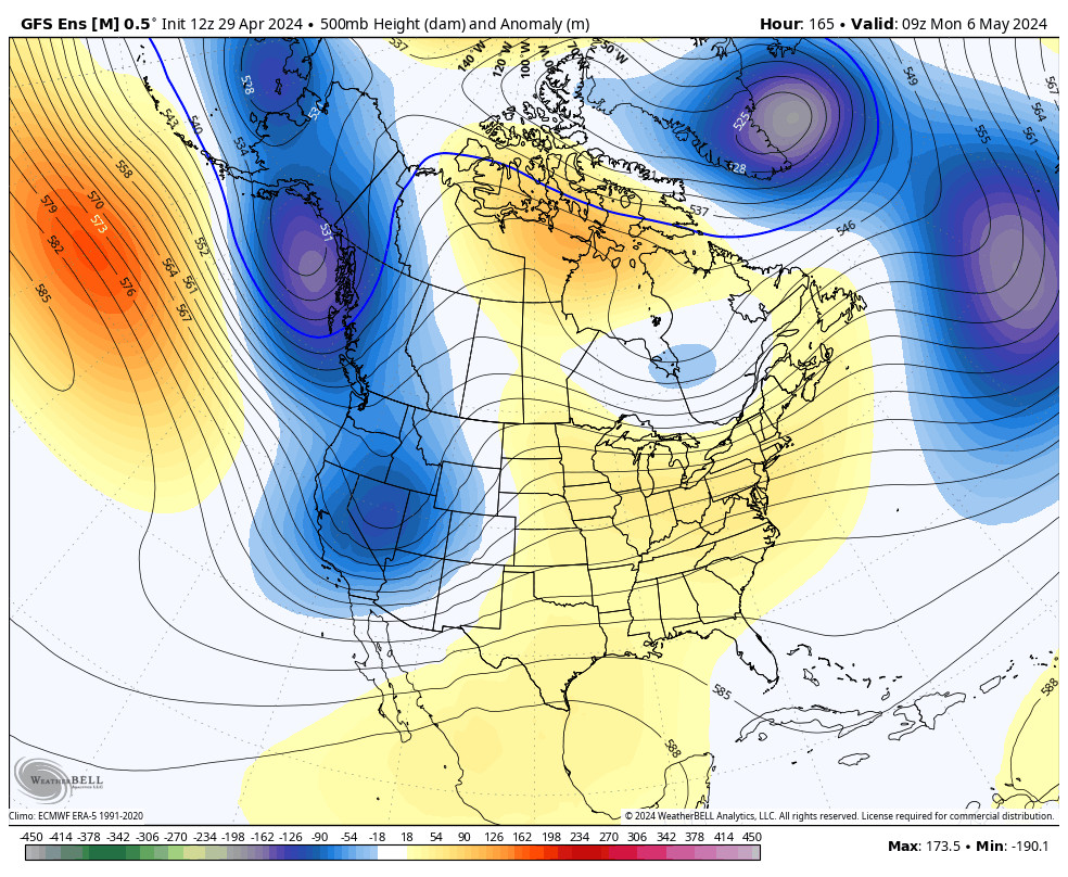
Almost all of the forecast models have done what I’ve been nervous about all week. They have dropped the precipitation forecasts over the mountain for the storm over the past 24 hours, down almost an inch for totals, which drops the snowfall forecasts by around a foot.
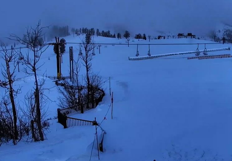
We’ll get into that in a minute. First off, we had snow move in during the early morning hours and there was 2 inches of fresh snow on the mountain as of 5 AM Sunday morning. Looking at the upper mountain sensor, it looks like another 3 inches has already fallen as of 7 AM!
Sunday – Monday Night Storm:
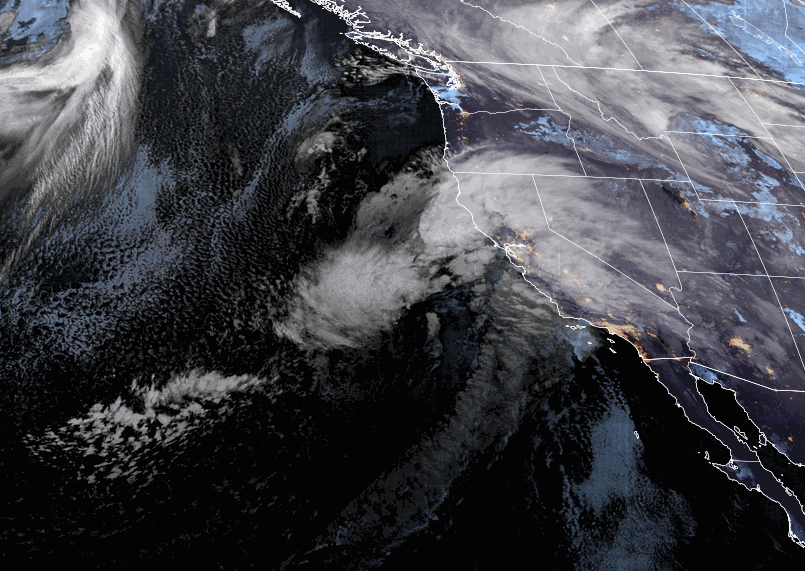
The storm is winding up off the coast and directing a lot of moisture at the Sierra. We will have heavy snow throughout the day on Sunday. Temperatures are starting out in the teens on the upper mountain and 20s at the base. The winds aren’t that strong yet but will increase through the day from the south with ridgetop gusts up to 70-80+ mph by evening. Highs into the 30s near the base and 20s for the upper mountain.
Most of the snow with this storm falls during the day on Sunday with 1-2 feet of snow just during the day. The big change on the models not filling the steady snow near the Tahoe basin on the east side of the low centered near the northern CA coast Sunday night into Monday. As the AR with the heavy snow drops south Sunday evening, the models now show a gap in precip through the evening.
That low eventually drops south and scattered snow showers are expected Sunday night through Monday night. The gap in the heavy precip Sunday evening should allow the winds to crank up a bit more with gusts possibly to 90+ mph later in the evening. The winds for Monday are forecast to be fairly strong in the morning from the southwest, with ridgetop gusts up to 60-70+ mph. Then come down through the day. Highs in the 30s near the base and 20s for the upper mountain.
The total precipitation forecasts on the latest model runs have dropped almost an inch from what they were showing for the storm over the last few days. That has dropped the expected snowfall totals for the storm by around a foot. By early Tuesday morning we now expect to see 1.5 – 2 feet at the base, and 2-3 feet on the mountain, with 1-2 feet of that falling by Sunday evening.
Tuesday – Friday:
The latest model runs have backed off on the system for Thu-Fri and keep it weak on the latest runs. We could see scattered snow showers Tuesday from the current storm, and some models linger them into Wednesday. Then scattered snow showers could be around for Thursday and Friday as well as the next weak system moves through.
We could see partly sunny skies each day between snow showers. Highs continue to be in the 30s for the lower elevations near the base, and 20s for the upper mountain. The latest model runs show enough precipitation for several inches of additional snowfall on the mountain through Friday. But that is spread out over 4 days so the daily snowfall amounts are expected to be light from the snow showers moving through.
Long-Range Forecast:
High pressure is still expected to begin building in over the West Coast next weekend into the week of the 12th. That should bring a drier and slightly milder weather pattern through mid-month and into the 3rd week of February. Some model runs try to sneak in a weak system during the period, so we’ll keep an eye on that, but overall only a weak system at best is likely with that pattern.
The long-range models continue to try and push the storm farther east into CA later in the month with lower heights still forecast to nudge into into CA around the 18th into the last week of February. The ensemble mean models still show increasing precipitation chances and amounts from the 19th-25th. We’ll continue to watch to see if storms will start to make it into the Sierra during this period.
BA