The Weekend:
Over the weekend high pressure breaks down as a cold trough begins to push in from the north. We should cool into the 50s for highs at the base and 40s up top. Mostly sunny skies with a few clouds. Winds up top could continue to gust up to 30+ mph from the west.
Monday Storm:
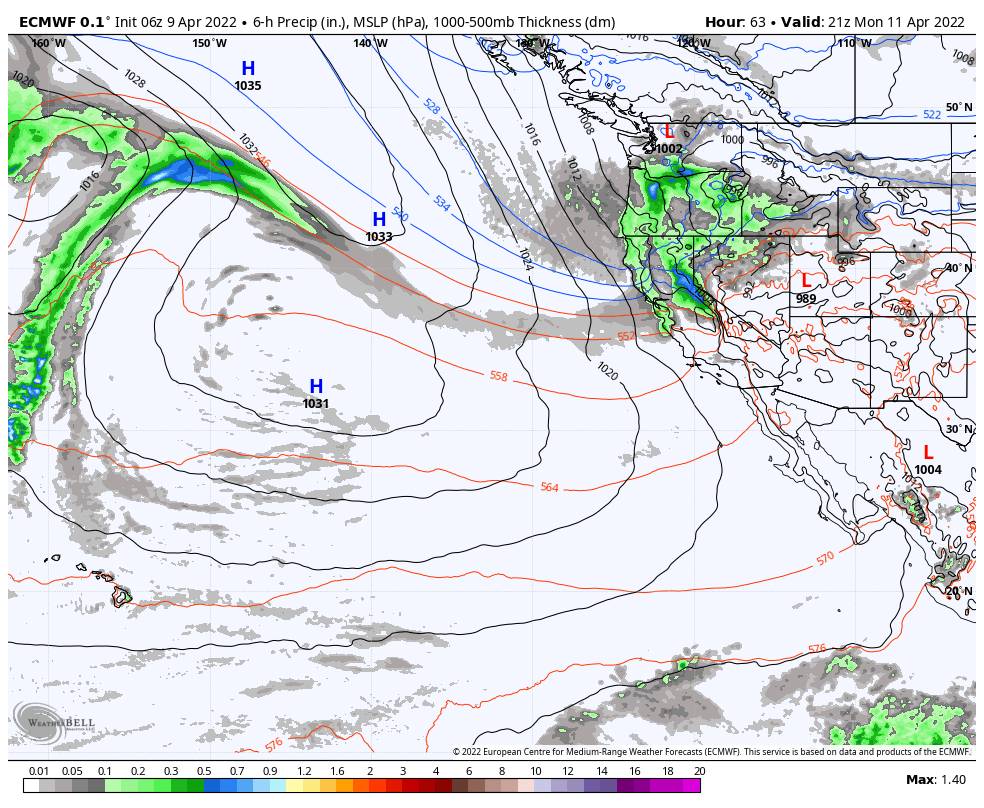
A cold trough is over the West through most of the week bringing in colder air and an unsettled pattern. Highs only in the 30s at the base and 20s up top Monday. A storm will dive into CA with snow arriving to the mountain around 6-8 AM Monday morning. The heaviest snow could fall Monday afternoon with the cold front with snow showers lingering into the evening before clearing Monday night.
We could see winds gusting up to 120+ mph up top which should close several lifts on the mountain for Monday. The snow levels should start near to below the base and then continue to fall into Monday night with the snow becoming powdery on the upper mountain. The strong winds will be blowing the snow around and make it feel even colder than the air temperatures.
The latest model runs continue to trend up with the snowfall forecasts. By Tuesday morning we could see 5-9 inches of fresh snow at the base, and 7-14 inches on the mountain. We will continue to watch the trends as the storm approaches and adjust the snowfall forecast if needed.
Tuesday – Friday:
We could stay cold through the end of the week with highs in the 30s & 40s at the base and 20s & 30s up top. There’s a chance for weak systems to keep a few clouds & isolated snow showers around Tue – Wed. Ridgetop winds could still be breezy with gusts from the west up to 40+ mph up top Tuesday & 50+ Wednesday, especially later in the day ahead of the next storm.
Some models suggest another storm for Wednesday night into Thursday that could bring more snow to the mountain, while others keep it to our north. Some show quite a bit of snow possibly falling in the northern Sierra. So we’ll continue to watch the trends as we get closer. Temperatures should stay below average through Friday.
Long-Range:
The pattern could start to become warmer & drier again the weekend of the 16th into the week of the 18th. That should bring nicer weather for Easter Sunday.
The pattern could become more unsettled later in the month, but no additional storms in the forecast right now that look to bring additional snowfall to the mountain. We’ll continue to watch the trends.
BA