Skip to content
Palisades Tahoe Logo Palisades Tahoe Logo Palisades Tahoe Logo
Explore
Main Menu
  • Explore Palisades Tahoe
  • Base to Base Gondola
  • Our New Name
  • Explore Legendary Lifts
  • Palisades Tahoe Blog
  • About Lake Tahoe
Plan Your Visit
Main Menu
  • Tickets & Passes
  • Lodging
  • Lessons & Guides
  • Deals & Packages
  • Rentals & Demos
  • Travel Here
  • Getting Around
Mountain Information
Main Menu
  • Snow and Weather
  • Lift and Grooming Status
  • Webcams
  • Hours of Operation
  • Trail Maps
  • Parking & Road Conditions
  • Snowfall Tracker
Events & Activities
Main Menu
  • Events Calendar
  • Aerial Tram
  • Activities
  • Dining & Apres
  • Shopping
  • Groups, Meetings & Weddings
  • Ski & Snowboard Teams
Winter Lodging Exteriors of the Village at Palisades Tahoe
Book Winter Early

Ikon Pass holders save up to 25% when you book with The Village at Palisades Tahoe this winter.

SAVE ON LODGING
Icon / FlashCreated with Sketch.
View All Offers
  • Weather

Windy with Cold & Snow for Monday

  • Apr 8, 2022
  • 8:11 am

Friday:

Sunny and mild Friday. Highs into the 60s on the mountain. Southwest breezes with gusts up to 30-40+ mph up top.

The Weekend:

Over the weekend high pressure breaks down as a cold trough begins to push in from the north. We should cool into the 50s for highs at the base and 40s up top by Sunday. Mostly sunny skies should continue. Winds up top could continue to gust up to 30+ mph from the west.

Monday Storm:

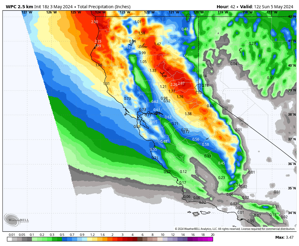
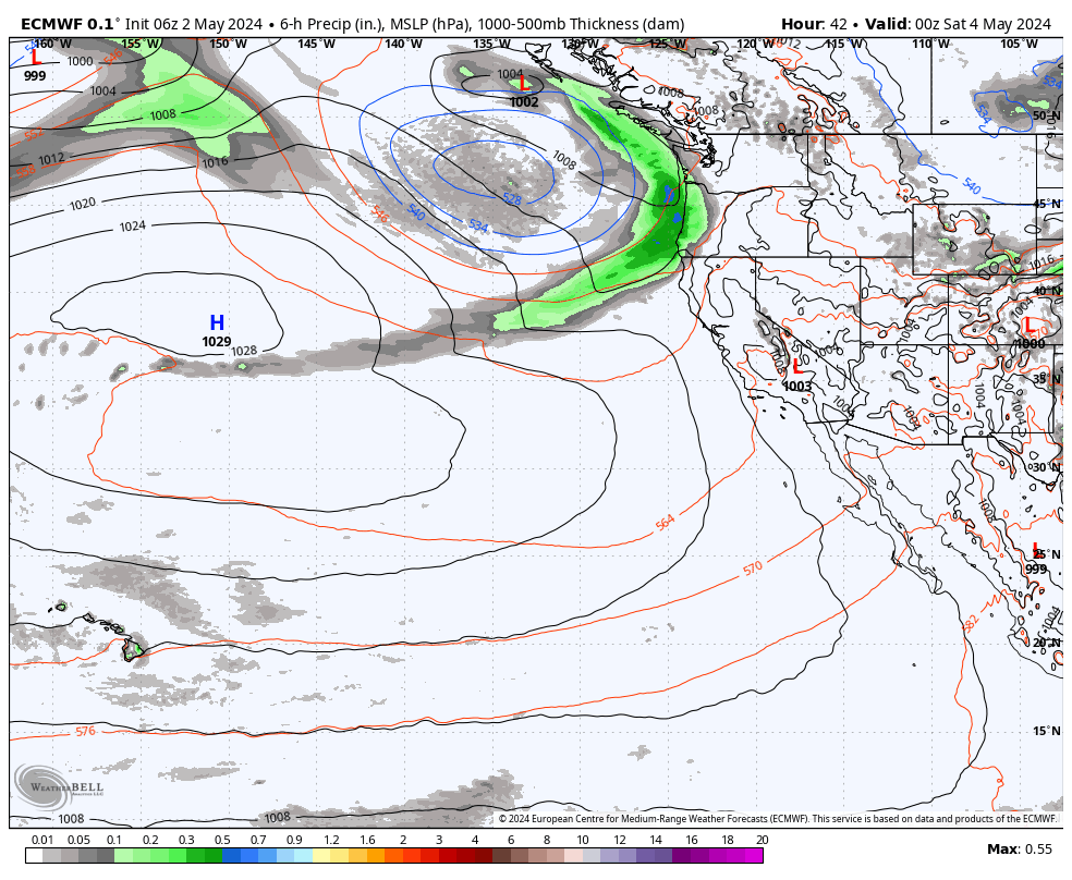
The cold trough is established over the West by Monday, and it could linger through most of the week bringing in colder air and an unsettled pattern. Highs only in the 30s by Monday as another cold front moves through with a storm that could bring accumulating snow to the mountain.

The latest forecast model runs suggest that snow could move in between 6-11 AM and could continue into Monday evening, and then clearing overnight. Monday we could see winds gusting up to 120+ mph up top which should close several lifts on the upper mountain.

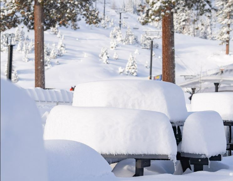
By Tuesday morning we could see 3-7 inches of fresh snow at the base, and 6-11 inches on the mountain. We will continue to watch the trends as the storm approaches and adjust the snowfall forecast if needed.

Long-Range:

We could stay cool through the end of the week with highs in the 30s & 40s. There’s a chance for weak systems to keep a few clouds & isolated showers around. Some models suggest another storm for next Thursday – Friday that could bring more snow to the mountain. We’ll continue to watch the trend on those as well as we get closer.

The pattern could start to become warmer & drier again the weekend of the 16th into the week of the 18th.

BA

lake tahoe weather palisades tahoe weather forecast snowfall forecast
Bryan Allegretto
Bryan Allegretto

Share this article:

Recent Posts

  • Weather ·
  • September 19, 2023·
The predicted El Nino pattern for this winter

2023-24 Palisades Tahoe Winter Forecast Preview…

As we look ahead to the 2023-2024 winter season, it's important to remember that any winter outlook will contain an inherent degree of uncertainty. However, there are a few clues that we can keep an eye on.
Read more
  • Weather ·
  • May 8, 2023·

Final Forecast of the 2022-23 Season

First Week of May Snowfall Report: The first week of May was a cold and snowy one. The upper mountain…
Read more
  • Weather ·
  • May 1, 2023·

Snowy First Week of May

Monday – Friday Snow Shower Chances: A low-pressure system will be making its way south down the coast on Monday…
Read more

Social

Instagram Twitter Facebook Youtube

Contact

   Email Us
   1.800.403.0206

Our Partners

U.S. Forest Service Logo
1960 Olympic Valley Road
Olympic Valley, CA 96146

©2022 Palisades Tahoe

Alterra Mountain Company
  • Privacy Policy
  • Terms of Service
  • Photo Upload Terms of Use
  • Accessibility
  • Do Not Sell My Personal Information
  • Privacy Policy
  • Terms of Service
  • Photo Upload Terms of Use
  • Accessibility
  • Do Not Sell My Personal Information