Monday – Tuesday Day:
We have some valley fog which will make the skies somewhat cloudy Monday morning, but above the fog on the ski hills, we expect mostly sunny skies. Highs into the 40s for the lower elevations near the base and 30s for the upper elevations.
Tuesday we should see a little sun in the morning with increasing clouds and winds throughout the day. Highs in the 30s. Ridgetop winds from the west gusting up to 50-60+ mph by the end of the day.
Tuesday Night Rain & Snow:
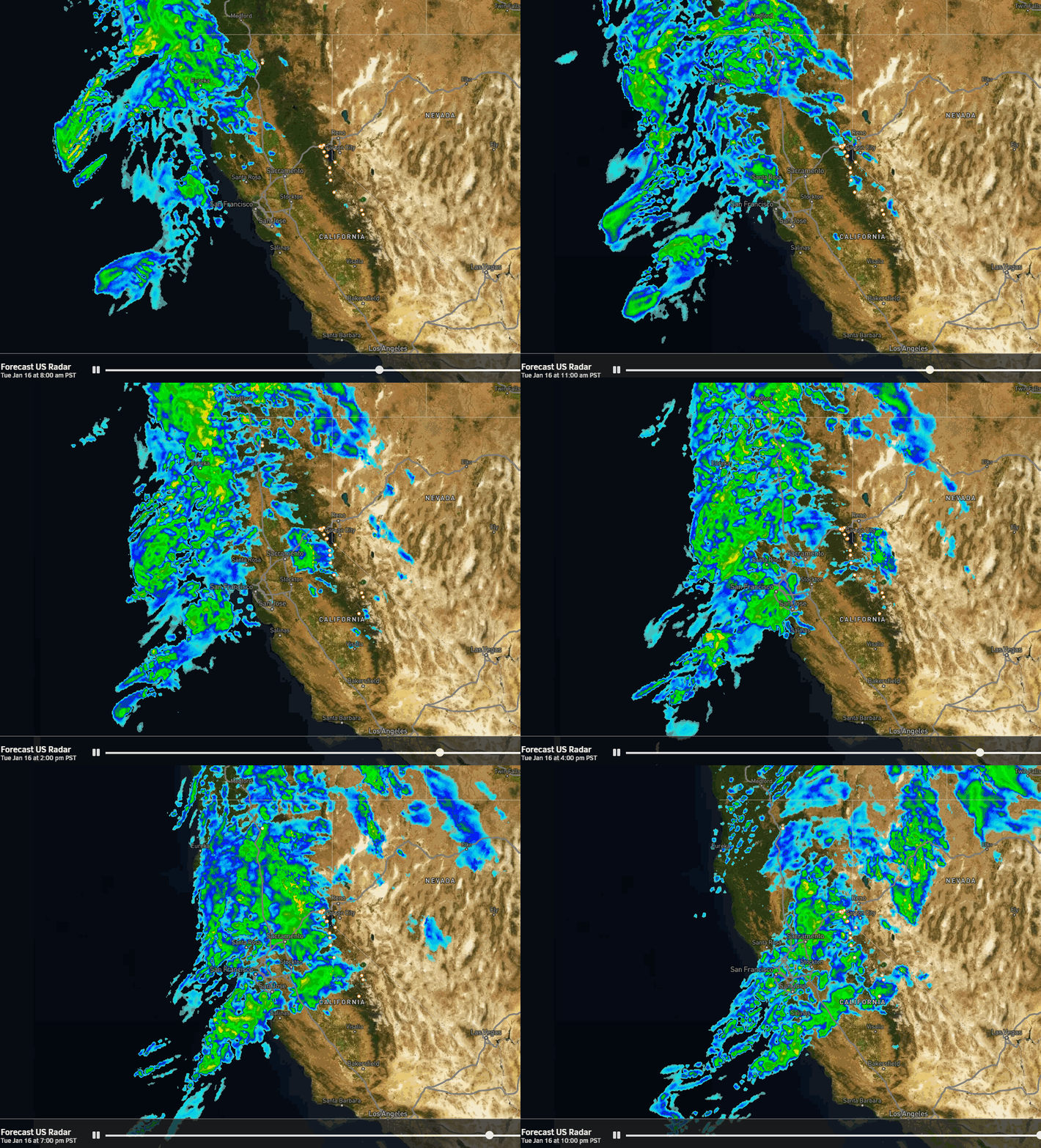
The latest model runs show showers reaching the Tahoe basin between 5-7 PM Tuesday evening with some steadier precipitation expected overnight. Most of the model runs clear out the storm by 10 AM on Wednesday.
Snow levels will start high, up around 8000-8500 ft., and then will fall slowly through the end of the storm Wednesday morning. They look to only bottom out around 7000 ft. by the end. We will have all rain below that at the base and on the lower mountain. Snow ratios will be low and may only average 8:1 at 8000 ft. overnight.
That means not much snow and wet snow for the upper mountains. That cuts down on how much snow can accumulate from the precipitation totals. My forecast hasn’t changed much and shows a coating up to 2 inches of snow falling between 7000-8000 ft., and 2-5 inches above 8000 ft.
We clear out through Wednesday afternoon with the winds subsiding and the sun poking out. HIghs into the 30s.
Thursday – Friday:
High pressure builds back in over CA briefly by Thursday into the day on Friday. We should see partly sunny skies on both days with highs in the 40s for the lower elevations, and 30s for the upper elevations. The winds start to increase from the southwest on Friday with ridgetop gusts up to 40-50+ mph by afternoon.
Long-Range Forecast:
No changes to the forecast for a pattern change by Friday night into the weekend, possibly lasting into Tuesday the 23rd. The models still show a fairly strong jet stream across the Pacific aimed toward CA with troughing to the north with storms spinning up and in the eastern Pacific and moving into the West Coast.
We could see 3-4 waves move through, basically one per day over a 3-4 day period Saturday – Tuesday, with not much of a break between each. The question will be how much moisture will be able to reach the Sierra as the storms could weaken some by the time they reach us. We need to watch the trends all week.
Snow levels on the latest model runs fluctuate between 6000-7000 ft. through the period. So we could see a mix of rain and snow for the lower elevations and a decent amount of snow for the upper mountain. I’ll have more details on potential snowfall starting Tuesday.
The Last Week of January:
By the 24th through the last week of January, the long-range models continue to show high pressure building over the West Coast with storm track being bumped to our north. That could give us a drier and milder end to the month, after a semi-active pattern over the previous 3 weeks.
BA


