

Friday – Sunday:
We have partly-mostly sunny skies through Saturday, with increasing clouds Sunday but likely dry for the daytime hours. Highs into the 40s.
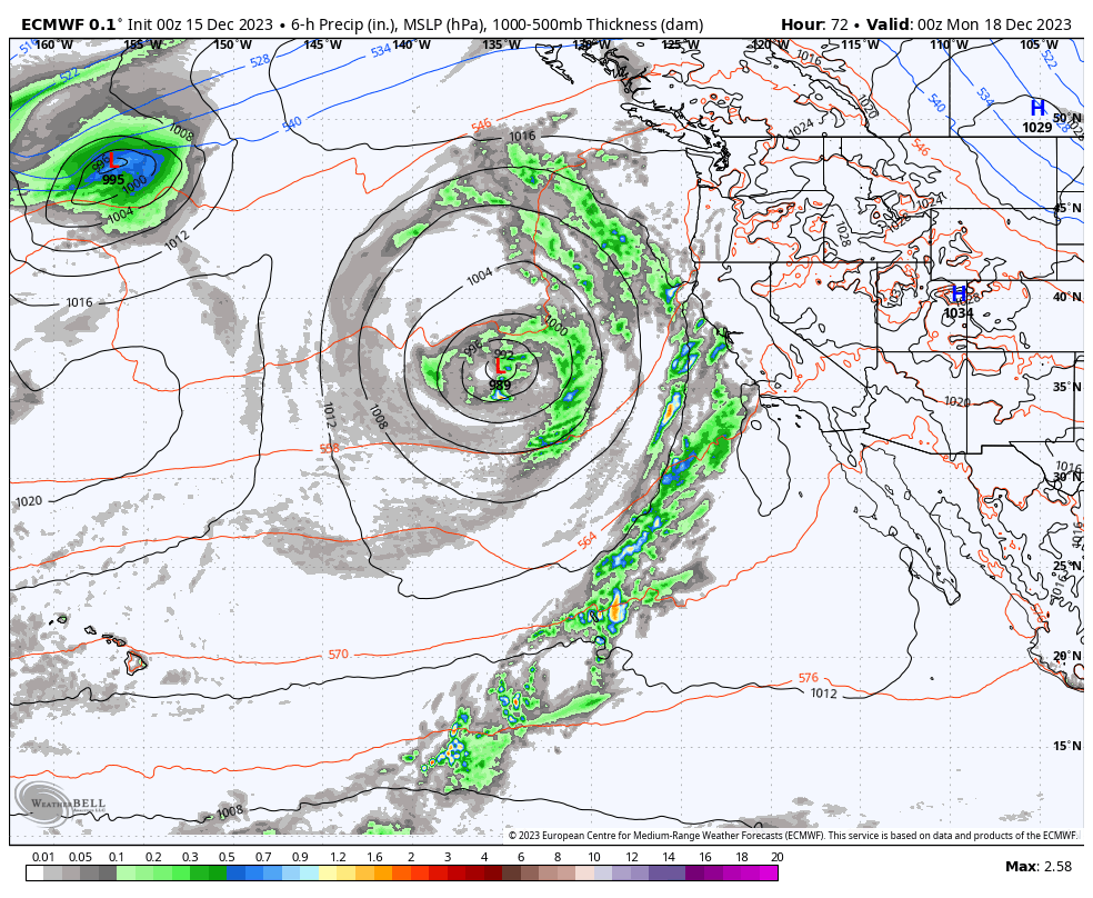
Monday – Tuesday Storm:
The latest model runs show only very light rain showers moving in Sunday night with snow levels starting up around 10,000 ft. Then steadier precipitation Monday through Tuesday as the cut-off low off the coast opens up and moves inland.
We will have southerly winds through the period, with the strongest winds expected for Monday. Ridgetop winds gusting up to 60-70+ mph. Then coming down some for Tuesday. That could close the upper mountain lifts on Monday.
This system will also be tapping into some warmer subtropical moisture. That will not only bring in some steadier precipitation Monday into Tuesday but will also help to keep snow levels on the higher side. The snow levels may drop to around 8000-8500 ft. on Monday, 7200-7700 ft. Monday night into Tuesday, maybe bottoming out around 6800-7300 ft. Tuesday evening.
The range for total precipitation amounts through Tuesday night is 0.7 – 3.0 inches near the mountain, with an average of the latest model runs of around 1.6 inches. That could bring us 0-2 inches of snow by Tuesday night near 7000 ft. 2-6 inches between 7000-8000 ft., and 6-12 inches above 8000 ft.
Wednesday – Thursday:
The second system may bring some clouds and may be close enough to push some showers near the crest. We’ll continue to watch the trends to see if we will stay completely dry or not.
Long-Range Forecast:
The latest model runs have trended back toward high-pressure building over the Pacific NW by the end of next week into the weekend of the 23rd-24th. That means we could stay fairly dry from Wednesday through Sunday next week if the second system misses us.
Christmas – New Year’s Eve:
Beyond 10 days the forecasted weather pattern still looks promising. The latest long-range model runs continue to forecast a deep trough in the northeast Pacific and a strong jet stream aimed toward CA.
There has been fewer model runs with drier scenarios over the past 24 hours, and the models have been suggesting a wetter pattern for over a week now. That is continuing to increase confidence even though this pattern change is still 10+ days away.
We could see the first storm move in around the 25th-26th, with a few more wet storms behind that one through the last week of the month. Hopefully, they have enough cold air for significant snowfall and not significant rainfall.
BA
