Saturday -Sunday Weather:
The weather has been beautiful. The inversions continue at night with temperatures above freezing on the upper mountains which is helping to keep the snow soft from top to bottom as temperatures warm into the 40s each day. The partly-mostly sunny skies and mild temperatures continue through Sunday.
Monday – Tuesday Storm:
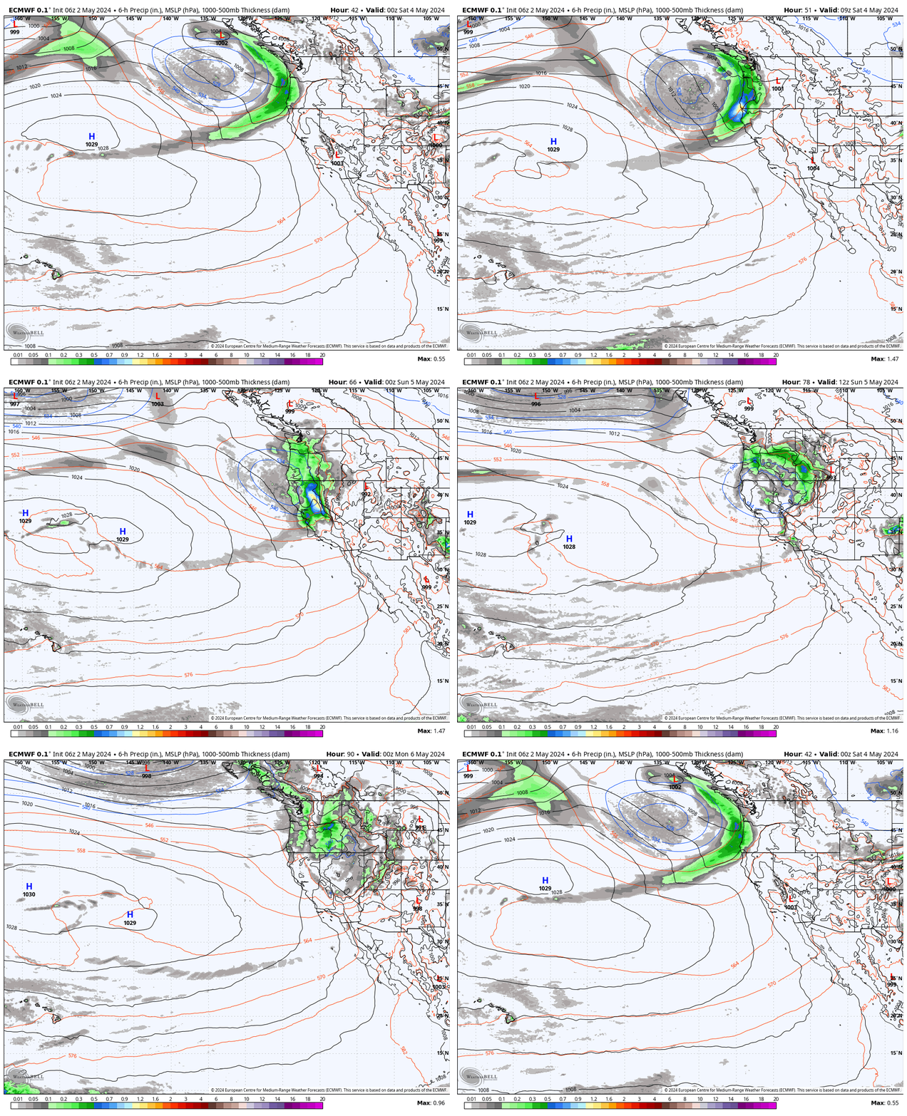
A cut-off low is spinning off the coast this weekend. That system is going to open up and move inland to our north Monday into Tuesday. That is going to push precipitation into the northern Sierra by early Monday morning. Waves of precipitation are expected over the 2-day period.
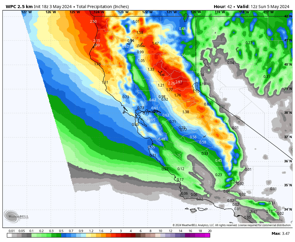
There is still a big spread among the models with precipitation forecasts with a range of 1-4 inches of liquid over the mountain, but the average is around 2 inches today which I’ll use for the snowfall forecast. Gusty south-southwest winds with gusts up to 60-70+ mph over the exposed ridges Monday and then coming down some into Tuesday.
Snow levels are going to be very high as the precipitation starts to move in, up above 10,000 ft.! Then dropping to around 8500-9000 ft. by Monday morning, settling in around 7500-8000 ft. Monday into Monday night, and bottoming out around 7000-7500 ft. Tuesday into Tuesday night, maybe a tad lower at times in a few spots.
That means all rain for base up to 7000 ft. The snowfall forecast near 7000 ft. is easy Monday with only rain but then trickier Tuesday as snow levels may or may not sit in that range or we could switch back and forth between rain and snow. Above 7500 ft. we’ll see snow Tuesday and wet snow above 8000 ft. both days. Snow ratios may only average around 8:1 near 8000 ft. which is heavy Sierra cement.
Snowfall totals based on the latest model runs would be around 1-9 inches between 7000-8000 ft. and 9-18 inches above 8000 ft. If the wetter model runs are correct the top peaks could see over 2 feet of snow.
Wednesday-Thursday System:
There is pretty good agreement now that the second cut-off low will drop down the coast Tuesday through Thursday, with maybe a few scattered showers reaching us Wednesday. We should dry out through the day with dry weather for Thursday as the low drops to our south.
Snow levels will rise back up above 8000 ft. on Wednesday with any showers that reach us. Highs near 40 degrees for the lower elevations near the base and 30s for the upper mountain on both days. We should see the clouds start to clear on Thursday with some sun.
Long-Range Forecast:
We are expecting a drier pattern through Sunday the 24th (Christmas Eve). Mostly sunny skies are likely Friday through next Saturday with highs into the 40s. Sunday we’ll have to watch how close the next storm is getting to see if we could see increasing clouds and winds.
Christmas Storm:
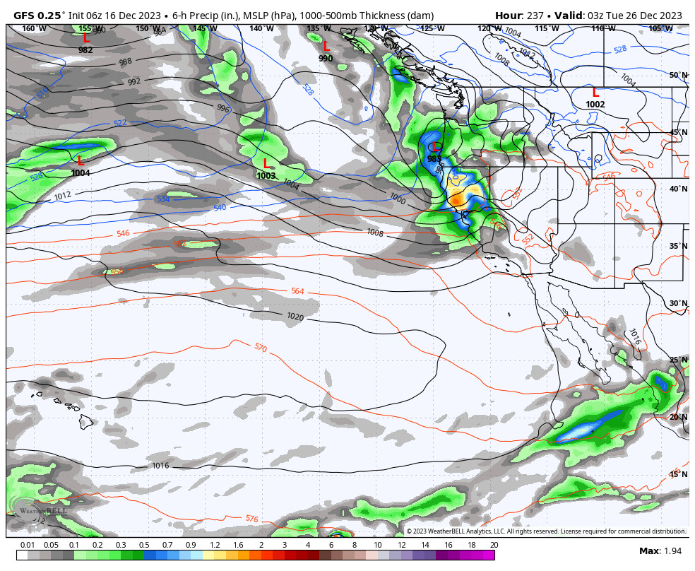
The latest model runs continue to suggest that we could see a stronger storm move in around Christmas Day into the 26th. If it is as wet and cold as the latest model runs show, this could be the biggest storm so far this season, and a Christmas miracle as we need snow for the lower elevations.
It could also mean travel headaches for a busy travel day on the 26th. So you’ll want to watch the forecast closely if you plan to travel up to the mountain.
The latest long-range model runs still show a deep trough near the West Coast through the last week of December with storms possibly continuing through the last week of the month. However the long-range models don’t agree on whether they will be wet or weak storms. We’ll continue to watch the trends.
BA

