Calm Weather:
We are waiting out this extended dry period through the end of the week and into the weekend. Temperatures are a little colder for Tuesday into Wednesday. But still near 40 degrees for highs down near the base and 30s on the mountain.
Partly-Mostly sunny skies are expected each day through at least Saturday, with highs into the 40s for the near the base and 30s for the upper mountain.
The latest model runs show the cut-off low-pressure system spinning near the CA coast over the weekend and show moisture finally spreading inland toward the Sierra Sunday night into Monday. We could see some clouds on Sunday and we’ll watch the trends to see when the precipitation could push in.
Long-Range Forecast:
The latest model runs are in fairly good agreement that the first system moves inland by Monday into next Tuesday. It could be lifting to the northeast as another system drops into the trough near the coast. The latest model runs show us being brushed on the southeast side of the system with light amounts of precipitation.
We are becoming fairly confident that we will see some rain and snow as early as Sunday night into Tuesday. We will see some gusty winds and slightly colder temperatures as well. Snow levels may start high and then lower to around 7000 ft. Monday, and near the base by Monday night.
Monday is day 7 so we’ll start to look at potential snowfall amounts once the storm is within the 5-day window. Right now the amounts look pretty light, with light accumulations for the lower mountain and up to a few or several inches for the upper mountain.
Subsequent Systems Next Week:
The latest forecast model runs are not in agreement with the second system dropping south along the West Coast for the middle of next week. Some have it missing us completely, while other models show the second system moving inland by next Thursday-Friday, with a more progressive system, dropping in from the northwest Friday-Saturday.
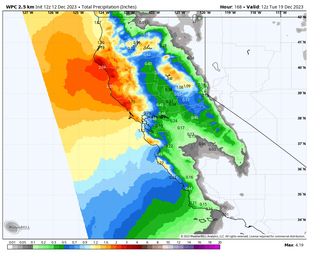
The latest ensemble mean model runs show 1-2+ inches of precipitation next week through Friday. We will be watching the trends closely. None of the storms look overly strong or wet, but the combination of the 2-3 systems over the 5-6 day period, as well as what looks to be lower snow levels later in the week, could bring some decent snowfall to the mountain in total.
Christmas Week:
The long-range models continue to show the pattern shifting by Christmas Day through the last week of December, with a large low-pressure trough setting up over the northeast Pacific into the West Coast. The jet stream is forecast to extend underneath toward the West Coast.
The combination of the two could open the storm door to storms spinning up in the eastern Pacific and moving into the West Coast through the period. No huge storms are showing up yet on the latest model runs, just a consistent flow of moderate-strong systems moving through the West Coast for several days.
We’ve been looking at this potential active period for about six days now, and the consistency with the forecast is building confidence in a more active pattern each day. If the forecasts continue to trend in this direction for the last week of December, we could see quite a bit of snow finally pile up on the mountain. We’ll continue to watch the trends.
BA


