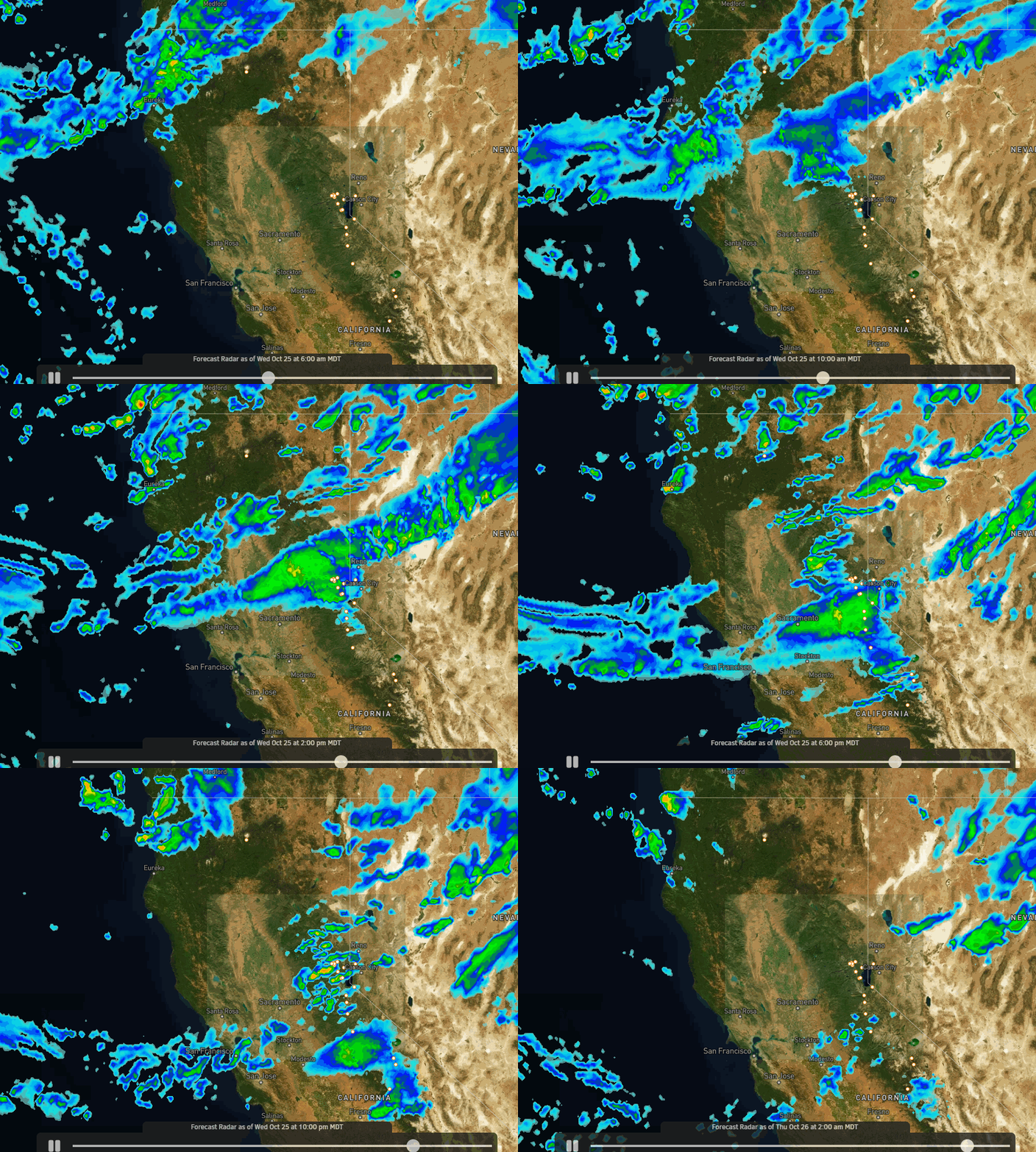
Wednesday System:
Winds will increase Wednesday with west-southwest winds gusting up to 80+ mph over the ridges. Increasing clouds by midday with rain and snow showers are now forecast to arrive around midday, with the heaviest precipitation expected with the front Wednesday afternoon and showers possible into Wednesday night before clearing out by Thursday morning.
Most of the latest model runs still show only up to 1/4 to 3-tenths of an inch of total precipitation over the mountain. The outlier model runs show a bullseye of up to 8-tenths of an inch. The average of the models is around 4-tenths of an inch on the high end.
Colder air with and behind the front will drop snow levels from above 8000 ft. at the start to around 7000 ft. pretty quickly Wednesday afternoon, and then close to the base by late afternoon/evening. Especially with any heavier bursts of precipitation we could see snow levels drop a bit faster.
If the drier models are right this system will be pretty weak with only a dusting of snow at the base and 1-3 inches of snow on the mountain. If the wetter models are onto something, we could see up to double that with 1-3 inches at the base and 3-7 inches on the mountain above 7000 ft.
I’d lean to the low end for now as that is what most models show. I’ll do a final forecast for the system Wednesday morning.
Thursday – Weekend:
The latest model runs have backed off on the idea of seeing any precipitation Friday-Saturday as the next front from the north is now forecast to stay to our east with any forcing.
We may see a reinforcing shot of colder air for the weekend with highs remaining in the 40s at lake level and 30s on the mountains, with a cool east wind for Saturday. But overall we may see mostly sunny skies each day through Sunday if the current trends continue.
Long-Range:
The drier pattern is expected to continue through the end of the month and likely into at least the 1st day of November. Highs next week are expected to rebound into the 50s at the base and 40s for the mountain with temperatures closer to seasonal averages.
By day 10 and beyond the majority of the forecast models keep the storm track to our north with the dry pattern continuing, with a couple hinting at a system digging far enough south to bring some showers around Thursday the 2nd, and then drier after that.
Overall, the long-range ensemble mean models show below-average precipitation for the Sierra with the wet pattern to our north through the 1st week of November. We’ll continue to watch for the 1st significant system in November…
BA


