Monday – Tuesday Weather:
Partly sunny for Monday and Tuesday. Fairly nice days with lighter winds and highs into the 40s for the lower elevations.
Wednesday:
Increasing clouds and winds for Wednesday. Highs are still into the 40s down near lake level and 30s for the upper mountains. Ridgetop winds from the southwest increasing with gusts up to 60-70+ mph by afternoon. We could see a few light snow showers reach the mountains NW of the lake during the afternoon.
Wednesday Night – Thursday Storm:
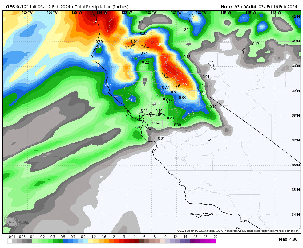
Most of the precipitation from the next storm is expected for Wednesday night into Thursday. This storm is going to try and tap into some deeper moisture to the south and direct it toward the northern Sierra by Thursday morning. The question will be how much moisture this far south?
The storm looks to wind down by Thursday evening. The winds could still be gusty Thursday morning but then look to fall through the afternoon. Highs in the 30s.
Snow levels could start around 6300-6800 ft. (just above the base) Wednesday evening, fall to around 5300-5800 ft. (below the base) by early Thursday morning, and then back up to around 6000-6500 ft. (near to just above the base) by Thursday afternoon. That means we could see rain to start and end the storm near the base.
By Thursday night we could see around 2-6 inches of new snow near the base, and 4-10 inches on the mountain above 7000 ft., with the highest totals above 8000 ft.
Friday:
The latest model runs show a break in the storms on Friday. We could see partly sunny skies with similar weather to Monday & Tuesday. Highs in the 30s on the mountains to around 40 degrees down near the base.
Saturday Storm:
The next storm is still expected to move in sometime on Saturday. This storm will be weakening by the time it reaches the Sierra and may take its time reaching us. The latest model runs suggest that the steadier rain and snow may hold off until Saturday afternoon, and then sweeps through Saturday night and starts to clear Sunday morning.
We will likely see gusty ridgetop winds of 40-50+ mph. Highs in the 30s. Snow levels could be fluctuating near the base with some rain mixing in, and several inches of snow is possible on the mountain above 7000 ft. by Sunday morning. We’ll be looking deeper into the details of this storm on Tuesday as it comes into the 5-day forecast window.
Sunday:
Sunday still looks to be a bit of a break between storms. We could see some scattered showers with highs in the 30s.
Sunday Night – Tuesday:
The next storm could move in by Sunday night continuing into next Monday, and possibly lingering into next Tuesday the 20th. The track of this system will want to favor southern CA, so we’ll have to see how far north the heaviest rain and snow track. The latest model runs still show it far enough north for some decent totals over the mountain.
This storm looks a bit colder as well so it could bring mostly snow down to the base. This storm could bring some significant snowfall totals if the current track holds. We will be watching the trends closely all week as Monday is typically a busy return travel day from the 3-day weekend.
Long-Range Forecast:
Some models suggest a final weaker system sneaks in for Wednesday the 21st, while others begin to build in high pressure near the West Coast beginning a quieter pattern. That quieter pattern is expected through the end of the week, and possibly into the weekend of the 24th-25th with high pressure over the West Coast.
The long-range models continue to suggest a colder West Coast trough pattern setting up during the last few days of the month. Besides some colder air, that pattern could open the door to a colder storm or two dropping into the west side of the trough from the northwest before the end of the month. We’ll continue to watch the trends on that potential pattern to end the month.
BA


