Skip to content
Palisades Tahoe Logo Palisades Tahoe Logo Palisades Tahoe Logo
Explore
Main Menu
  • Explore Palisades Tahoe
  • Base to Base Gondola
  • Our New Name
  • Explore Legendary Lifts
  • Palisades Tahoe Blog
  • About Lake Tahoe
  • About Us
Plan Your Visit
Main Menu
  • Tickets & Passes
  • Lodging
  • Lessons & Guides
  • Deals & Packages
  • Rentals & Demos
  • Travel Here
  • Getting Around
Mountain Information
Main Menu
  • Snow and Weather
  • Lift and Grooming Status
  • Webcams
  • Hours of Operation
  • Trail Maps
  • Parking & Road Conditions
  • Snowfall Tracker
Events & Activities
Main Menu
  • Events Calendar
  • Activities
  • Dining & Apres
  • Shopping
  • Things To Do In Lake Tahoe
  • Groups, Meetings & Weddings
  • Ski & Snowboard Teams
IKON PASS HOLDER LODGING DISCOUNT

Ikon Pass holders save up to 20% on slopeside lodging at The Village at Palisades Tahoe.

SLOPESIDE LODGING
Icon / FlashCreated with Sketch.
View All Offers
  • Weather

Starting off November with a Snowstorm

  • Nov 1, 2022
  • 7:51 am

It’s November and as the mountain ops teams begin to watch for cold nights to make snow, we will get them started with some natural snow! The mountain isn’t open yet, but we will be tracking early-season storms as the team begins to build terrain ahead of the ski season.

Tue – Wed Storm:

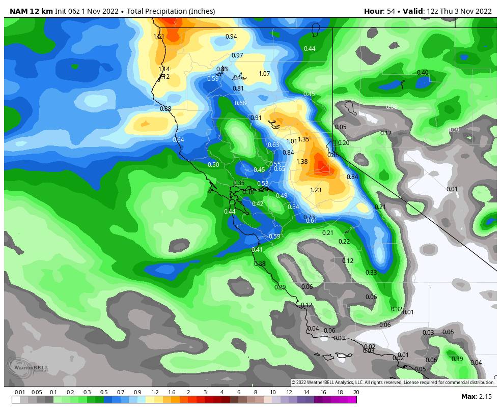
The latest forecast model runs still show the rain & snow reaching the mountain by early afternoon. Snow levels start out above 7000 ft. but they should fall pretty quickly to the base between 1-4 PM. Then falling below 5000 ft. Tuesday night.

The heaviest snow is expected through into the evening with the cold front. Then turning to more scattered snow showers behind the front as cold unstable air moves in. The winds crank up Tuesday with southwest winds gusting up to 80+ mph up top. Highs in the 40s early and then dropping into the 30s and then 30s for highs at the base Wednesday, and 20s up top. Winds drop Wednesday but are still breezy.

The latest model runs have continued to trend up slightly with the total precipitation amounts through Wednesday. The average is around 1 inch over the mountain. That could equate to 5-10 inches on the lower mountain to the base, and 10-15+ inches on the upper mountain to the top.

Thursday – Saturday:

Thursday is still cold with highs in the 30s at the base and breezy northeast winds. But the sun should return through Friday. Friday the winds begin to turn back to the southwest and highs warm into the 40s.

Saturday we could see increasing winds and clouds by afternoon ahead of the next storm. The ridgetop winds could once again be gusting up to 80+ mph from the southwest by later in the day. Rain could move in by evening from the next system with snow levels possibly staying above 8000 ft. into Sunday morning.

Sunday – Monday Storm:

I will get into more details on the Sunday – Monday storm over the next few days as it moves into the 5-day outlook window. Right now, this system may feature a small AR (atmospheric river) of moisture streaming into northern CA Sunday which usually comes along with higher snow levels. So we may see rain and high-elevation snow above 8000 ft.

Then Sunday night into Monday we could see a colder low move down the West Coast bringing in more moisture and colder air with falling snow levels. So we could see a decent snowfall on the mountain and some snow to the base again by Monday.

Long-Range:

The pattern is shifting in the Pacific with a high-pressure ridge up near Alaska and a trough over the West. That can feature a storm track shifted farther south into the Pacific NW and at times into California.

We could see a break in the storms next Tuesday. Then the long-range models suggest that more storms could move through northern CA next Wednesday through the end of next week. So the pattern could stay active for the next 10+ days. It could also stay below average for high temperatures over most of the West.

BA

lake tahoe weather palisades tahoe weather forecast snowfall forecast
Bryan Allegretto
Bryan Allegretto

Share this article:

Recent Posts

  • Weather ·
  • March 30, 2023·

Drier thru Saturday, Snow Showers Sun-Mon

Snowfall Report: An additional 2 inches of snow fell on the mountain Wednesday from the snow showers. That brings the…
Read more
  • Weather ·
  • March 29, 2023·

Partly Sunny Wed-Sun w/ Snow Showers Possible

Snowfall Reports: 12 inches of new snow fell on the mountain in the past 24 hours as of 5 AM…
Read more
  • Weather ·
  • March 28, 2023·

Snow & Strong Winds Tuesday

Tuesday  – Wednesday Storm: Snow showers are pushing in Tuesday morning, with heavier snow expected later in the morning into…
Read more

Social

Instagram Twitter Facebook Youtube

Contact

   Email Us
   1.800.403.0206

Our Partners

U.S. Forest Service Logo
1960 Olympic Valley Road
Olympic Valley, CA 96146

©2022 Palisades Tahoe

Alterra Mountain Company
  • Privacy Policy
  • Terms of Service
  • Photo Upload Terms of Use
  • Accessibility
  • Do Not Sell My Personal Information
  • Privacy Policy
  • Terms of Service
  • Photo Upload Terms of Use
  • Accessibility
  • Do Not Sell My Personal Information