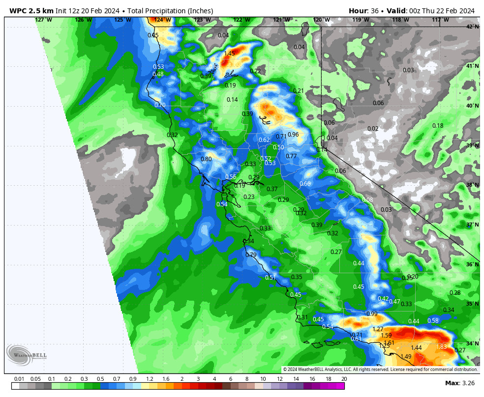
Snowfall Report:
Another 7 inches of snow fell on the mountain from the snow showers on Monday. That brings the 2-day storm totals to 13 inches so far, with one more day to go with the current storm.
Final Day of Snow Showers:
We have about 24 hours to go for snow showers moving through the Sierra. We have a bit of a lull on Tuesday as the low near the coast that rotated moisture inland on Monday is moving to the north. That is pulling the snow showers to our northwest. We could see some scattered snow showers with the gusty winds coming down throughout the day. Highs in the 30s.
Tuesday night we still expect a final weak wave to move through with a bit more coverage in snow showers for the northern Sierra, and then that diminishes into Wednesday morning, with clearing into the afternoon with mostly sunny skies by the end of the day. Highs in the 30s.
Snow levels on Tuesday will be fluctuating between 6000-7000 ft. and then dropping to around 4500-5000 ft. Tuesday night for the last round of snow showers. That will bring some higher snow ratios and lighter-density snow for the upper mountains on top of the snow that has fallen over the last two days. We could see a final 1-5 inches of snow by Wednesday morning.
Thursday – Saturday:
We are still expecting a drier pattern through Saturday as high pressure builds in over the West. The forecast models now agree that any precipitation from the cut-off low off the coast will stay to our West until later Sunday. We should see partly-mostly sunny skies each day with highs in the 30s for the upper mountain, and 40s for the lower elevations near the base.
Sunday – Monday Storms:
The cut-off low looks to finally be drawn inland with the help of the cold trough digging down from the north on Sunday, which will dig into CA Sunday night. We could see a few light showers reach the northern Sierra by Sunday afternoon, and then some steadier snow possible sometime Sunday night into Monday.
The trend on the latest model runs is for the trough to dig down a bit farther east toward the Great Basin. That would be a drier track for the front moving down from the north bringing snow by Monday, so the storm doesn’t look to be that big, but with the cold air and higher snow ratios, it could bring some fun powder to ski. We’ll continue to watch the trends all week.

Long-Range Forecast:
The long-range models continue to show the first trough into the West as being progressive with weak high pressure possibly building in by the last day of the month, and drier weather for the 28th-1st. The high pressure looks to be progressive as well and another cold trough is forecast to dig down over the West Coast during the 1st week of March, and it may stick around longer.
With the ridge up near the Aleutians and trough over the West, that is a pattern we like that can produce some cold storms spinning up in the trough over the West Coast. The ensemble mean models are in good agreement this morning that we could see a wetter pattern again during the first week of March. But this time, it will come along with much colder air.
We love cold air for several reasons including low snow levels, high snow ratios (powdery snow), and colder air is more unstable and better for mountain orographics. Storms tend to overproduce vs underproduce in milder patterns like we’ve seen most of this season so far. We’ll continue to watch the trends for the first week of March.
BA


