Snowfall Report:
As of 5 AM Monday morning, 2 inches of wet snow were measured at the base and 6 inches on the upper mountains. The SNOTEL sensor had 7 inches on it at the top of the mountain and we saw 100 mph winds overnight, so a bit more snow likely fell than what was measured, with pockets of deeper snow.
Monday – Wednesday Showers:
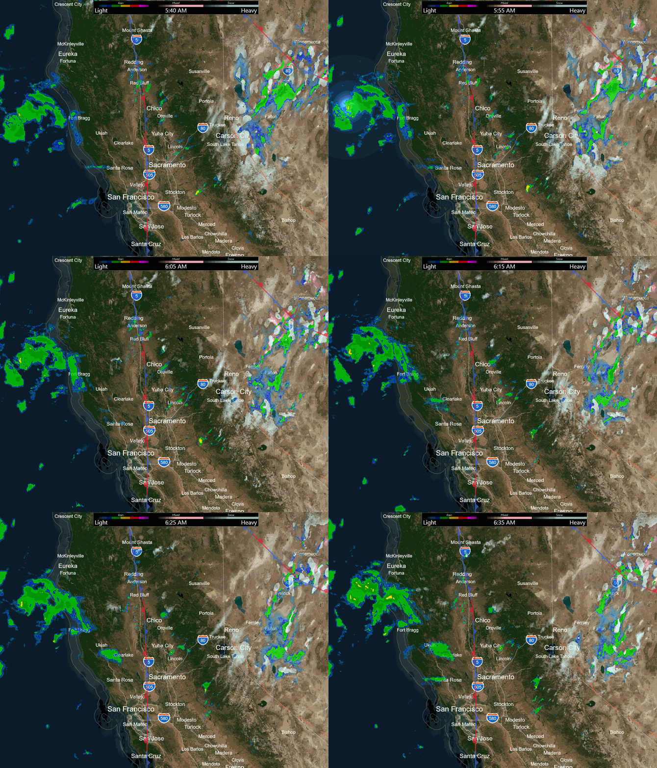
With low pressure spinning close to the coast Monday into Monday night, we will see moisture flowing into CA with convective showers and thunderstorms moving through northern CA, and bands of heavier snow moving through the mountains at times along with lulls in the precipitation.
The ridgetop winds will be strong for Monday likely keeping some upper mountain lifts closed. Gusts up to 70-80+ mph for exposed ridges for most of the day. Highs in the 30s. Snow levels could rise as high as 7000 ft. during mist or drizzle and drop to 6000 ft. with heavier bands of snow moving through. Then dropping as low as 5000 ft. with heavier bands Monday night.
We could see fewer showers with a bit of a lull on Tuesday as the low moves north away from the region. The winds come down through the day and highs are still in the 30s. Then Tuesday night we could see a final wave of steadier showers move through that diminishes into Wednesday morning, and we clear into Wednesday afternoon. Highs are still in the 30s. Snow levels could continue to fluctuate between 5000-7000 ft.
Additional Snowfall:
We expect some rain to mix in near the base and some wet snow with any heavier showers through the period. We could add around 4-8 inches of additional snowfall near the base by Wednesday afternoon, 7-12 inches near mid-mountain, and 9-14 inches on the upper mountain. Around 2/3rds of the forecasted amounts are expected by early Tuesday morning, and the rest mostly falls Tuesday night into early Wednesday morning.
Thursday – Friday:
We should see beautiful weather for Thursday and Friday with mostly sunny skies and lighter winds expected. Highs into the 30s on the mountains and into the 40s for the lower elevations near the base.
The Weekend:
We should see partly sunny skies on Saturday and Sunday, but we have a chance for some rain and snow showers from the cut-off low near the West Coast as it moves closer. Some forecast models still show some showers possible on Saturday while other models keep the low far enough off the coast to stay dry until Sunday afternoon.
Snow levels could be above 7000 ft. So any showers may be rain near lake level and light snow for the upper mountains, with the best chance for showers near the crest. Highs in the 30s on the mountains and 40s near the base.
Long-Range Forecast:
We are still expecting a pattern change by Sunday night into early next week with a cold trough digging down the West Coast from the north. The initial cold front could bring some steadier snow by Sunday night into next Monday the 26th.
The long-range models still suggest that the trough is progressive and we could see high pressure build in briefly by the end of the month with the storm track just to the north in the Pacific NW. Then we could see another cold trough digging down the West Coast during the 1st week of March.
That could open the door to more cold storms from the north-northwest. In these patterns, the storms can be moisture-starved if they drop down from the north over land vs down over the ocean. But these patterns can produce some nice powder dumps, so we’ll be watching the trends closely over the next week.
BA


