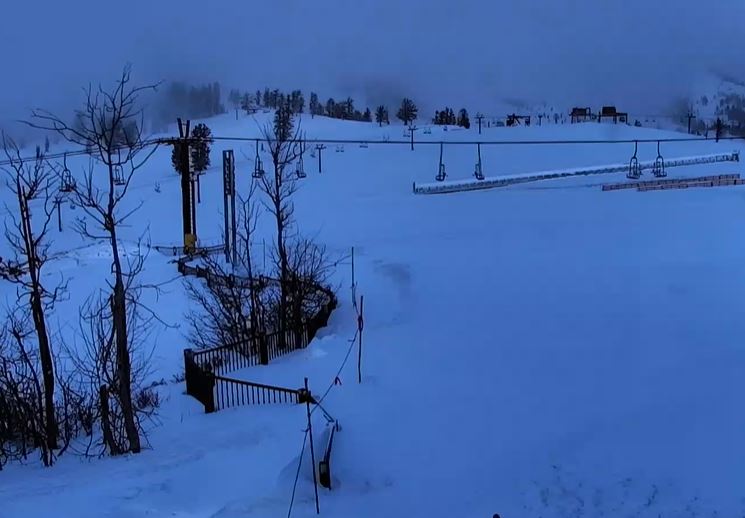
Thursday:
For Thursday we have partly sunny/cloudy skies and lighter winds. Highs in the 30s on the upper mountain and 40s at the base.
Christmas Night Storm:
Increasing clouds and gusty winds through the day on Friday, with gusts up to 80+ mph up top by Friday afternoon likely affecting some upper mountain lifts. Highs in the 30s on the mountain.
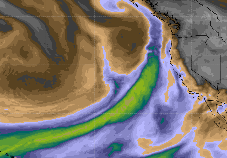
The next storm moves into northern California as early as late Friday afternoon with light snow showers. Then a cold front with a period of heavier snow is possible Friday night, and snow showers lingering into Saturday morning before ending. Snow levels may initially start just above the base around 6500 ft, but falling during the evening below the base.
The forecast models have been showing a trend for the heaviest precipitation to stay just to our north with this system. Therefore, we had to pull back the snowfall forecast this morning. We could now see 2-5 inches of snow at the base, 5-8 inches at mid-mountain, and 6-10 inches up top by Saturday morning when the snowfall ends.
Strong winds drop off through the day on Saturday with clearing skies through the afternoon. Highs only in the 20s on the upper mountains and 30s at the base.
In a typical season there are a lot of moving parts to Squaw Alpine’s post-storm mountain operations, and this winter Covid-19 protocols add an additional challenge to how the teams must proceed as safely as possible to open the mountains. Significant post-storm mountain operations, including avalanche control, building access roads, and de-icing chairlifts will likely take longer than usual. Examples of new impacts include splitting teams up in ways that require more troop carrier missions than ever before, fewer people in equipment assembly rooms, staggered use of locker rooms, fewer people in lift terminals to carry out de-icing and reduced capacity of transport equipment. Please read the latest resort operation blog for more details.
Sunday Night Storm:
We should see a break from Saturday afternoon through most of Sunday with colder temperatures. Highs in the 20s on the mountain and 30s at the base. South/southwest winds gusting up to 30 mph up top.
The next system moves in Sunday evening/night into Monday morning bringing the chance for light snow showers. This system is a closed low moving in to our south over central/southern CA with the heaviest snowfall staying to the south.
This storm is colder with all snow to the base and higher snow ratios with a more powdery snow. We could an additional 1-2 inches at the base, and 1-3 inches on the mountain by Monday morning. We begin to clear out through Monday afternoon. Cold with highs in the 20s on the mountain to around 30 degrees at the base.
Tuesday – Wednesday:
Expecting a drier pattern for Tue – Wed behind the Monday system. Mostly sunny skies with highs in the 20s on the upper mountain, warming into the 30s at the base by Wednesday.
Long-Range:
The next storm is possible on New Year’s Eve, but the long-range models are still in disagreement on whether this storm tracks into northern CA or stays to the north of the Tahoe Basin. Stay tuned because if it tracks farther south we could see more snow for New Year’s Eve.
The pattern may allow a few weak systems to start January, with the possibility of some stronger systems by the end of the 1st week of the month.
BA