Thursday:
Thursday morning will start off with some sun and highs into the 40s. Then later in the day clouds will be increasing ahead of the next system moving into northern CA. Winds will start to increase from the southwest but may only be gusting up to 30+ mph over the ridges by the end of the ski day.
Thursday Night – Friday System:
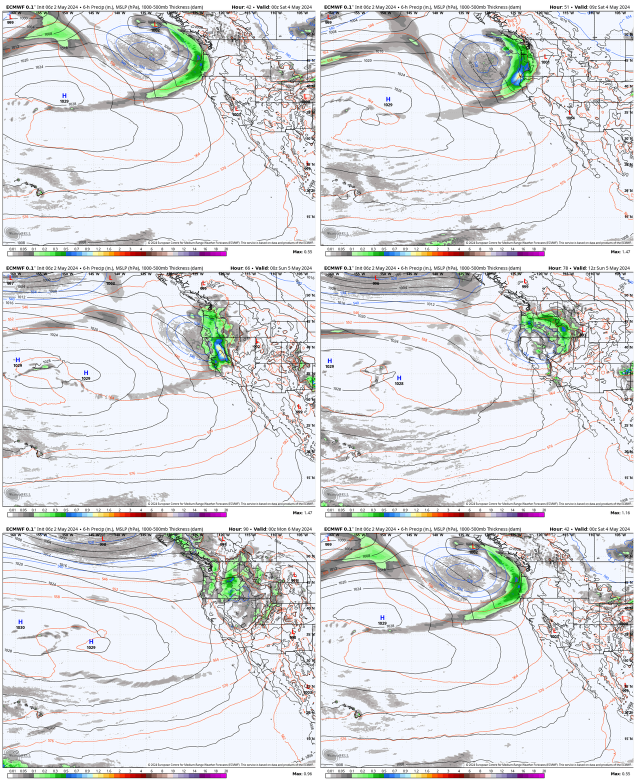
Later Thursday night around midnight we could see rain and snow showers move in and continue into Friday. Friday we expect rain and snow showers and gusty winds, with southwest winds gusting up to 50-60+ mph over the ridges. That could affect a few upper mountain lift operations. Highs into the 30s on the mountain and near 40 degrees at the base.
The showers should diminish into the evening with some clearing Friday night. Snow levels look to be around 6300-6800 ft. by midnight Thursday night. Then falling below the base into early Friday morning, and rising back up to 6100-6600 ft. by Friday afternoon into the evening. That would bring a little rain or mix to the village elevations.
By early Saturday morning we could see storm snowfall totals of:
- 0-3 inches at the base.
- 1-4 inches at mid-mountain elevations.
- 2-5 inches up top.
Weekend Weather:
The forecast models have had us on a roller coaster over the past week for the weekend forecast into early next week. First, they were warm and dry, then cooler and wet, and now continuing to trend drier and warmer as they show the ridge build farther west over the Rockies into early next week.
That will help to keep the northeast Pacific trough at bay and the storm track to the north, as well as allow the temperatures to warm a little more. We could see a few clouds Saturday morning and then become mostly sunny with lighter winds, with the same for Sunday. Highs warming into the 40s on the upper mountain and 50s at the base.
Monday – Tuesday:
The Monday system is now expected to remain north as well with mostly sunny skies expected to continue each day into Tuesday.
Monday it will get a bit windy with the storm moving through to the north. Ridgetop winds could be gusting from the southwest up to 50-60+ mph by afternoon and then coming down into Tuesday. Highs into the 40s on the mountain and 50s at the base.
Long-Range:
By Wednesday we still expect the ridge to shift east with a trough and possible cut-off low dropping down the West Coast. We’ll be watching for the low to possibly move through CA between Wed-Fri next week with possible showers for the Sierra along with some colder air.
Troughing is still forecast to remain near the West Coast through the 3rd week of April. The latest long-range model runs have shifted the position of the trough a bit west with the West Coast on the eastern edge.
We expect the cooler weather to continue through the period. If the trough is just off the coast that could make it harder for any storms to move far enough south to reach the Sierra. We’ll keep an eye on the trends.
BA

