Friday Weather:
Partly sunny for Friday with highs into the 40s for the lower elevations and 30s for the upper mountain.
Saturday Storm:
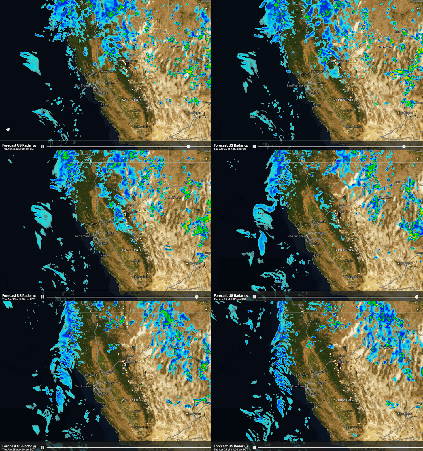
The next storm approaches on Saturday. We will see increasing winds from the south with ridgetop gusts up to 50-60+ mph by afternoon, possibly affecting some lift operations. Highs in the 40s for the lower elevations and 30s for the upper elevations.
We could see some lighter showers reaching the mountains during the day, with some steadier rain and snow expected by later in the afternoon into the evening. The latest model runs are clearing the storm out even faster by early Sunday morning.
Snow levels will start out up around 6500-7000 ft. Saturday afternoon, falling to around 6300-6800 ft. by evening, and then bottoming out around 5500-6000 ft. by the end early Sunday morning. That means some rain for the base and then wet snow Sunday night. Low snow ratios on the mountain, so not powdery snow.
We could see around 1-4 inches near the base, 2-6 inches near mid-mountain, and 3-7 inches of new snow on the upper mountain by Sunday morning.
Sunday Weather:
We are expecting a break between storms on Sunday, with partly sunny skies in the morning. Then increasing clouds and winds ahead of the next storm. Highs in the 30s. Ridgetop winds from the south-southwest increase to 40-50+ mph. Some models have some lighter rain and snow showers reaching the mountains by late afternoon.
Sunday Night – Wednesday Storm:
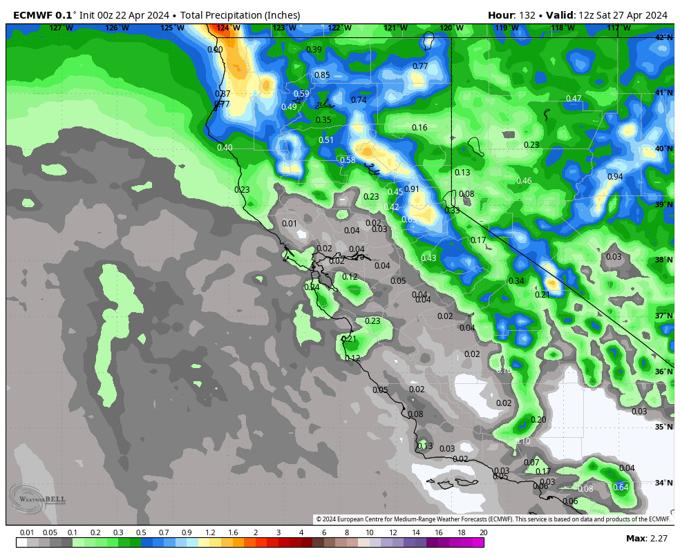
A large low-pressure system approaches the CA coast into Sunday night and then meanders near the coast through Tuesday before moving out Wednesday. It will initially direct an AR (atmospheric river) of moisture into CA toward the Sierra later Sunday night into Monday, with some heavy rain and snow. Highs in the 30s Monday with ridgetop winds increasing to 50-60+ mph from the south-southwest.
That drops south and diminishes the precipitation rates Monday night into Tuesday with lighter showers expected. A secondary wave of heavier precipitation is possible Tuesday night, before diminishing to showers again Wednesday and clearing out by Thursday morning. The winds should come down some on Tuesday and Wednesday. Highs continue to be in the 30s.
The snow levels will be high to start as the warm subtropical moisture is being directed toward CA. They could be up around 7000-7500 ft. Sunday evening. They want to stay higher but the models are trying to drag them close to the base by early Monday morning with the heavy precipitation rates. Then they could hover there through Tuesday.
That means we could be going back and forth from rain to snow through the 2-day period near the base, with high-density snow on the mountain. Tuesday night snow levels could fall 1000 ft. below the base, which would make a surge of heavier precipitation more interesting if it happens.
Forecasting snowfall near the base will be a pain with fluctuating snow levels. Above 7000 ft. we should see all snow. We could see 3-day storm totals of around 9-14 inches near the base, 20-26 inches near mid-mountain, and 24-31 inches on the upper mountain by Thursday morning.
Long-Range Forecast:
The long-range models continue to show weak high-pressure building in over the West later next weekend into Saturday the 24th. That should bring a drier pattern for at least part of that period, but a cut-off low could be meandering off the CA coast.
That cut-off low could eventually move inland over the weekend, which is the weekend of the Stifel Palisades Tahoe Cup, but the models that show that have it moving in to our south and mostly missing the northern Sierra. So for now we’ll expect a drier pattern for the 22nd – 25th, and we’ll keep an eye on the hard-to-forecast cut-off low.
The week of the 26th the long-range models continue to show a cold West Coast trough pattern developing. It’s easier to forecast the colder air, and any storms dropping into the trough from the north-northwest would be colder. But if the trough is too far east the storms could take a drier track over land.
The ensemble mean models are showing above-average precipitation during the period through the 2nd. So they are seeing chances for colder storms hitting the Pacific NW down into northern CA. We’ll continue to watch the trends and hope that we start to see some colder storms with some powdery snow by the end of the month!
BA


