Wednesday – Thursday Weather:
We are in the middle of a drier and milder pattern on Wednesday. That will continue through Thursday with sunny skies and highs into the 60s for the lower elevations, and 50s for the higher elevations.
Friday – Sunday Storm:
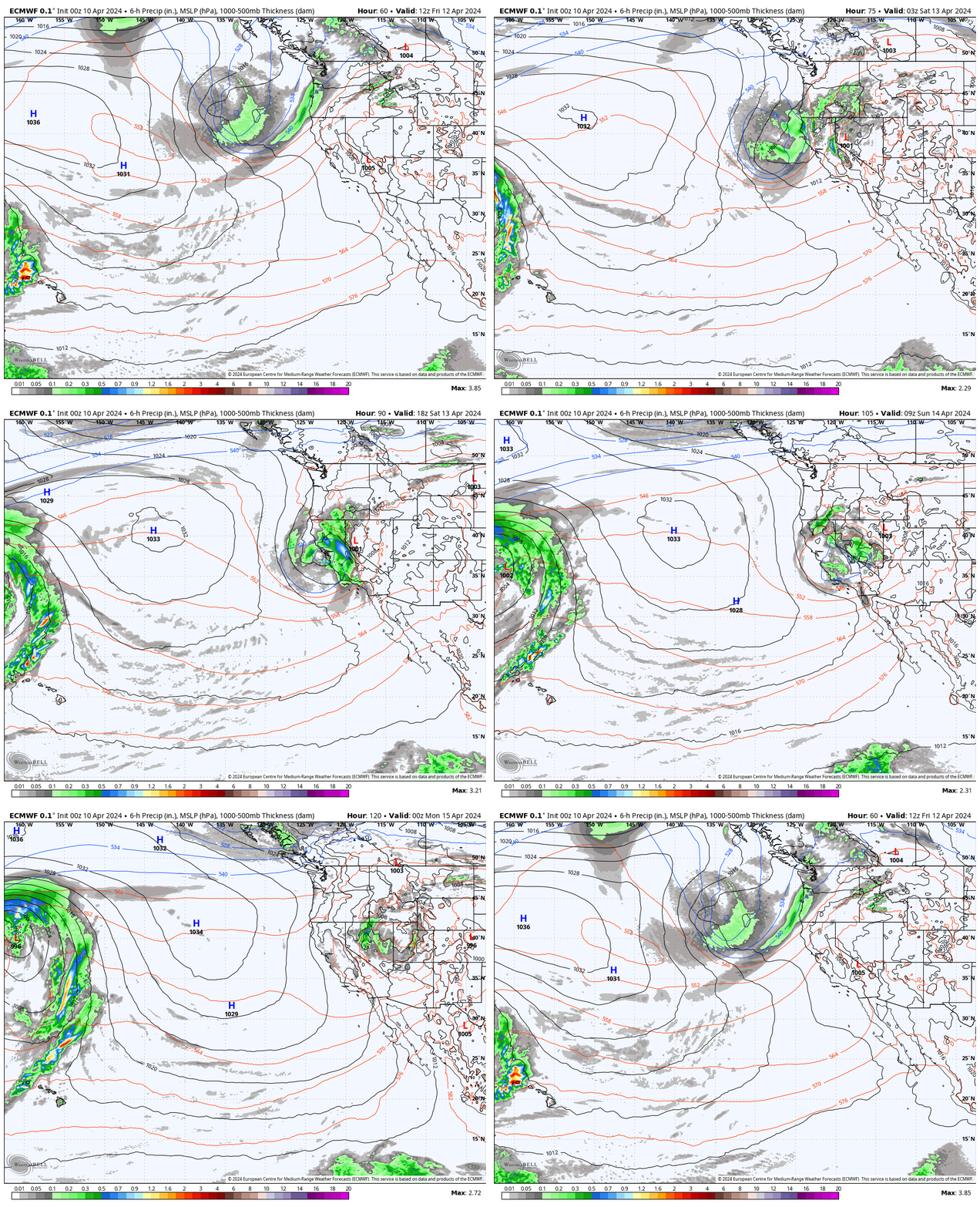
The latest model runs show rain showers reaching the northern Sierra by late morning on Friday and continuing into Friday night. We will have gusty winds on Friday from the south-southwest gusting up to 60-70+ mph over the ridges, which could close some upper mountain lifts. Highs in the 50s for the lower elevations and 40s for the higher elevations.
The center of the low-pressure system tracks through SoCal over the weekend. Heavier precipitation on the east side of the low is expected to push in sometime on Saturday into Saturday night. The flow turns more easterly by Saturday night into Sunday as showers wrap around the north side of the rotation.
The winds are not expected to be as strong on Saturday and Sunday. Highs in the 40s near the base and 30 for the mountain through the weekend. Snow levels start out very high on Friday, up around 9000-9500 ft, and only dropping to around 8000-8500 ft. for Saturday. That means mostly a rain storm is expected below 8000 ft. through Saturday.
The colder air is forecast to push in over the Sierra Saturday night with snow levels dropping quickly at some point, similar to the last storm. They should drop below the base overnight and then rise back up to around 6300-6800 ft. with the remaining showers on Sunday. We could see partly sunny skies on Sunday as well between showers.
Forecasting snowfall when snow levels are above the peaks and dropping to the base, and then rising above the base at the end, is very tricky. The easy part is the rain below 8k through Saturday with up to a few inches of wet snow possible above 8k’. Totals by Sunday night could be 0-2 inches at the base, 1-3 inches near mid-mountain, and 3-7 inches up top.
Drier & Milder Pattern:
The pattern quickly returns to a drier and milder pattern next week as high pressure builds in near the West Coast through the end of the week. Mostly sunny skies are expected each day with highs into the 50s near the base and 40s for the upper mountain.
Long-Range Forecast:
High pressure is forecast to remain over the West into the last week of April. That should continue the drier and milder pattern into the last week of the month. There’s always a chance for some moisture to work into the region that could help to bring a few afternoon showers or thunderstorms over the mountains, so we’ll keep an eye out for that.
Overall no signs right now of another storm. I was thinking the same thing last week for after the last storm, and then the storm for this upcoming weekend trended farther south. So I’ll keep an eye out for any more late-season storms that try to show up into May.
BA


