The long-range weather pattern is continuing to trend in a much more positive direction from the dry and mild pattern we are still in. The weather pattern looks like it will start to become more active and cooler starting next week.
Thursday – Sunday:
Not much change in the weather we’ve been seeing through Sunday. We are finishing out the very dry and mild pattern. Sunny days with highs into the 50s, and 40s for the higher elevations. Light winds through Saturday with ridgetop gusts starting to increase slightly by Sunday. Overnight inversions continue with poor snowmaking conditions at night on the upper mountain.
Monday System:
Monday will continue to be mild ahead of the front moving down from the north with highs still in the 50s. But increasing clouds west winds during the afternoon, with ridgetop gusts up to 80+ mph.
We are on the western edge of this system moving down from the north, and snow levels are expected to be above 9000 ft. to start. We could see showers move in by midday through the evening and then clearing by Tuesday morning.
Snow level may drop below 7000′ at the end, but mainly expecting rain showers for most elevations and maybe a coating to an inch of snow for the upper mountain. We will continue to watch the trends over the next few days.
Tuesday – Wednesday:
Some colder air filters in behind the front Monday night through Tuesday night. We may see better snowmaking conditions with colder temperatures. Tuesday & Wednesday should be mostly sunny but with highs only in the 40s at the base and 30s for the upper mountain.
Thursday Storm:
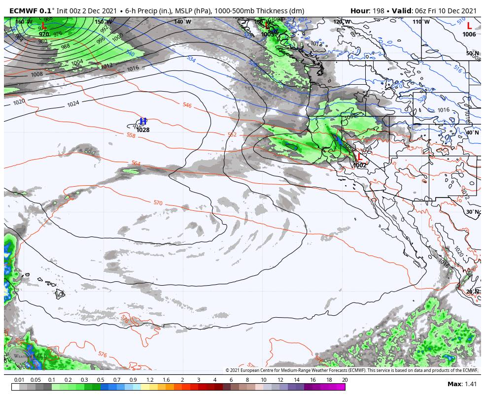
Things get a little more interesting by next Thursday into Thursday night. We have another cold trough digging south but this time farther West over CA. This will allow the next system to track farther west over the ocean picking up a bit more moisture before moving inland. We will still have to watch the trends for the track of this storm.
This is a cold storm and snow levels should drop to well below the base. That makes it even more interesting with the latest trends. Let’s hope the positive trends continue over the next 7 days. We will be watching this system closely. Hoping for a nice helping of snow and cold air behind the storm for good snowmaking.
Long-Range:
Behind the storm, it should be colder through the end of the 2nd week of December. Right now Friday – Saturday the 10th – 11th look dry. The Western trough is forecast to back farther west with time through mid-month. That could bring in another storm by Sunday the 12th.
A ridge centered near the Aleutians and a trough along the West Coast is usually our perfect setup for cold West Coast storms. We could see additional storms the week of the 13th into the 3rd week of December. Fingers crossed…
BA


