The Weather thru Monday:
We are in a drier pattern through Monday with mostly sunny skies expected most days along with a few clouds. Highs into the 50s at the base and 40s for the upper mountain.
Tuesday – Saturday Next Week:
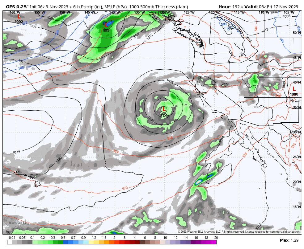
A deep trough is still forecast to dig south near the West Coast by Tuesday through the end of next week. We’ve been discussing how the first system is forecast to break off from the easterly flow as it spins up into the trough off the coast Tuesday – Wednesday.
Rain could reach the coast, but the latest model runs continue to show the center of the cut-off low staying far enough off the coast that the moisture on the east side of the rotation stays west of the Sierra. We could just see some clouds and gusty winds through Wednesday.
We were watching for a 2nd system upstream to push the first system inland and progress inland itself next Thursday – Friday. But the latest model runs are trending toward this low also becoming cut off from the easterly flow and spinning off the coast of CA.
Eventually, by Friday-Saturday it should progress inland, but by then it may have lost most of its moisture feed and only bring lighter rain showers. The center of the low is trending toward SoCal where the jet stream is forecast to be aimed.
The current trends are also warmer with the snow levels likely to stay above 8000 ft. The models could trend back toward more progressive storms, so we’ll watch closely.
Long-Range:
Beyond the 18th, the long-range models suggest a progressive pattern of ridges and troughs. That could bring periods of dry and wet weather through the end of the month. Nothing points toward any big snowstorms yet, but any storms do look colder after Thanksgiving.
BA


