Snowfall Report:
Another 5 inches of snow fell on the upper mountain over the past 24 hours, with mostly rain and a little wet snow near the base. That brings the 3-day total on the upper mountain to 14 inches of sticky wet snow.
Monday:
Clouds and showers are still over the region as moisture continues to move through the Sierra on Monday. The rain and snow showers will be more scattered through the day before diminishing Monday evening and clearing overnight.
Highs into the 30s. Winds are on the lighter side, only gusting up to 30-40+ mph over the ridges. Snow levels will continue to fluctuate between 6000-7000 ft., with mist & drizzle even higher during lulls in the precipitation, and dragging down close to the base during any heavier showers, just like we’ve been seeing since Saturday.
The latest model runs show an additional 1-5 tenths of an inch of total precipitation falling through the day on Monday. We are not expecting much for accumulations in the lower elevations, but we could see an additional 1-4 inches of snow on the upper mountain.
Tuesday:
Partly sunny for Tuesday with highs in the 30s. It may be one of the nicer days this week.
Wednesday Storm:
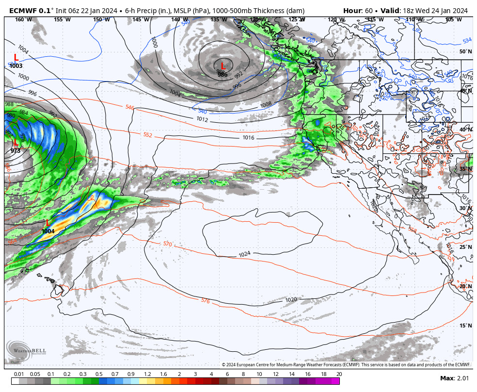
Wednesday morning rain and snow showers move back in and continue into the evening before clearing out by early Thursday morning. Highs in the 30s. Ridgetop winds gusting up to 40-50+ mph from the west.
This storm will be similar to Monday with another mild system and snow levels fluctuating between 6000-7000 ft. The latest model runs still show only light precipitation totals as we are on the southern edge of this storm. They have 0.2 – 0.5 inches of total precipitation falling over the mountain.
With snow levels and precipitation amounts similar to Monday, my snowfall forecast for Wednesday is similar to Monday, with rain and wet snow for the lower elevations and 1-4 inches of snow for the upper mountain by early Thursday morning.
Thursday:
We should see a similar day on Thursday as Tuesday. Partly sunny skies with highs in the 30s.
Friday – Saturday:
We were expecting high pressure to build over CA and to bump the storm track to our north starting Thursday. The latest model runs show the southern edge of weekend storms hitting the Pacific NW now digging a bit farther south with precipitation close to the northern Sierra.
We will continue to watch the trends. We could see partly sunny skies with some clouds from the storms to the north, we could see a few scattered showers move through, or we could see some steadier showers reach us Friday – Saturday.
It will be mild with highs in the 40s for the lower elevations. The snow levels will likely be above 8000 ft. with any precipitation, so if we see anything it will likely be rain showers for most elevations…
Long-Range Forecast:
The high-pressure ridge building over the West through the weekend should be strong enough to bring us a drier and milder pattern by Sunday through next Tuesday – Wednesday (the 30th-31st). We should start to see mostly sunny skies each day with highs in the 40s.
By days 10-11, we are at February 1st and the long-range models still show the pattern shifting by the 1st into the first week of February. Another extension of the Pacific jet stream is forecast which is what kicked off the wetter pattern for this past weekend as well. With troughing and lower heights forecast over the West Coast.
The first storm could move in around the 1st-2nd. Additional storms could follow. The models suggest that the extended jet may retract by the 5th – 7th. That may mean that the stormier pattern may only last several days similar to this past week. But they keep the trough over the West Coast through the 6th-7th, so we could see at least some weaker systems continue to move through.
BA


