Saturday Weather:
We will see an increase in clouds later in the day with the gusty ridgetop winds up to 60+ mph. Highs in the 30s to near 40 degrees down at the base. A few scattered showers could reach the mountain by later Saturday afternoon-evening. We could see a dusting of snow on the peaks. Snow levels may stay above 7000 ft.
Sunday Storm:
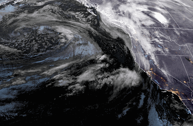
We will see similar weather for Sunday with partly sunny skies to start the day and increasing clouds with a few showers possible by the end of the day. Ridgetop winds will still be gusty and could gust a bit higher at times, up to 60-70+ mph from the southwest over the peaks, possibly closing some upper mountain lifts.
The latest model runs have trended drier with this storm as the trough doesn’t dig as far south, and the precipitation is slow to reach the northern Sierra and diminishes as it does. We expect a period of steadier snow showers Sunday night that diminish by Monday morning.
Snow levels could be around 6500-7500 ft. Sunday afternoon to start and then fall below the base Sunday night. That could start us off with some rain showers at the base and low snow ratios overall, with 10 -15:1 ratios Sunday night on the mountain.
We could see a dusting up to 2 inches of snow at the base by Monday morning, and 1-4 inches on the mountain.
Monday Weather:
We could see scattered snow showers Monday, mainly in the morning, and then partly sunny skies. Highs continue to be in the 30s the near 40 degrees down at the base. The winds are forecast to drop on Monday between storms.
Monday Night – Tuesday Storm:
The next storm will also struggle to push heavier precipitation farther south into the northern Sierra as it arrives later Monday evening, with snow showers continuing through Tuesday before ending by Tuesday night. This storm has also been trending drier over the past 24 hours.
The snow levels should stay just below the base with wet snow expected. Snow ratios averaging around 10-15:1 between 7000-9000 ft. Highs in the 30s for Tuesday with ridgetop winds gusting up to 50-60+ mph from the west.
We could see an additional 1-4 inches of snow near the base and 2-6 inches on the mountain by Tuesday evening.
Wednesday – Friday Winds:
Behind the storms, we will see a drier pattern for Wednesday through Friday with sunny skies. Highs into the 30s on the upper mountain and 40s for the lower elevations. But northeast winds increase through the day on Wednesday and could become quite gusty over the ridges Thursday into Friday.
Milder Weather:
Strong high pressure builds in over the West Coast by next weekend with sunny days continuing. Temperatures will warm into the weekend with a mild St. Patrick’s Day expected. Highs into the 40s on the upper mountain and 50s for the lower elevations near the base are expected for next weekend.
Long-Range Forecast:
The dry pattern is expected to last through the 3rd week of March, and likely into the last week of the month. The ridge is forecast to weaken some and start to retrograde off the West Coast going into the last week of March. But the latest operational model runs are not showing any storms through the 25th.
As we get into late March and April we go into cut-off low season as the jet stream weakens and shifts north. We usually see weaker systems if any, which is possible the last week of March as the ridge weakens and shifts.
If we see any bigger snowstorms late season they tend to come from cut-off lows that move slowly over the area. But late-season strong cold fronts are not out of the question, they just become less likely by the end of the month into April. We’ll continue to watch the trends to see when storms could return…
BA