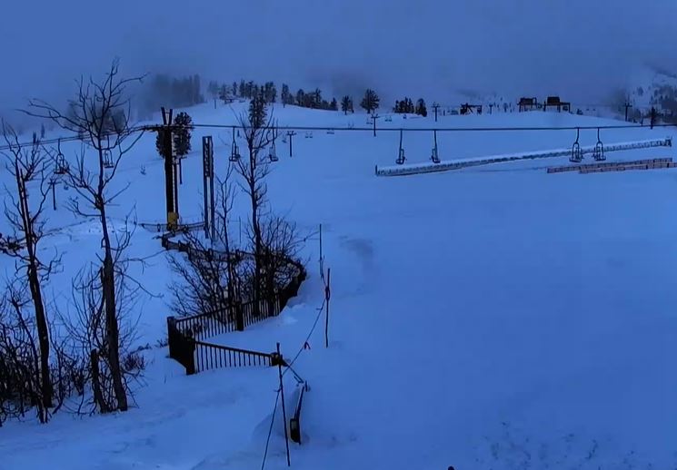
Snowfall Report:
As expected, the final weak system, which moved in Monday night and is still bringing snow showers Tuesday morning, was the wettest of the series. 1-4 inches of new snow fell on the mountain Monday night, and snow is still falling early Tuesday morning.
Tuesday Weather:
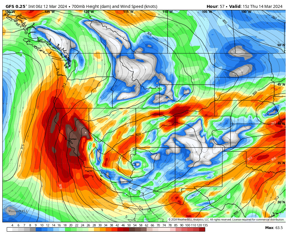
The snow showers will diminish and become more scattered through the day, with a little sun possible by afternoon, and highs in the 30s. Ridgetop winds are gusting up to 60+ mph Tuesday morning and could continue to gust from the west up to 60-70 mph before slowly diminishing through the afternoon. That could cause some upper mountain ski lift opening delays.
The Winds Turn & Continue:
Low pressure moves toward the southwest Wednesday and sits there into Friday while high pressure builds in over the Pacific NW. In between the flow will turn northeasterly over CA with gusty winds by Wednesday afternoon increasing into Thursday.
Ridgetop winds could be gusting up to 50-60+ mph Thursday into Friday morning, maybe even higher over the peaks. That could close some upper mountain lifts and will make the highs in the 30s feel much colder, even with sunny skies expected each day. The winds are expected to come down Friday afternoon with highs warming into the 40s.
The Weekend into Early Next Week:
Sunny skies are expected to continue for the weekend and into early next week as high pressure builds over the region. Lighter winds are expected. Highs into the 50s for the lower elevations and 40s for the higher elevations. The sun is getting stronger as we go into spring, so you’ll want some sun protection.
Long-Range Forecast:
The long-range models continue to show the ridge shifting up towards the Gulf of Alaska by the 21st into the last week of March. That will help to drive colder air into the West. It will also open the door to storms dropping down from the north and moving in from the west under the northeast Pacific ridge.
The first system could be associated with a cold front from the north around Wednesday the 21st into Thursday the 22nd. Right now that system looks pretty weak, but right now that’s our next chance for a little snow.
Going through the last week of March the storm door could remain open. Usually, as we get to the end of March into April we mainly see weak systems and cut-off lows as the jet stream weakens. But a slower-moving low could draw in moisture and bring us a bigger storm at some point.
We’ll be watching the trends closely…
BA