Weekend Weather:
We have nice weather through most of the weekend. Partly-mostly sunny skies with highs into the 40s through Sunday. Maybe near 50 degrees at the base on Saturday.
Sunday we could see some clouds move in later in the day with a few scattered showers possibly reaching the mountain by evening. Ridgetop winds from the southwest gusting up to 30-40+ mph by afternoon.
Monday Storm:
The latest model runs have been trending back toward their ideas from two days ago, where the cut-off low off the coast heads more toward southern CA by Monday and the cold front from the north digs down farther east into the Great Basin and Rockies. Thursday the models were suggesting that the two systems could merge closer to the Sierra.
We are still expecting a windy day on Monday with southwest winds gusting up to 80-90+ mph over the ridges. Highs in the 30s.
The precipitation and snowfall forecasts have dropped back toward where they were two days ago and prior. The snow level forecasts have jumped up a little as well. We could start around 6800-7300 ft. Sunday night, dip as low as 6000-6500 ft. Monday, and finish around 5300-5800 ft.
That means we could see some rain below 7000 ft. down to the base Sunday night and rain could mix in near the base on Monday. By Tuesday morning, we could see around 1-3 inches of snow near the base, 2-6 inches near mid-mountain, and 4-8 inches up top. Snow ratios may be 9-13:1 between 7000-9000 ft. which is thicker snow.
Tuesday – Thursday:
It still looks like weak high pressure will build in by Tuesday through Thursday with a few days of partly-mostly sunny skies and highs in the 30s on the mountain and near 40 degrees at the base. The winds will come down on Tuesday.
Long-Range Forecast:
The long-range models still show a cold trough digging down the West Coast for the weekend of the 1st-3rd and a strong storm moving through. We will continue to watch the trends on this storm all week. If the current forecasts hold we could see snow Friday through Sunday next week, along with strong winds. Hopefully, we will be measuring the storm in feet.
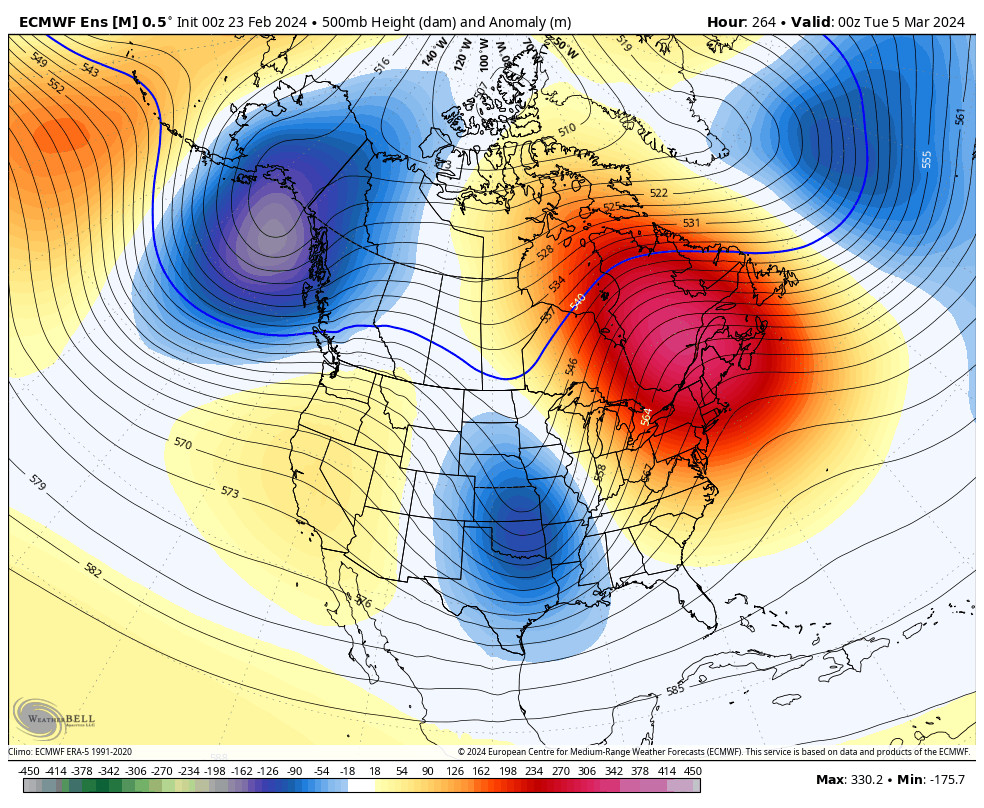
The ensemble mean models are starting to diverge by the 4th. The GFS model is showing the trough shifting east and another trough digging south with storms possibly containing through the 1st week of March into the 2nd week. But the latest European model runs are now showing the trough shifting east and high pressure sticking around starting around the 4th.
We’ll continue to watch the trends to see not only if we will get a cold strong storm next weekend, but also if that could be a one-hit wonder or if the storms could continue into March.
BA


