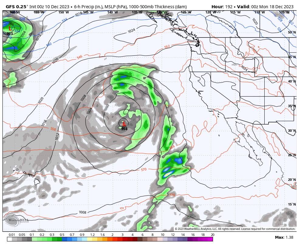
8-9 Day Dry Pattern:
We are starting off Sunday morning with inversions again with temperatures in the 20s down near 6000 ft. and 40s above 8000 ft.!
There are some storms moving through to the north so we could see some high clouds at times this week. Other than that, we expect partly-mostly sunny skies each day for the next 8-9 days, through next weekend and possibly into Monday the 18th. Highs into the 40s near the base and 30s for the upper mountain.
Cut-off Low Fun (headaches):
Whenever we have a low-pressure system spinning off of the coast, cut off from the west-east flow, we always know that we are going to struggle to forecast the timing of when that system could move inland and what the track will be. The latest model runs show the trough near the West Coast next weekend finally pushing slowly inland by Tuesday the 19th.
The first cut-off low that spins up in the trough may be joined by another upstream system diving into the trough now that it is expected to linger a bit longer off the coast. That could help to push them both inland and could help to bring us a bit more moisture over a prolonged 3-4 day period next week, from around the 19th-22nd.
If the forecast holds, we could see waves of light-moderate precipitation rotate through the Sierra over the period. Nothing looks heavy yet unless we take a direct high with the center of the low as it moves inland by the end of the week, with some heavier precipitation on the east side.
Even though we may not have any days with a lot of snowfall, it could start to pile up over the period if the low moves slowly inland through CA. We’ll continue to watch the trends over the next week in regards to the potential snowfall during the week of the 18th.
Long-Range Forecast:
No matter when the trough and associated storms do swing through, the long-range models have consistently been showing high pressure trying to quickly build back in over California. With the slow movement of the cut-off low, that period of drier weather has shrunk down to possibly just the weekend of the 23rd-24th.
Last Week of December:
Over the last few days, we have touched on the long-range models suggesting a strong, linear, and extended jet stream across the Pacific during the last week of December, and how that could push in a wetter pattern. While we are hopeful for a wetter pattern, I cautioned against believing anything out that far.
The latest ensemble mean model runs have pulled back the strength and extension of the jet stream as we go into the last week of December. They still show a large trough in the northeast Pacific by Christmas, and keep it there through the last week of December.
The question may go back to what it has been for a lot of the season so far, which is how far south into CA will storms that spin up in the trough track? The current pattern forecasts still suggest that storms will be moving into the Pacific NW and possibly south into CA.
For now, we have a week+ of dry weather, a cut-off low to deal with the week of the 18th, and then possibly a more active pattern the last week of the month. We’ll continue to hold onto hope that we finish the year on a snowy note.
BA


