High pressure is building over the West to start the week. That will bring a dry and milder pattern to the region. We will see mostly sunny skies each day through Thursday with highs into the 50s.
Friday – Monday:
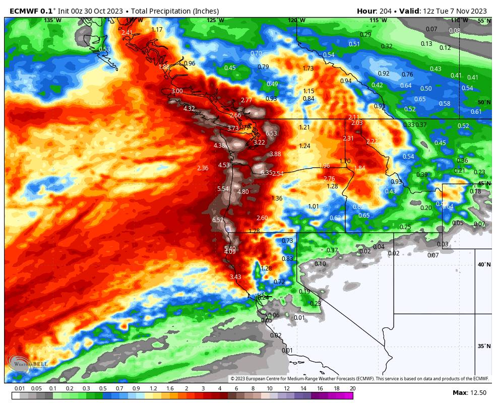
The Pacific NW will see an active pattern by the end of the week as a large trough and low pressure in the Pacific NW nudges in. A strong jet stream will take aim at the Pacific NW just to our north through the upcoming weekend and into early next week.
The first storm on Friday should at least bring in some clouds to the northern Sierra, along with gusty southwest winds. We could get brushed with some rain and high-elevation snow on the southern edge. Right now it looks like light if any with snow levels above 8000 ft.
The next storm Saturday night into Sunday is forecast to have a decent moisture feed from down near Hawaii, and a nice AR (atmospheric river) of moisture aimed to our north. That will bring heavier rain to the Pacific NW. We will have to see how far south the moisture shifts through Sunday as the AR weakens. Some models mainly keep it to our north with some light showers Sunday, and some have the southern edge of some heavier precipitation reaching the northern Sierra.
A 3rd storm could move through to our north next Monday the 7th with northern CA once again on the southern edge. Overall, the Pacific NW seems to be a sure bet for a very wet 4-5 day period and into far northern CA. Some models only have light amounts of precipitation reaching the northern Sierra through next Monday while other models nudge some heavier precipitation very close to the Tahoe region.
We’ll continue to watch the trends all week…
BA


