Dry Pattern:
We saw some inversions develop overnight into Monday morning. Temperatures dropped into the teens near lake level and warmed to near freezing at 9000 ft. But it should have stayed cold enough for snowmaking at most elevations.
Our dry pattern will continue through at least Tuesday. High temperatures into the 40s for the lower elevations near the base and 30s for the upper mountain. Overnight lows in the 20s for continued snowmaking.
Cut-off Low:
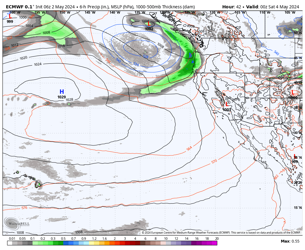
There is a weak cut-off low forecast to spin down the CA coast on Wednesday. Some models bring it close enough for a few clouds and maybe a few stray snow showers over the mountain. But most keep us completely dry. It will be partly-mostly sunny with highs a bit cooler in the 30s.
Active Pattern:
A broad trough will dig into the West by Thursday into the weekend. That will usher in some colder air and open up the door to storms tracking farther south into California. Highs will drop into the 30s near the base and 20s for the upper mountain Thursday through the weekend.
We could see the first system move through sometime Thursday into Friday, with another Saturday, and a third for Sunday. The question is still how far south will they track which will determine how much precipitation and snowfall we could see in the northern and central Sierra.
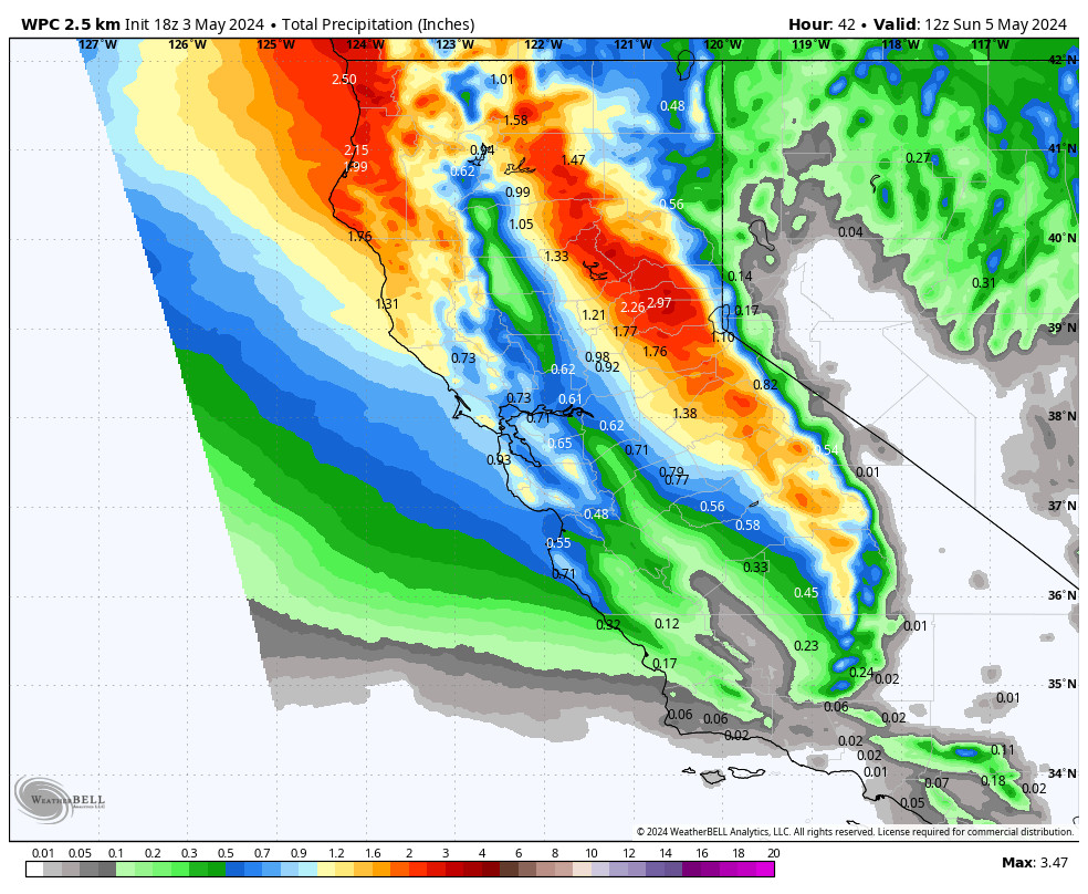
Looking at the WPC’s blended model average, it shows up to an inch of total precipitation near the mountain through Sunday. That is from 3 systems over 3-4 days, so not overly impressive. These would be classified as “weak” systems if that is all we get by Monday morning. We’ll be watching the trends closely all week to see how much snow we could see during what could be a short active period.
Thursday – Friday Snowfall:
I don’t like to forecast specific snowfall amounts out more than 5 days due to the inaccuracy of the models. Historically beyond 5 days, they have less than a 50% accuracy. Therefore, although we are expecting storms and snowfall possibly through Sunday, I’m only going to talk about the snowfall potential through Friday for now.
The snow levels look to start out around 6,000 ft. Thursday (near the base) and then should stay below the base through the weekend. The latest model runs show a range of 0.15 – 0.8 inches of total precipitation for through Friday night. Most of that falls Thursday night from the first system and later Friday night from the 2nd system approaching. The total model average Monday morning is around half an inch near the mountain.
That could bring us 1-3 inches of snow at base in total by Saturday morning, and 3-6 inches of new snow on the mountain. We’ll continue to fine-tune the forecast all week and I’ll add in Saturday and Sunday over the next two days if it continues to look like we could see snowfall on those two days as well.
Long-Range Forecast:
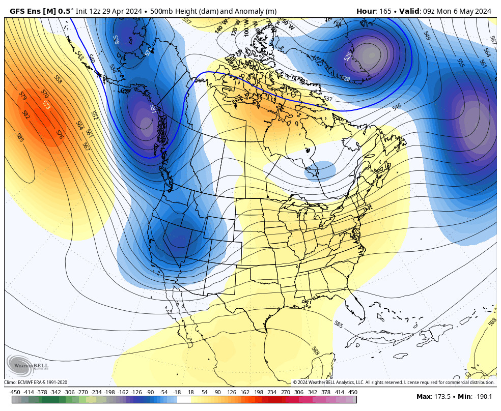
The long-range models show the mean high-pressure ridge position over the West for the 7-10 day period starting next Monday the 4th. That is expected to bump the storm track farther north into the Pacific NW. It should bring quieter weather along with milder temperatures. Highs could rebound back into the 40s and 50s next week with mostly sunny skies each day.
There is a deep trough in the northeast Pacific with a strengthening Pacific jet stream trying to send storms into the West Coast. Some stronger storms are possible for the Pacific NW with some atmospheric river events possible as well. At some point, a storm could be successful in pushing a bit farther south into the northern Sierra.
For now, we are still expecting a drier and milder pattern next week after a 3-4 day period of active weather later this week. We’ll continue to watch the long-range for a stronger storm that could bring significant snowfall to the mountain.
BA