Skip to content
Palisades Tahoe Logo Palisades Tahoe Logo Palisades Tahoe Logo
Explore
Main Menu
  • Explore Palisades Tahoe
  • Base to Base Gondola
  • Our New Name
  • Explore Legendary Lifts
  • Palisades Tahoe Blog
  • About Lake Tahoe
  • About Us
Plan Your Visit
Main Menu
  • Tickets & Passes
  • Lodging
  • Lessons & Guides
  • Deals & Packages
  • Rentals & Demos
  • Travel Here
  • Getting Around
Mountain Information
Main Menu
  • Snow and Weather
  • Lift and Grooming Status
  • Webcams
  • Hours of Operation
  • Trail Maps
  • Parking & Road Conditions
  • Snowfall Tracker
Events & Activities
Main Menu
  • Events Calendar
  • Activities
  • Dining & Apres
  • Shopping
  • Things To Do In Lake Tahoe
  • Groups, Meetings & Weddings
  • Ski & Snowboard Teams
IKON PASS HOLDER LODGING DISCOUNT

Ikon Pass holders save up to 20% on slopeside lodging at The Village at Palisades Tahoe.

SLOPESIDE LODGING
Icon / FlashCreated with Sketch.
View All Offers
  • Weather

Cold Saturday, Sunny Sunday, Windy Monday, Weak Storm Tuesday

  • Jan 1, 2022
  • 8:43 am

Snowfall Report:

The snow showers Friday brought another coating of snow to the base and 1 inch of new snow to the mountain. That brings the 2-day storm total to 2 inches.
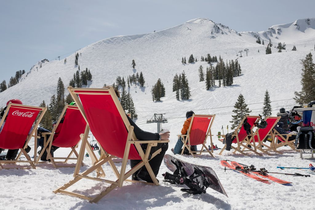
The Weekend:

Saturday and Sunday we expect mostly sunny skies during the day. Highs into the 30s at the base and 20s up top. Saturday the winds look to be lighter. Then they could increase again Sunday from the southwest, gusting up to 70+ mph by afternoon up top, possibly affecting some upper mountain lift operations.

Monday – Tuesday Storm:

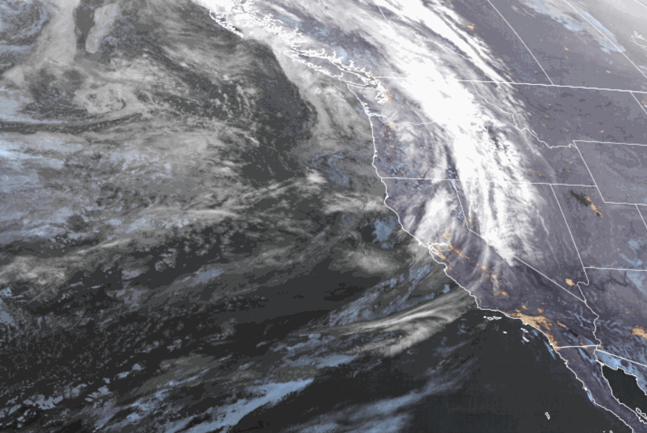
Monday we could start with partly sunny skies and then increasing clouds later in the day as the next storm approaches. Highs are still in the 20s and 30s. The winds could continue to increase from the southwest gusting up to 100+ mph up top, and up to 130+ mph by afternoon! That will likely close some upper mountain lifts.

Monday night through Tuesday night the next storm is forecast to move through. This is a weak storm with only light-moderate snow expected. The snow levels look to stay below the base through Tuesday and then we could see them rise Tuesday night up to 7000+ ft. by Wednesday morning. Strong winds continue Tuesday from the west gusting up to 70+ mph up top through the afternoon.

We could see 1-4 inches possible at the base and 2-6 inches on the mountain. The snow at the base and lower mountain could end with some rain on top Tuesday night, and becoming wetter up top into Wednesday morning as temperatures rise.

Wednesday – Thursday:

Wednesday we could see partly sunny skies and then mostly sunny for Thursday. It will be milder with highs into the 40s at the base and 30s up top.

The winds could turn northwest Wednesday and could gust up to 60+ mph up top in the morning and drop to 40+ in the afternoon. Thursday we could start with lighter winds but then maybe increasing later in the day ahead of the next approaching storm.

Long-Range:

Another storm is forecast to move through Friday into next Saturday the 8th. Right now it looks like several inches of new snow are possible with falling snow levels to the base as the storm moves in. We will fine-tune the details all week as the storm gets closer.

From Sunday the 9th through the 2nd week of January the forecast models suggest we could see a drier pattern, possibly through mid-month. We could see milder temperatures as well during this period. We could see the pattern start to shift again during the 3rd week of January.

BA

lake tahoe weather palisades tahoe weather forecast snowfall forecast
Bryan Allegretto
Bryan Allegretto

Share this article:

Recent Posts

  • Weather ·
  • March 21, 2023·

Weak Systems & Snow Showers thru Sunday

Tuesday Storm: The next storm pushes snow showers back in by later Tuesday morning, with steadier snow through Tuesday afternoon.…
Read more
  • Weather ·
  • March 20, 2023·

More Weak Systems Tuesday-Friday

Snowfall Reports: No real surprises with the weak storm that moved through on Sunday. We were expecting 3-11 inches from…
Read more
  • Weather ·
  • March 19, 2023·

Two More Storms Sun & Tue

Sunday Storm: Snow showers are moving in Sunday morning, and will continue through the day before becoming more scattered Sunday…
Read more

Social

Instagram Twitter Facebook Youtube

Contact

   Email Us
   1.800.403.0206

Our Partners

U.S. Forest Service Logo
1960 Olympic Valley Road
Olympic Valley, CA 96146

©2022 Palisades Tahoe

Alterra Mountain Company
  • Privacy Policy
  • Terms of Service
  • Photo Upload Terms of Use
  • Accessibility
  • Do Not Sell My Personal Information
  • Privacy Policy
  • Terms of Service
  • Photo Upload Terms of Use
  • Accessibility
  • Do Not Sell My Personal Information