Skip to content
Palisades Tahoe Logo Palisades Tahoe Logo Palisades Tahoe Logo
Explore
Main Menu
  • Explore Palisades Tahoe
  • Base to Base Gondola
  • Our New Name
  • Explore Legendary Lifts
  • Palisades Tahoe Blog
  • About Lake Tahoe
  • About Us
Plan Your Visit
Main Menu
  • Tickets & Passes
  • Lodging
  • Lessons & Guides
  • Deals & Packages
  • Rentals & Demos
  • Travel Here
  • Getting Around
Mountain Information
Main Menu
  • Snow and Weather
  • Lift and Grooming Status
  • Webcams
  • Hours of Operation
  • Trail Maps
  • Parking & Road Conditions
  • Snowfall Tracker
Events & Activities
Main Menu
  • Events Calendar
  • Activities
  • Dining & Apres
  • Shopping
  • Things To Do In Lake Tahoe
  • Groups, Meetings & Weddings
  • Ski & Snowboard Teams
IKON PASS HOLDER LODGING DISCOUNT

Ikon Pass holders save up to 20% on slopeside lodging at The Village at Palisades Tahoe.

SLOPESIDE LODGING
Icon / FlashCreated with Sketch.
View All Offers
  • Weather

Chilly Thursday, Warming For the Weekend

  • Apr 13, 2023
  • 7:49 am

Thursday:

It’s a chill start to Thursday with temperatures starting out in the teens on the upper mountain and 20s at the base. We will see mostly sunny skies with highs warming into the 30s on the upper mountain and 40s at the base. The gusty winds have finally fallen off.

The Weekend:

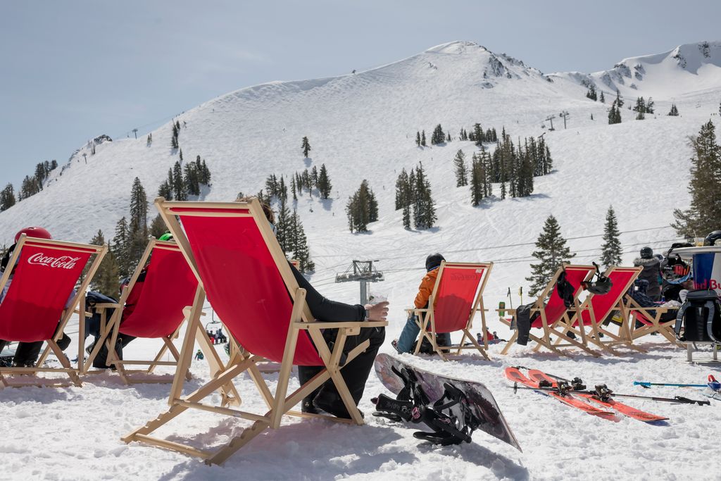
Friday through Sunday we expect mostly sunny skies each day with a slow warming trend as a weak high-pressure ridge builds over the West.

Highs into the 40s on Friday to near 50 degrees at the base. Then 50s at the base and 40s above 8000 ft. Sat-Sun. The winds look to be lighter through Saturday. Sunday we could see increasing southwest winds with ridgetop gusts up to 50-60+mph by afternoon, possibly affecting a few upper mountain lifts.

Monday:

Monday we should stay dry during the day with mostly sunny skies and some high clouds possible later in the day. Ridgetop winds could increase to 60-70+ mph from the southwest, which could continue to affect some exposed upper mountain lifts. Highs may cool into the 40s.

Tuesday – Wednesday Snow Showers:

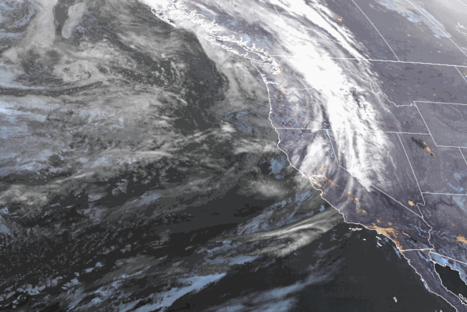
By Tuesday we still expect a large trough to dig into the West. That should continue the gusty winds as well as bring in even colder air and maybe some showers on the southern edge of the storm track.

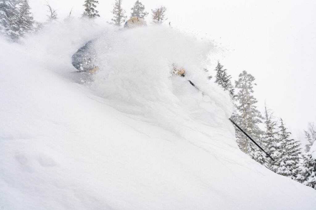
Highs could dip into the 30s for Tuesday with snow levels near to below the base. That could bring some snow showers to the mountain. The snow showers could move in as early as Monday night and could possibly linger into Wednesday before clearing.

The latest model runs keep most of the heavier precipitation to our north through Wednesday, with some light precipitation amounts reaching the northern Sierra. We’ll continue to watch the trends over the next few days to see if we could pick up a few inches of fresh snow on the mountain.

Long-Range:

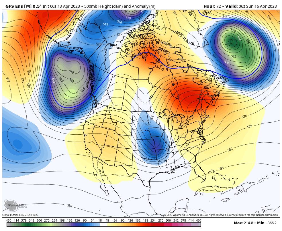
The long-range models continue to suggest that troughing is near or over the West Coast through most of the period through the 26th. That could keep the door open to additional systems possibly tracking through northern CA and bringing us some precipitation. The spring models are terrible at forecasting specific storms so we won’t try to speculate anything beyond 7 days, just that the pattern could remain unsettled.

The ensemble mean models suggest that above-average precipitation is possible for the Pacific NW into northern CA through the period, with Tahoe on the edge between above-average precip to the north and below-average to the south. We’ll continue to watch the trends and will keep an eye out for any systems that could possibly bring more than just snow showers and light accumulations to the mountain.

Beyond the 26th, the long-range models suggest that high pressure builds in over the West Coast through the end of April. That could bring a prolonged drier and milder pattern.

BA

lake tahoe weather palisades tahoe weather forecast snowfall forecast
Bryan Allegretto
Bryan Allegretto

Share this article:

Recent Posts

  • Weather ·
  • May 8, 2023·

Final Forecast of the 2022-23 Season

First Week of May Snowfall Report: The first week of May was a cold and snowy one. The upper mountain…
Read more
  • Weather ·
  • May 1, 2023·

Snowy First Week of May

Monday – Friday Snow Shower Chances: A low-pressure system will be making its way south down the coast on Monday…
Read more
  • Weather ·
  • April 29, 2023·

Cooler with Rain & Snow Showers Possible Starting Monday

Saturday – Sunday Weather: It’s another mostly sunny day with some high clouds on Saturday. Highs into the 60s to…
Read more

Social

Instagram Twitter Facebook Youtube

Contact

   Email Us
   1.800.403.0206

Our Partners

U.S. Forest Service Logo
1960 Olympic Valley Road
Olympic Valley, CA 96146

©2022 Palisades Tahoe

Alterra Mountain Company
  • Privacy Policy
  • Terms of Service
  • Photo Upload Terms of Use
  • Accessibility
  • Do Not Sell My Personal Information
  • Privacy Policy
  • Terms of Service
  • Photo Upload Terms of Use
  • Accessibility
  • Do Not Sell My Personal Information