

Friday Weather:
We will have increasing clouds and winds throughout the day on Friday. Highs in the 20s on the mountains, and low 30s near the base. Ridgetop winds from the west increasing with gusts up to 60-70+ mph by afternoon, which could close some exposed upper mountain lifts. It will also make it feel much colder to the skin.
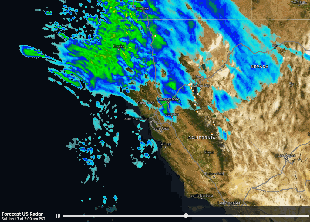
Friday night we will start to see some scattered snow showers move into the northern Sierra. Most of it looks like overrunning precipitation ahead of the main storm. The snow looks fairly light with snow showers starting to increase into Saturday morning. Only expecting around a dusting to an inch of snow by 4-5 AM.
Saturday Storm:
The snow will increase through the day on Saturday with the heaviest snow expected Saturday afternoon-evening. Saturday will be a storm and very windy day. Highs in the 20s for the higher elevations and 30s for the lower elevations as this storm will bring in some warmer air. Ridgetop winds gusting up to 90-100+ mph most of the day, which should keep quite a few upper mountain ski lifts closed on Saturday.
The latest model runs have started to diverge again for precipitation amounts based on how far south they dig the storm and heaviest precipitation. That’s frustrating only 24 hours before the storm moves in. However, the model average is still close to where it was the last two days even though the range of solutions has expanded.
The snow levels will be a little tricky to forecast. They will start below the base early Saturday morning and then rise as warmer air works in with the heaviest precipitation. The latest model runs show freezing levels topping out around 7100 ft. Saturday afternoon-evening. With heavy precipitation rates, the snow levels will usually drag down to around 1000 ft. below the freezing levels, which is near the base.
Some rain could mix in near the base but we could also hold as wet snow, which could impact the snowfall amounts. Then snow levels drop back to 5000-5500 ft. by the end of the storm. Above 6500 ft. I expect all snow with snow ratios averaging around 10-14:1 between 7000-9000 ft. We could see around 5-10 inches of snow near the base, and 14-19 inches on the mountain by Sunday morning.
Sunday – Monday:
Clearing on Sunday with nicer weather for the remainder of MLK weekend. Mostly sunny skies are expected by Sunday afternoon as the storm clears the region, and the winds drop off. Highs into the 30s both days.
Tuesday – Thursday:
The forecast models are still out of sync for the middle of next week, similar to how they were for this Saturday a week out. Some models show a stronger high-pressure ridge over CA keeping us dry through the week, and mild temperatures with highs into the 40s for the lower elevations.
Other models show a weaker ridge and allow a storm to move through Tuesday night – Wednesday. We will continue to watch the trends over the next several days. If we get some precipitation on Wednesday, the snow levels will likely be higher with a milder storm moving through.
Thursday looks like a drier day if we see a storm or just another dry day in a dry week…
Long-Range Forecast:
If the long-range models continue to show a pattern shift starting around the 20th. But some models show more troughing near the West Coast with above-average precipitation for several days with storms starting to move into CA starting around the 20th-21st, while others only show weaker systems if any making it into the northern Sierra.
BA
