We have nice weather forecast for Monday (10/23) and Tuesday as the weekend trough exits and high pressure builds in for a couple of days. Mostly sunny skies are expected with highs near 60 degrees at the base and 50s on the mountain.
Wednesday System:
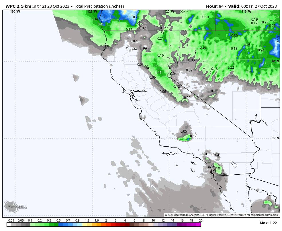
The next trough is forecast to dig south into the West on Wednesday with colder air and a front with some showers possible by Wednesday afternoon into Wednesday night.
Most of the precipitation is currently forecast to fall Wednesday night with clearing for Thursday, and colder air behind the front. Highs may only be in the 40s Wednesday and Thursday, with snow levels falling near 7000 ft. (near to just below mid-mountain) Wednesday night, possibly a tad lower briefly.
The latest model runs still don’t agree on the amount of precipitation with this system, but it still looks very light, with only up to 3 tenths of an inch. That could be enough for a coating up to an inch or two of snow above 8,000 ft., and maybe a dusting to mid-mountain or just below by early Thursday.
Friday – Saturday System:
The forecast models suggest another cold front Friday into Saturday could stall near the Tahoe region or just to our north or south, and could pull in some moisture from a weak system moving in from the West.
The latest model runs are at odds on whether this front stalls north or south or right over the region, and how much moisture it can draw in. That has some models showing a drier scenario with just a shot of colder air and maybe a few flakes and others showing up to half an inch or more of liquid over the mountain by Saturday.
The winds are forecast to get pretty strong by Friday with ridgetop gusts up to 80+ mph from the west-southwest ahead of the front. Then coming down a bit but still breezy Saturday and winds turning northeast by Saturday night.
We have a lot of ironing out to do this week to see if we could see just some wind and colder air for the weekend, or possibly some measurable snowfall on the mountains. snown levels could reach or dip just below 7000 ft. again by Friday night.
Long-Range:
The long-range models continue to show a ridge of high pressure building over CA by early next week to end October and for trick or treating. That would likely mean we start to warm up a bit by Sunday and continuing into early next week along with a drier pattern.
The long-range models suggest that an active pattern could return to the Pacific NW sometime during the 1st week of November, with northern CA possibly on the southern edge of the storms. We’ll keep an eye on that.
The climate models suggest that November could be wet overall for CA, so we’ll keep an eye out for that as well.
BA


