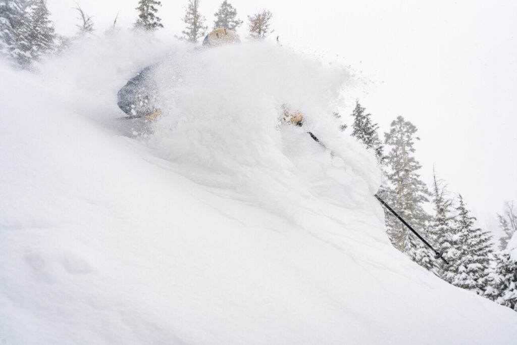
Skip to content
Palisades Tahoe Logo Palisades Tahoe Logo Palisades Tahoe Logo
Explore
Main Menu
  • Explore Palisades Tahoe
  • Base to Base Gondola
  • Our New Name
  • Explore Legendary Lifts
  • Palisades Tahoe Blog
  • About Lake Tahoe
  • About Us
Plan Your Visit
Main Menu
  • Tickets & Passes
  • Lodging
  • Lessons & Guides
  • Deals & Packages
  • Rentals & Demos
  • Travel Here
  • Getting Around
Mountain Information
Main Menu
  • Snow and Weather
  • Lift and Grooming Status
  • Webcams
  • Hours of Operation
  • Trail Maps
  • Parking & Road Conditions
  • Snowfall Tracker
Events & Activities
Main Menu
  • Events Calendar
  • Activities
  • Dining & Apres
  • Shopping
  • Things To Do In Lake Tahoe
  • Groups, Meetings & Weddings
  • Ski & Snowboard Teams
IKON PASS HOLDER LODGING DISCOUNT

Ikon Pass holders save up to 20% on slopeside lodging at The Village at Palisades Tahoe.

SLOPESIDE LODGING
Icon / FlashCreated with Sketch.
View All Offers
  • Weather

50″ So Far in April, A Couple More Feet Possible

  • Apr 20, 2022
  • 8:27 am

Snowfall Report:

An additional 6 inches of new snow fell on the upper mountain Tuesday bringing the storm total to 7 inches up top. A mix of rain and snow at the base brought less than an inch. We were expecting 0-3 inches at the base and 3-8″ on the mountain, so the storm performed as we expected.

It also brings the April total to 50 inches of snow so far, which is more than we saw during Jan-Mar combined!

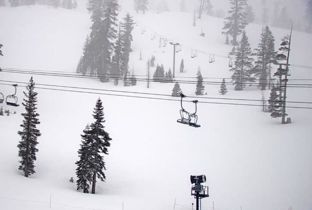
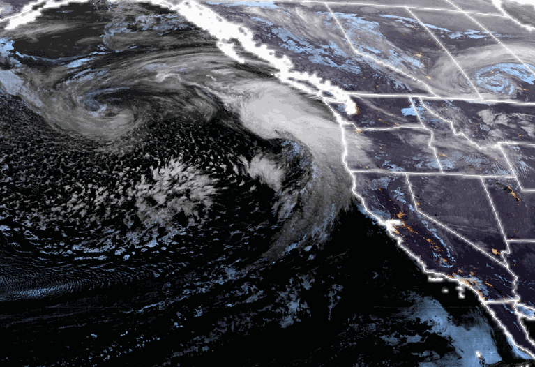
Wednesday – Friday Storm:

We have a break between storms into Wednesday afternoon. Highs into the 40s at the base and 30s up top. Ridgetop winds from the southwest with gusts up to 60-70+ mph, possibly closing some upper mountain lifts.

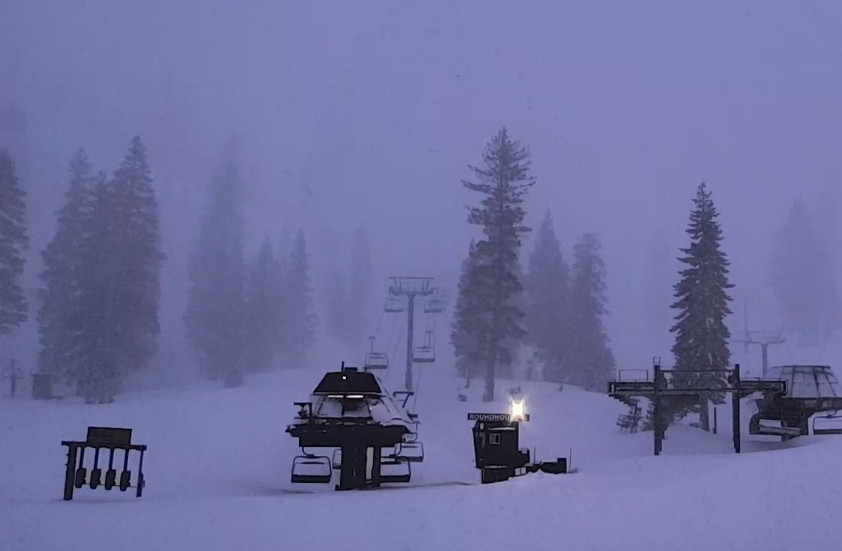
Rain & snow push in Wednesday evening around 8-11 PM based on the latest forecast model runs. Snow levels up around 6900-7900 ft. to start with rain at the base and on the lower mountain. Heavier precipitation pushes in overnight into Thursday with snow levels falling to around 6200-6800 ft. Wednesday night and 5300-5800 ft. by Thursday morning. That means rain changing to snow at the base at some point.

Highs in the 30s for Thursday as the snow continues. Winds gusting up to 80+ mph up top Thursday morning and falling to 50-60+ mph during the afternoon, which should delay some upper mountain lift openings. Snow levels falling below 5000 ft. Thursday night as snow showers continue.

Friday lighter scattered showers could continue into Friday afternoon before clearing out by evening. Snow levels could rise back up to 6000-7000 ft. by afternoon with a few rain showers possible at the base at the end of the storm. Highs in the 30s with lighter winds expected for Friday.

This should be an impressive snowstorm by April standards. We could see 9-14 inches of new snow at the base, and 16-26 inches on the mountain by Friday.

The Weekend:

The weather will be nicer over the weekend as high pressure builds in. We should see sunny skies and highs warming into the 40s Saturday and then 50s at the base for Sunday. We should have lighter winds as well. 

Long-Range:

The nice weather should continue next week.

The storm track could be just to our north by the end of the month into early May, so we will have to watch for any possible storms trying to dip into northern CA.

BA

lake tahoe weather palisades tahoe weather forecast snowfall forecast
Bryan Allegretto
Bryan Allegretto

Share this article:

Recent Posts

  • Weather ·
  • March 29, 2023·

Partly Sunny Wed-Sun w/ Snow Showers Possible

Snowfall Reports: 12 inches of new snow fell on the mountain in the past 24 hours as of 5 AM…
Read more
  • Weather ·
  • March 28, 2023·

Snow & Strong Winds Tuesday

Tuesday  – Wednesday Storm: Snow showers are pushing in Tuesday morning, with heavier snow expected later in the morning into…
Read more
  • Weather ·
  • March 27, 2023·

Snowstorm Tuesday, Snow Showers Wed-Sun

Monday: Monday will start out sunny with highs in the 30s at the base and 20s up top. Some high…
Read more

Social

Instagram Twitter Facebook Youtube

Contact

   Email Us
   1.800.403.0206

Our Partners

U.S. Forest Service Logo
1960 Olympic Valley Road
Olympic Valley, CA 96146

©2022 Palisades Tahoe

Alterra Mountain Company
  • Privacy Policy
  • Terms of Service
  • Photo Upload Terms of Use
  • Accessibility
  • Do Not Sell My Personal Information
  • Privacy Policy
  • Terms of Service
  • Photo Upload Terms of Use
  • Accessibility
  • Do Not Sell My Personal Information