Skip to content
Palisades Tahoe Logo Palisades Tahoe Logo Palisades Tahoe Logo
Explore
Main Menu
  • Explore Palisades Tahoe
  • Base to Base Gondola
  • Our New Name
  • Explore Legendary Lifts
  • Palisades Tahoe Blog
  • About Lake Tahoe
  • About Us
Plan Your Visit
Main Menu
  • Tickets & Passes
  • Lodging
  • Lessons & Guides
  • Deals & Packages
  • Rentals & Demos
  • Travel Here
  • Getting Around
Mountain Information
Main Menu
  • Snow and Weather
  • Lift and Grooming Status
  • Webcams
  • Hours of Operation
  • Trail Maps
  • Parking & Road Conditions
  • Snowfall Tracker
Events & Activities
Main Menu
  • Events Calendar
  • Activities
  • Dining & Apres
  • Shopping
  • Things To Do In Lake Tahoe
  • Groups, Meetings & Weddings
  • Ski & Snowboard Teams
IKON PASS HOLDER LODGING DISCOUNT

Ikon Pass holders save up to 20% on slopeside lodging at The Village at Palisades Tahoe.

SLOPESIDE LODGING
Icon / FlashCreated with Sketch.
View All Offers
  • Weather

5 Foot Storm Total, Up to 2 More Feet by Thursday

  • Dec 15, 2021
  • 8:08 am

Storm Totals:

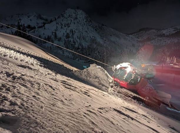
The mountain received an additional 9 inches of snow in the past 24 hours bringing the 3-day storm total to 61 inches or over 5 feet!

The mountain is still struggling with power as of Tuesday morning so follow social media closely for updates.

Wednesday – Thursday Storm:

The next storm is moving in already Wednesday morning. The latest forecast model runs show snow showers moving back in Wednesday morning, with heavier snow for Wednesday night, and then snow showers Thursday winding down during the afternoon.

This is a colder storm and snow levels should peak out well below the base. Highs only in the 20s so we start cold as well. The winds pick back up again Wednesday with gusts up to 60+ mph from the west-southwest up top in the morning and increasing to 120+ mph by evening. Snow:liquid ratios of 12-17:1 on the mountain and 10-11:1 at the base. So a nice light snow for the mountain by Thursday. 

The winds drop off again Thursday with highs near freezing at the base and 20s on the mountain. We could see an additional 13-19 inches of snow from this storm at that base and 16-28 inches on the mountain by Thursday afternoon!

The Weekend:

High pressure builds in over CA Friday into Saturday with sunny skies and highs into the 30s. Later Saturday into Saturday night the winds could increase with ridgetop gusts up to 50+ mph.

We should be dry again for Sunday with highs in the 30s, but with increasing winds up to 80+ mph.  That could affect upper mountain lift operations. We could also see some clouds depending on how close the next approaching storm gets by Sunday.

Long-Range:

Next week the forecast models are still struggling with the timing and details of the storms. But the good news is that the storm door is open as another deep trough digs down over the West Coast.

Low-pressure systems are forecast to spin down from the north off the West coast, and possibly tap into subtropical moisture. The first one could be spinning off the West Coast by Monday, but the models are struggling with how close it is to the coast. It may sit off the coast with a dry day for Monday, or we could start to see snow push in. We’ll keep watching closely and will update you.

By Tuesday into next Wednesday, the storm should move inland with heavy precipitation and snow. We will be tracking this storm closely with better details on timing and the potential snowfall amounts as we get closer.

The storm door looks to stay open, with another storm possible for Christmas Eve into Christmas Day. We will continue to track this one closely as well, especially with a lot of people expected to travel into the Sierra for the holidays.

BA

lake tahoe weather palisades tahoe weather forecast snowfall forecast
Bryan Allegretto
Bryan Allegretto

Share this article:

Recent Posts

  • Weather ·
  • March 21, 2023·

Weak Systems & Snow Showers thru Sunday

Tuesday Storm: The next storm pushes snow showers back in by later Tuesday morning, with steadier snow through Tuesday afternoon.…
Read more
  • Weather ·
  • March 20, 2023·

More Weak Systems Tuesday-Friday

Snowfall Reports: No real surprises with the weak storm that moved through on Sunday. We were expecting 3-11 inches from…
Read more
  • Weather ·
  • March 19, 2023·

Two More Storms Sun & Tue

Sunday Storm: Snow showers are moving in Sunday morning, and will continue through the day before becoming more scattered Sunday…
Read more

Social

Instagram Twitter Facebook Youtube

Contact

   Email Us
   1.800.403.0206

Our Partners

U.S. Forest Service Logo
1960 Olympic Valley Road
Olympic Valley, CA 96146

©2022 Palisades Tahoe

Alterra Mountain Company
  • Privacy Policy
  • Terms of Service
  • Photo Upload Terms of Use
  • Accessibility
  • Do Not Sell My Personal Information
  • Privacy Policy
  • Terms of Service
  • Photo Upload Terms of Use
  • Accessibility
  • Do Not Sell My Personal Information