Snowfall Report:
We expected rain for the base with a mix on the lower mountain and snow up top from the weak & warm system that moved through Tuesday night. That’s what we saw as mostly rain fell from the base up to 7000 ft., and 1-4 inches of new snow fell from 7000 ft. up to the top of the mountain.
Wednesday – Friday Weather:
We have a few scattered showers left over early Wednesday morning. We will clear out through the rest of the day, with partly sunny skies by afternoon. Highs in the 30s. Ridgetop winds are still pretty gusty with gusts from the west up to 60-70+ mph this morning, and they will only slowly come down through the afternoon, so some ski lifts could be on hold.
Thursday and Friday will be dry. Partly sunny Thursday and increasing clouds Friday. Highs into the 40s for the lower elevations and 30s for the upper elevations. Lighter winds on Thursday. A bit breezier by Friday afternoon, but ridgetop gusts from the south-southwest may only be up to 30-40+ mph.
3 Days of Mild Storms:
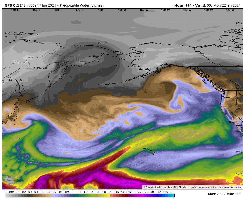
We have been watching for the pattern to shift this weekend for a while now. The long-range models did a pretty good job forecasting this time. The Pacific jet stream becomes stronger/faster across most of the Pacific, ending near the West Coast this weekend into Monday.
The strongest winds however are to our south. Storms will be spinning up along the jet and moving into the West Coast for a few days, and they will be tapping some warmer subtropical moisture as they approach the coast.
But without the jet stream nosing into northern CA, that will limit the amount of moisture transport into the northern Sierra, and the lighter winds, especially from the south, are not that good for orographic enhancement from the mountains. The storms will end up weaker and will struggle to push heavier precipitation over the mountain.
Friday Night – Saturday Night:
The first system looks to bring in the first wave of precipitation Friday evening into Saturday, with a moist onshore flow likely keeping some showers around into Saturday night. The flow looks more southerly with this first system.
Snow levels look to start out around 7000-7500 ft. Friday evening, and then falling a bit and hovering between the base and 7000 ft. through Saturday night. We should see mostly snow above 7000 ft. We could see a slushy coating up to 2 inches of snow below 7k’, and 2-5 inches above 7k’ on the upper mountain by Sunday morning.
Highs in the 30s for Saturday. The winds don’t look over strong, and may only be gusting up to 40-50+ mph over the ridges, part of the reason for the lack of heavier precipitation.
Sunday – Monday Night:
The latest model runs show the winds turning more southwesterly Sunday into Monday night, with a wetter storm possible Sunday night into Monday. This one could have more of a push and better orographics, but it may also be warmer.
The latest model runs show the heaviest precipitation falling Sunday night into Monday, with lighter showers for Sunday and Monday night. Snow levels could start out near the base Sunday morning, but then look to rise to around 6500-7000 ft. by afternoon, and continue to rise Sunday night up to 7000-7500 ft., and then slowly lower into Monday night to near the base.
That means we could start with some snow near the base Sunday morning, a change to rain all the way up to 7000-7500 ft. into Sunday night, and then we could end with some snow near the base Monday night. That only gives us a snowfall forecast of 0-2 inches near the base from the total of what falls at the start and the end.
Between the base & 7k’ we could see 1-9 inches as you go up in elevation. Between 7-8k’ we could see 9-14 inches, and above 8k’ we could see 12-17 inches of snow in total by Tuesday morning. This will be a wetter/thicker snow, not powder. We’ll continue to fine-tune the forecast over the next few days.
Long-Range Forecast:
High pressure is trying to build in by Tuesday into next Wednesday the 24th. We could see a final weak system sneak through before the ridge gets stronger later next week through the last week of January. That is expected to bring a dry and mild end to the month of January.
The long-range models are trying to extend the Pacific jet stream again as we go into the 1st week of February, but currently, they have it falling even more short of the West Coast, so that may not help at all to break the drier pattern.
We’ll continue to watch the trends and to look for any signs of an active pattern returning.
BA


