
Snowfall Report:
3-4 inches of fluffy powder fell on the mountain Monday night. Exactly what were expecting from the 2-6 inches that were forecast for the storm.
Tuesday:
We have a bit of a break Tuesday but systems are moving through to our north. We should see sun and clouds throughout the day. Highs in the 30s at the base and 20s up top. Ridgetop winds are breezy with gusts from the west up to 30-50 mph possible throughout the day.
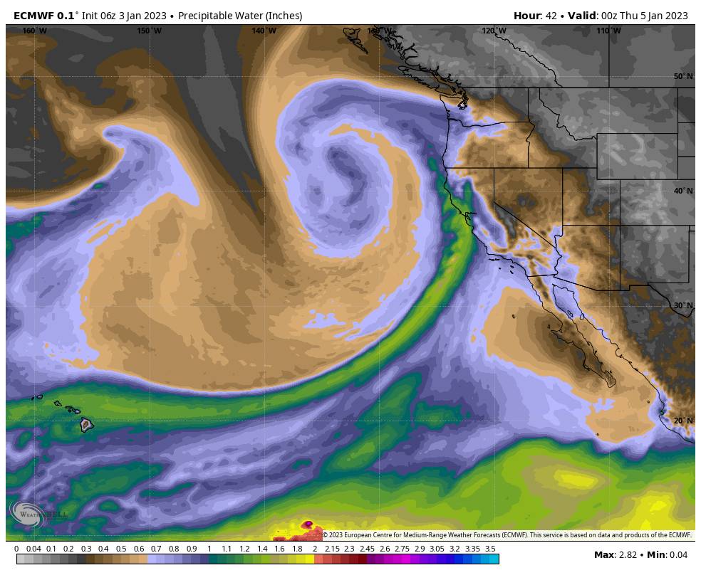
Wednesday – Thursday Storm:
A stronger storm moves into northern CA Wednesday morning, but the southerly flow parallel to the Sierra should limit the heavy precip from reaching the mountain through Wednesday evening. We should see light-moderate snow showers through the afternoon and evening and rising snow levels as warmer air pushes in. We could see some rain below 7000-7500 ft. for a time Wednesday afternoon-evening.
We may only see 3-6″ of wet snow on the upper mountain above the snow line through Wednesday evening. Then the cold front pushes through later Wednesday night into Thursday morning with a period of heavier snow and falling snow levels. Snow levels drop below the base overnight. The snow becomes lighter behind the front Thursday afternoon and more scattered Thursday night before ending by Friday morning.
Highs in the 30s Wednesday and dropping into the 20s on the upper mountain Thursday. Ridgetop gusts up to 90-100+ mph from the south by Wednesday afternoon. That should close some upper mountain lifts. The gusty winds continue Thursday with gusts from the southwest possibly only dropping to 60-70+ mph by afternoon, and then dropping more Thursday night.
I’m going to assume that we see a period of rain at the base and rain mix in up to mid-mountain Wednesday afternoon/evening in my snowfall forecast. Here is the updated snowfall forecast for this storm by Friday morning:
- 8-16 inches at the base.
- 16-25 inches at the mid-mountain elevations.
- 25-32 inches up top.

Friday:
We could see some sun and clouds between storms on Friday. A few scattered snow showers could fall around the region. The winds will drop off so the skiing should be pretty good on Friday. Highs in the 30s at the base and 20s up top.
Weekend Storm:
The forecast models have come into agreement that the next storm will move in by Saturday afternoon with lighter showers expected into the evening along with rising snow levels. Snow levels could rise to just above the base in the 6200-6800 ft. range. Ridgetop winds increase up to 60-70+ mph from the southwest by afternoon, which could close some upper mountain lifts.
Then later Saturday night into Sunday morning we expect some heavier snow and falling snow levels as the cold front moves through. Snow levels fall below the base. Then lighter snow showers are possible for Sunday afternoon into Sunday evening possibly tapering off briefly early Monday morning.
We could see a little rain at the base to start but most of the storm through Sunday should be snow. Here is the initial snowfall forecast for the weekend storm through Sunday evening.
- 4-10 inches at the base.
- 10-14 inches at the mid-mountain elevations.
- 14-20 inches up top
The snow starts wetter and then somewhat lower-density snow for Sunday into Sunday night. But overall not a very cold storm.
Long-Range:
The next storm could move in by Monday morning and could last through Tuesday. This storm looks warmer and could become quite wet Monday night into Tuesday as yet another atmospheric river could be pointed at northern CA.
We will nail down the details of this system as we get closer and it enters the 5-day forecast window. Overall we could see rain for the lower elevations that turns to snow later in the storm as colder air works in, and another round of significant snowfall for the upper mountains. Strong winds are also likely.
The latest long-range model runs suggest that we could see a break in the storms next Wednesday the 11th through Thursday the 12th. But that could change as we get closer. The long-range models show the next storm moving in around Friday the 13th. The active pattern could continue into the 3rd week of January.
BA


