Palisades Tahoe Logo Palisades Tahoe Logo Palisades Tahoe Logo
Explore
  • Explore Palisades Tahoe
  • Our New Name
  • Explore Legendary Lifts
  • Palisades Tahoe Blog
  • About Lake Tahoe
  • About Us
Plan Your Visit
  • Tickets & Passes
  • Lodging
  • Lessons & Guides
  • Deals & Packages
  • Rentals & Demos
  • Travel Here
  • Getting Around
Mountain Information
  • Snow and Weather
  • Lift and Grooming Status
  • Webcams
  • Hours of Operation
  • Trail Maps
  • Parking & Road Conditions
  • Snowfall Tracker
Events & Activities
  • Events Calendar
  • Activities
  • Dining & Apres
  • Shopping
  • Things To Do In Lake Tahoe
  • Groups, Meetings & Weddings
  • Ski & Snowboard Teams
IKON PASS HOLDER LODGING DISCOUNT

Ikon Pass holders save up to 25% on slopeside lodging at The Village at Palisades Tahoe.

SLOPESIDE LODGING
Icon / FlashCreated with Sketch.
View All Offers
  • Weather

4 Inches of New Snow, With Storms Lined Up

  • Jan 23, 2021
  • 8:44 am

Snowfall Report:

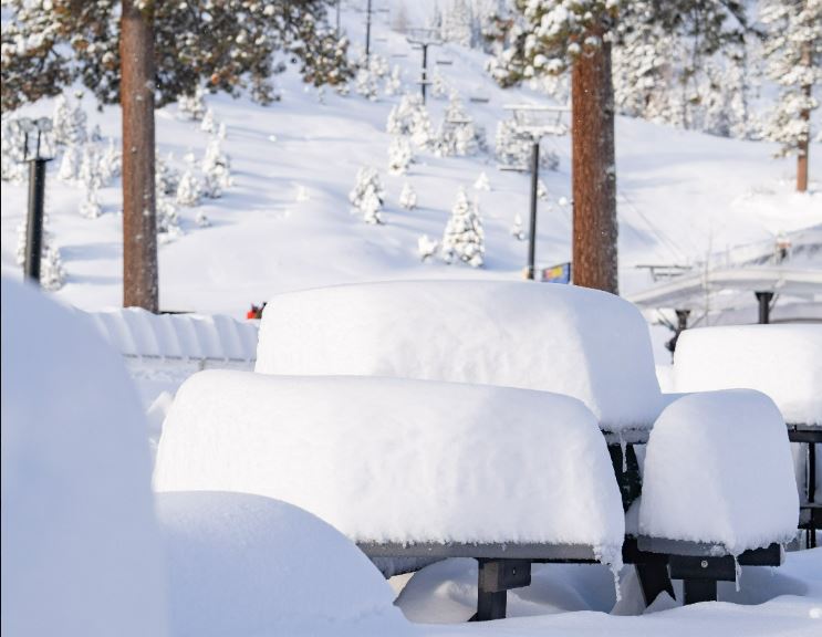
We were expecting 1-3 inches of new snow from the weak system that move through Friday. The storm over-produced slightly with 4 inches of new snow being reported up top and 3 inches at the base. That brings the season total to 107 inches on the upper mountain.

Saturday:

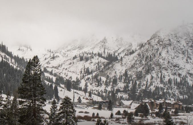
Expecting clearing skies Saturday with highs in the 30s at the base and 20s for the upper mountain.

Sunday – Monday Storm:

The next cold system drops down from the north on Sunday. We could see partly sunny skies Sunday morning. Then increasing clouds and winds Sunday afternoon with southwest winds gusting to 30+ mph up top. Light snow showers could move in Sunday afternoon with steady showers possible Sunday night into Monday.

Even colder air expected with highs in the 20s down to the base and maybe only teens up top Monday. That will bring powdery snow and high snow ratios. We could see an additional 3-6 inchesof snow at the base, and 4-8 inches on the mountain by Monday night.

Tuesday – Thursday Storm:

We will likely see a break during the day Tuesday. We could see partly sunny skies in the morning and increasing clouds through the afternoon. Highs in the 20s at the base and teens up top.

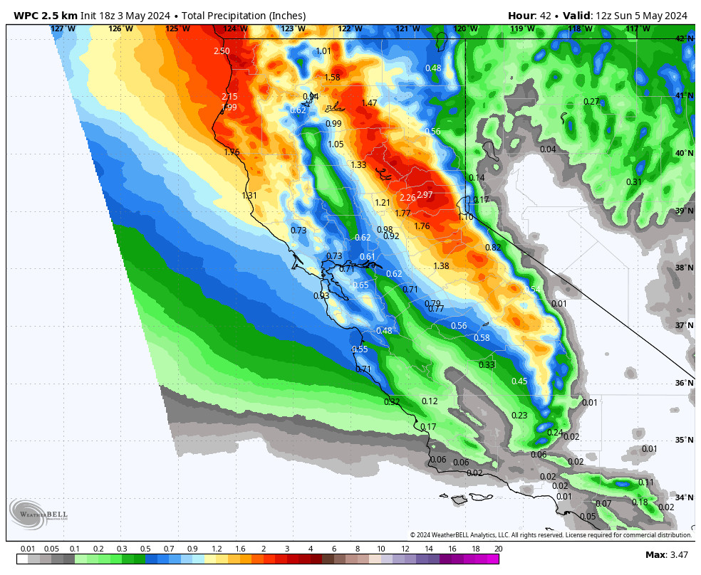
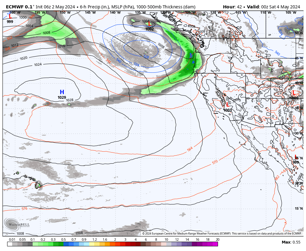
A strong storm will be taking a position off the West Coast Tuesday night into Wednesday and will direct a stream of heavy precipitation into the Sierra. That should bring heavy snow Tuesday night into Wednesday. Snow levels look to stay below the base along with strong winds up top gusting to 70+ mph. We could see 2-3 feet of new snow by Wednesday evening.

The question is then what happens with the moisture plume. Some forecast models shift it well south of the area with just scattered snow showers Wed night into Thursday. Other forecast models suggest the moisture plume shifts just to the south Wednesday night with steady snow continuing and then shifts back north with heavy snow Thursday.

The difference would be either 3-6 inches of additional snowfall or another 2-3 feet of new snow. So we will have to watch the trend on the models closely to see what happens with the position of the heavy precip streaming into the Sierra. Either way, a decent Sierra snowstorm.

Long-Range:

The long-range models show more storms possibly moving in the weekend of the 30th and into early the week of the 1st. We will be tracking each system and fine-tuning the snowfall and details as we get closer.

BA

lake tahoe weather snowfall forecast Squaw Weather Forecast
Bryan Allegretto
Bryan Allegretto

Share this article:

Recent Posts

  • Weather ·
  • May 26, 2022·

Colder with Unsettled Weather for Memorial Day Weekend

It’s the last weekend of the season and we could see a few flakes fall on the mountain! Thursday –…
Read more
  • Weather ·
  • May 17, 2022·

Quick Cooldown Thu-Fri, Then Milder Weather

A cool trough moves through Thursday – Friday. Highs dip down into the 60s at the base Thursday and 50s…
Read more
  • Weather ·
  • May 11, 2022·

After 15″ of Snow, A Return to Spring

Snowfall Report: We have had a cold and wintry first half of the week with several systems that rotated through…
Read more

Social

Instagram Twitter Facebook Youtube

Contact

   Email Us
   1.800.403.0206

Our Partners

U.S. Forest Service Logo
1960 Squaw Valley Road
Olympic Valley, CA 96146

©2022 Palisades Tahoe

Alterra Mountain Company
  • Privacy Policy
  • Terms of Service
  • Photo Upload Terms of Use
  • Accessibility
Menu
  • Privacy Policy
  • Terms of Service
  • Photo Upload Terms of Use
  • Accessibility