Skip to content
Palisades Tahoe Logo Palisades Tahoe Logo Palisades Tahoe Logo
Explore
Main Menu
  • Explore Palisades Tahoe
  • Base to Base Gondola
  • Our New Name
  • Explore Legendary Lifts
  • Palisades Tahoe Blog
  • About Lake Tahoe
  • About Us
Plan Your Visit
Main Menu
  • Tickets & Passes
  • Lodging
  • Lessons & Guides
  • Deals & Packages
  • Rentals & Demos
  • Travel Here
  • Getting Around
Mountain Information
Main Menu
  • Snow and Weather
  • Lift and Grooming Status
  • Webcams
  • Hours of Operation
  • Trail Maps
  • Parking & Road Conditions
  • Snowfall Tracker
Events & Activities
Main Menu
  • Events Calendar
  • Activities
  • Dining & Apres
  • Shopping
  • Things To Do In Lake Tahoe
  • Groups, Meetings & Weddings
  • Ski & Snowboard Teams
IKON PASS HOLDER LODGING DISCOUNT

Ikon Pass holders save up to 20% on slopeside lodging at The Village at Palisades Tahoe.

SLOPESIDE LODGING
Icon / FlashCreated with Sketch.
View All Offers
  • Weather

2 Storms up to 2 Feet Each Possible

  • Nov 29, 2022
  • 8:27 am

Tuesday – Wednesday:

Tuesday into Wednesday will be mostly sunny with in the 30s on the mountain to near 40 degrees at the base. Wednesday the winds begin to crank up by afternoon ahead of the next storm. Southwest winds gusting up to 60-70+ mph up top could affect some upper mountain lifts by Wednesday afternoon.
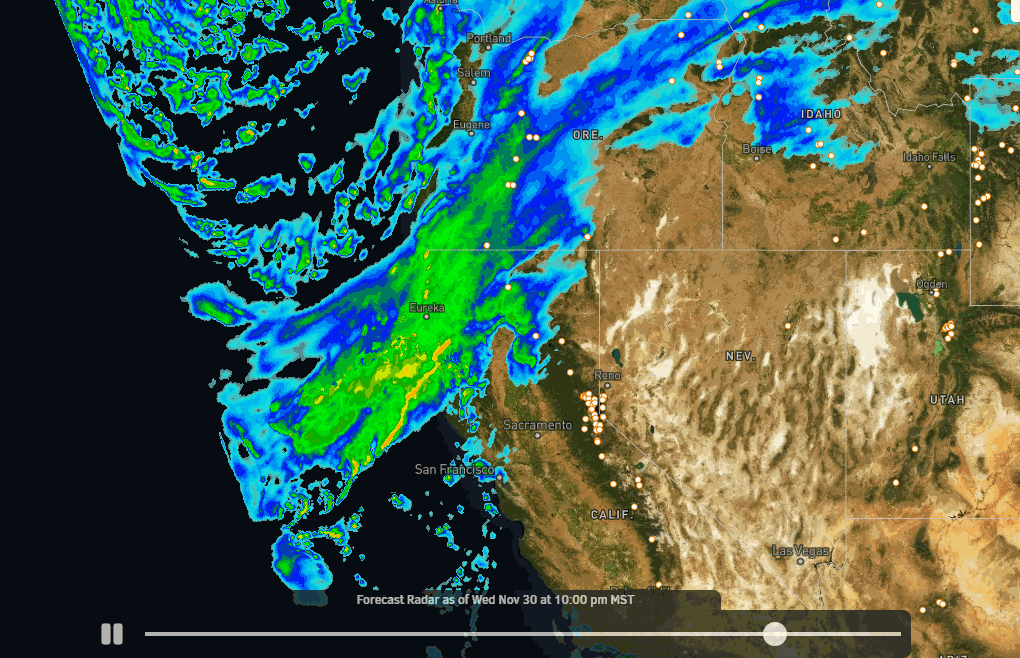
Thursday Storm:

Winds crank up to over 100 mph over the ridgetops Thursday so expect some lift closures. The moisture is forecast to reach the Tahoe Basin very early Thursday morning before sunrise and continues into Thursday evening, then clearing by Friday morning. Snow levels may start out just below the base and fall below 1000 ft. by the end. Highs in the 30s at the base and 20s up top.

The heaviest snow is expected during the day on Thursday along with the high winds. The storm could start with thicker snow Thursday that turns very powdery into Thursday night. The latest model runs show enough precipitation for 1-2 feet of new snow at the base and 20-30 inches on the mountain with this storm by Friday morning.

Friday:

Friday the sun comes out and the winds come down with gusts up to 30+ mph up top. It’s cold with highs only in the 20s on the mountain to near 30 degrees at the base. It should be a great powder day!

Weekend Storm:

The next storm is still on track to move in by late morning Saturday and could last into Sunday evening before ending. This will also tap a decent amount of moisture off of the Pacific ocean. Ridgetop winds will increase again on Saturday with gusts up to 60-70+ mph from the SW with potential upper mountain lift closures.

Snow continues Sunday with the winds coming down some into the afternoon. Highs in the 20s on the mountain and low 30s at the base both days. We could see an additional 12-18 inches of snow at the base and 18-24 inches on the mountain by Monday morning. 4-day totals of 2-3 feet possible at the base and 3-4+ feet on the upper mountain!

Long-Range:

The long-range models continue to suggest that we could see quieter weather the week of the 5th, but it may stay fairly cold keeping all of the new snow in good condition.

Then they suggest that the storm track could return to CA around the 10th-12th through mid-December. We’ll continue to watch the trends as we get closer.

BA

lake tahoe weather palisades tahoe weather forecast snowfall forecast
Bryan Allegretto
Bryan Allegretto

Share this article:

Recent Posts

  • Weather ·
  • February 8, 2023·

Tracking Light Snow for Friday Night

Wednesday – Thursday: Mostly sunny skies through Thursday. Highs into the 30s for the upper mountain and 40s at the…
Read more
  • Weather ·
  • February 7, 2023·

Weak System Possible Fri Night – Saturday

Tuesday – Thursday: Mostly sunny skies with a few clouds possible through Thursday as high pressure builds in over CA.…
Read more
  • Weather ·
  • February 6, 2023·

1-2 Feet of Fresh Snow

Snowfall Report: We definitely saw more than the 8 inches being reported by mountain ops fall on the mountain on…
Read more

Social

Instagram Twitter Facebook Youtube

Contact

   Email Us
   1.800.403.0206

Our Partners

U.S. Forest Service Logo
1960 Olympic Valley Road
Olympic Valley, CA 96146

©2022 Palisades Tahoe

Alterra Mountain Company
  • Privacy Policy
  • Terms of Service
  • Photo Upload Terms of Use
  • Accessibility
  • Do Not Sell My Personal Information
  • Privacy Policy
  • Terms of Service
  • Photo Upload Terms of Use
  • Accessibility
  • Do Not Sell My Personal Information