Skip to content
palisades tahoe
Explore
Main Menu
  • Explore Palisades Tahoe
  • Discover Palisades Tahoe
  • Our Name Change
  • Explore Legendary Lifts
  • Palisades Tahoe Blog
  • About Lake Tahoe
  • Mountain Safety
Plan Your Visit
Main Menu
  • Lodging
  • Tickets & Passes
  • Lessons & Guides
  • Deals & Packages
  • Rentals & Demos
  • Travel Here
  • Ikon Pass Benefits
Mountain Information
Main Menu
  • Weather
  • Lift Status
  • Webcams
  • Hours of Operation
  • Trail Maps
  • Parking & Road Conditions
  • Snowfall Tracker
Events & Activities
Main Menu
  • Aerial Tram
  • Events Calendar
  • Activities
  • Dining & Apres
  • Shopping
  • Groups, Meetings & Weddings
  • Ski & Snowboard Teams
Summer High Camp Tram with wildflowers.
Basecamp for Lake Tahoe
Palisades Tahoe is the beating heart of Lake Tahoe adventure. Plan your trip with us today.
PLAN YOUR VISIT
Icon / FlashCreated with Sketch.
View All Offers

17 Inches of New Snow! Drier but Cold thru Friday

  • By Bryan Allegretto
  • Weather
  • Feb 23, 2022

Snowfall Report:

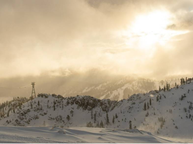
The scattered snow showers continued Tuesday adding 5 additional inches of snow to the 2-day storm totals. We saw a total of 8 inches at the base and 17 inches on the upper mountain! Pretty much what we expected from this storm. A nice refresh of the slopes.

Wednesday – Saturday:

High pressure builds back in with a drier pattern Wednesday through Saturday. It starts out cold with highs in the 20s at the base and teens up top Wednesday. Then 30s at the base and 20s up top Thu – Fri, and then 40s & 30s for the weekend. We should see mostly sunny skies each day.

Gusty north-northeast winds up to 40+ mph are possible up top Wednesday, turning northwest Thursday. That could make it feel even colder on the upper mountain. Then they should be lighter Friday into Saturday.

Sunday – Tuesday:

Sunday night into Monday the forecast models are at odds over the storm track. Some models bring storms far enough south for rain & snow reaching the northern Sierra and the Tahoe Basin. Others keep them to our north over northern CA. We’ll continue to watch the trends and update as we get closer.

For now, we’ll expect sun and clouds through the period with some gusty winds possible. By Sunday afternoon ridgetops winds could be gusting to 50+ mph from the southwest. Highs could continue to be in the 40s at the base and 30s up top.

Long-Range:

Starting around March 3rd-4th the pattern could shift allowing storms to track farther south into northern CA with a more active pattern for the Tahoe region. We’ll continue to watch the trends on that as well.

Looking way out there, the long-range models continue to suggest a better chance for wetter storms the 2nd week of March. Fingers crossed…

BA

Share this article
Picture of Bryan Allegretto
Bryan Allegretto

Recent Posts

  • Weather ·
  • April 30, 2025·

Weekend Snow Showers Possible

There is a chance for high elevation snow showers for the first weekend of May. The mountain is aiming to…
Read more
  • Weather ·
  • April 28, 2025·

11 Inch Weekend Snowfall Total!

Snowfall Report: The weekend storm brought snow down to the base as we expected. We saw several inches accumulate on…
Read more
  • Weather ·
  • April 24, 2025·

Winter’s Quick Return

All of the focus this week is on winter’s last gasps over the weekend, as snow showers and low snow…
Read more

Social

Instagram Twitter Facebook Youtube

Contact

   Email Us
   1.800.403.0206

Our Partners

U.S. Forest Service Logo
1960 Olympic Valley Road
Olympic Valley, CA 96146

©2025 Palisades Tahoe

Alterra Mountain Company
  • Privacy Policy
  • Terms of Service
  • Photo Upload Terms of Use
  • Accessibility
  • Do Not Sell My Personal Information
  • Privacy Policy
  • Terms of Service
  • Photo Upload Terms of Use
  • Accessibility
  • Do Not Sell My Personal Information