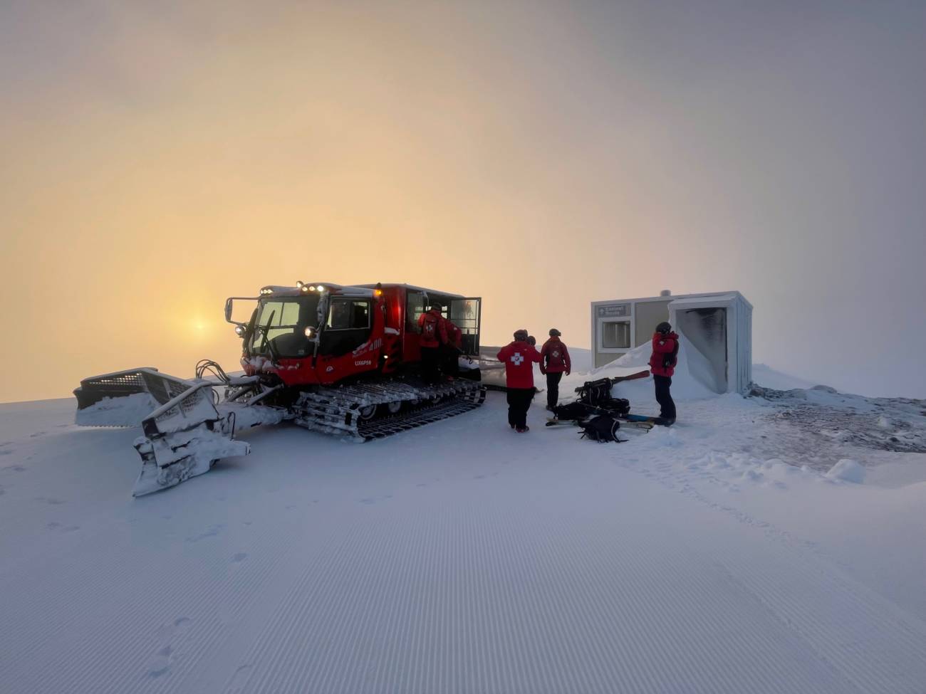
The Tahoe basin got pounded with some much-needed rain and a light dusting of snow throughout this Monday-to-Wednesday storm cycle. It nuked snow on our upper elevations the whole time without letting up. Our storm total for this first cycle on the upper mountain came out to 18 inches, and this is just the beginning. Our crews dealt with some seriously high winds and quite a lot of ice out there the past few days, but we were able to rally and get almost every lift back on the schedule and opened today. We know that the Palisades specifically experienced a few more delays than people were hoping for, so we’ll explain what happened in a moment.
The photo above was taken by Ski Patroller Brandon Walsh
Behind The Scenes of the Storm
High winds moved in starting on Monday evening, reaching up to 130 miles per hour at times. The snowfall was steady, creating occasional whiteout conditions.
Grooming
Lift Maintenance
As we said in our last Operations Blog, we expected rime ice (which is ice that forms when droplets freeze instantly upon contact with the lift) to build up on most of our chairlifts, especially those on the upper mountains. That projection was certainly correct as de-icing has been the name of the game for the past 48 hours. To try to prevent ice buildup, we spun KT-22, Resort Chair, Exhibition, and First Ventures overnight, all of which opened at 9am. The team also worked throughout the day yesterday on de-icing: For some context, it took 4 hours to break Gold Coast free and then get it spinning yesterday (Tuesday, December 27th).


These photos show rime ice built up on the Shirley Lake chairlift and on the Headwall lift line this morning. If you’re wondering why some lifts like Shirley, Siberia, Sherwood, or Scott were delayed, THIS is why. All this ice must be manually broken off before the lift can start spinning safely.
Shirley Lake photo taken by Marcus Morgan, Upper Lift Maintenance Manager. Headwall photo taken by Steve Grotta, Lift Maintenance.
What happened at Palisades today?
Updates started rolling in before 5:30am with reports of decreased winds, snow totals at various elevations, and (to no one’s surprise) lots of rime ice on chairlifts. By 7:40am, after we’d gotten some eyes on the upper mountain, we estimated that we’d have most lower mountain lifts at 9am, and any lifts that access the upper mountain would be delayed while we de-iced.
We also anticipated that the Base to Base Gondola would open as one continuous lift at 9am. This did not end up happening: In the high winds on Tuesday, it was difficult to keep the Gondola spinning, which would have helped to prevent freezing. As was the case with many other lifts, the grips on the Base to Base Gondola were frozen, as were the cabin doors. Our crews also ended up needing to do a tower repair. We opened the Palisades side as soon as we were able.
Meanwhile, as stated above, we expected that the Funitel would be slightly delayed. We shared this information on our Mountain Operations Twitter as soon as it was confirmed. The Funitel ended up opening around 11:50am. The long delay was due to a mechanical issue with the conveyance system. One of our electrical engineers immediately set to work on fixing this issue, and using the new digital diagnostic system, they were able to contact the manufacturers in Europe to find a solution. While we worked on the Funitel, we also had teams shift attention to Wa She Shu so that guests could access the upper mountain. Wa She Shu opened by 9:50am.
The Weather Forecast
With this first storm out of the way, there is still the potential for up to 40+ inches of snow through this weekend, and another 49 inches the following week. You can always get the latest on the forecast from our Weather Blog, written by local forecaster Bryan Allegretto of OpenSnow.
Thursday to Friday Morning:
- 2-5 inches of new snow at the base.
- 4-8 inches at mid-mountain elevations.
- 8-13 inches on the upper mountain above 8000 ft.
Friday to Saturday:
This band of the storm will be wetter and warmer, so snow levels could vary and we could see a mix of rain and snow depending on the elevation. There will also be wind impacts from this storm.
Sunday:
By Sunday morning we could see additional snowfall amounts of:
- 1-4 inches at the base
- 11-43 inches at mid-mountain
- 43-52 inches up top (above 8000 ft.)
Sunday through Tuesday are shaping up to be the clearest days in the forecast for the next week. We will keep you updated on what to expect, but please know that these days are likely to be busy. Our lots filled quickly today, so you’ll want to plan ahead. We’ll share some tips for how to prepare in a blog later this week.
WANT THIS BLOG TO COME TO YOUR EMAIL INBOX?
Sign up for our Mountain Operations email list, and we’ll send this blog directly to you every time we have an update. We’ll probably share our next update on Friday, if not sooner. Sign up here.
HOW ELSE CAN I STAY UP-TO-DATE THIS SEASON?
We’ll arm you with all the information you need to plan the perfect ski day any day this winter. Bookmark these pages:
Not wanting to check the website constantly? Try these other methods:
- Follow our Mountain Operations Twitter account
- Sign up for the Palisades Tahoe Ski & Ride Report (Weather Blogs, Conditions Blogs, + Operations Blogs are included here)
- Download the Palisades Tahoe App
Do you have any requests for this season’s Operations Blogs? Topics you’d like to see covered or information you think is missing? Send us an email at chatter@palisadestahoe.com with your feedback.


