We are open Friday – Sunday through 5/30 thanks to the 7 feet of snow that fell in April!
We continue to be on the southern edge of an active storm track into the Pacific NW this week. We have a storm moving through the to our north Monday bringing us gusty winds. It is also keeping highs in the 40s to near 50 degrees down at the base. Ridgetop winds are gusting up to 100+ mph from the southwest.
Nicer Weather:
High pressure builds in with nicer weather for Tuesday through the end of the week. Highs into the 60s at the base and 50s up top. Thursday & Friday we could see the ridgetop winds pick back up again, with southwest gusts up to 70+ mph both days. That could affect some upper mountain lifts on Friday.
Unsettled Weekend:
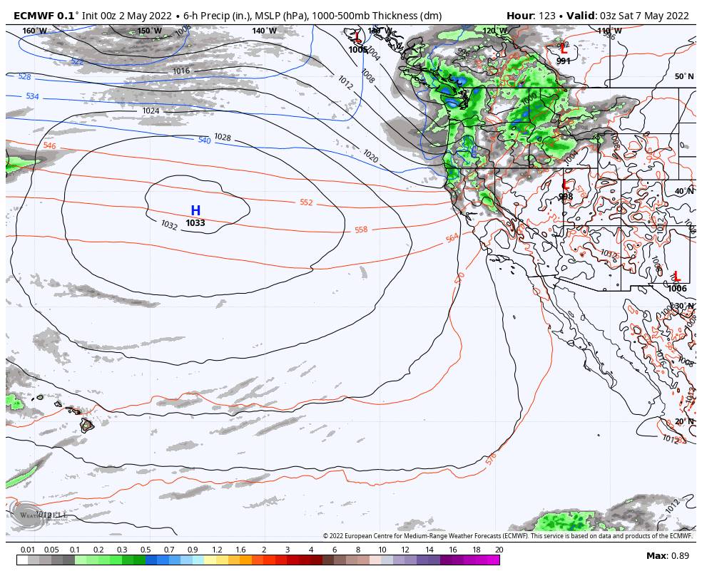
Another cool trough digs into the West for the weekend starting Friday. That should bring us a cooler weekend with highs dropping back into the 50s at the base and 40s up top. The winds will likely be gusty at times as well.
There could be two systems moving through to our north that brush us. One as early as Friday afternoon into Saturday, and another sometime Sunday into Monday. We will be keeping an eye on those systems. Snow levels look to be above 7000 ft. right now.
I’ll update again later this week if it looks like we could see any measurable snowfall on the mountain over the weekend. Some models show a few inches of snow, but the average of the models this morning keeps most of the precip to our north.
Long-Range:
It looks like high pressure will build back in the week of the 9th with nicer weather by mid-week. The long-range forecast models suggest the ridge could stay parked over the region through mid-month. As we get later into May the chances increase that the dry pattern will become more prolonged as we head into the dry season.
I’ll keep an eye on the pattern and will let you know if any additional late-season storms show up. If there are no imminent storms I’ll only be posting weekly until next season.
BA


