Snowfall Report:
An additional 2 inches fell at the base from the Thursday storms and 12 inches up top. That brings the 6-day total on the upper mountain to 23 inches.
Friday – Saturday Wind & Showers:
The Thursday night storm is clearing out with a lull and only scattered showers are expected for Friday, some steadier showers are possible as the moist onshore flow continues. Freezing levels as of 7 AM are up around 8000 ft. which means snow levels should be up around 7000-7500 ft. under any showers. Ridgetop winds are gusting up to 90+ mph.
The winds will come down some through the day with gusts up to 50-70+ mph from the west during the afternoon. Snow levels will continue to rise through the day up to 8000-9000 ft. Highs in the 30s on the mountain and near 40 degrees at the base. We could see some breaks of sun with high clouds as we are between storms before the next storm moves into the Pacific NW Friday night into Saturday.
Similar weather for Saturday with rain & high elevation snow showers possible along with gusty winds. Ridgetop winds gusting up to 60-80+ mph continue to threaten to close some upper mountain ski lifts. Highs in the 30s to near 40 degrees down at the base again. Snow levels rise up to 8800-9800 ft.
With the snow levels continuing to rise Friday into Saturday, we will see mainly rain showers for the lower mountain, and some wet snow up top through Friday night, and maybe rain to the top for Saturday. We could see a coating up to 2 inches of wet snow up top by Saturday morning.
Sunday Rain to Snow:
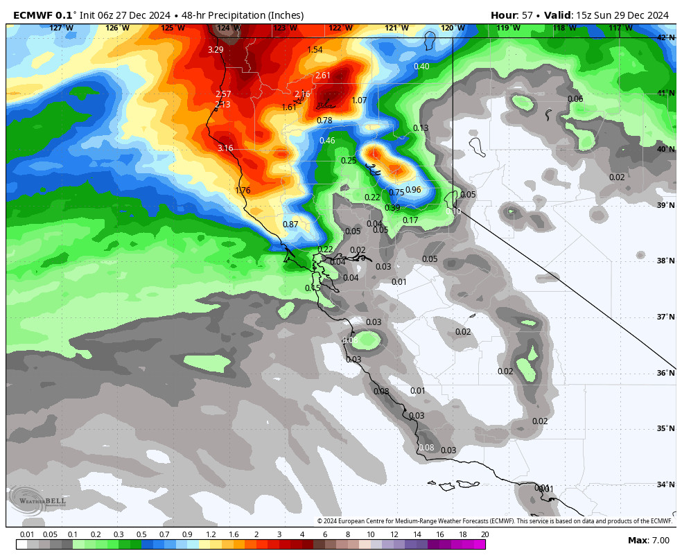
The precipitation with the final storm is expected to push in around 7-10 AM Sunday morning. This storm digs a bit farther south and pushes through a cold front during the afternoon with some heavier rain & snow, along with falling snow levels. The question for the lower elevations is still how fast?
The winds will be the strongest on Sunday with ridgetop winds from the southwest gusting up to 80-100+ mph during the day, likely closing quite a few upper mountain lifts, and gusty winds down to the base. Highs in the 30s. The heaviest snow is likely by late morning into the afternoon, with the fast-moving storm clearing out by early Sunday night.
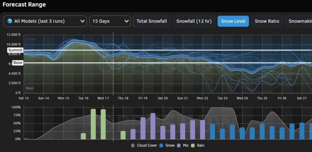
The latest model runs suggest snow levels up around 7500-8000 ft. to start around 7 AM on Sunday, down to around 6200-6700 ft. by midday, and to around 5000-5500 ft. by 4 PM. The period around midday with the heaviest precipitation with the front is when the models show the snow levels hovering right near to just above the base.
I’m going to continue to be conservative and forecast for the base as if it stays rain until the afternoon, but if it changes faster the amounts will be higher. By Sunday night we could see snowfall totals around 1-4 inches at the base, 4-8 inches near mid-mountain, and 6-11 inches up top.
Monday – Thursday:
We will finish out the 7-day forecast period and the New Year’s holiday with some nice weather. High pressure builds in over CA starting Monday and lasting through Thursday. That will bring mostly sunny – sunny days and highs into the 30s & 40s along with lighter winds. It will start colder Monday – Tuesday and will warm a little for Wednesday – Thursday.
Long-Range Forecast:
Some forecast models suggest that a weak system will sneak in next Friday with some showers, but most models keep us dry, with the high-pressure ridge amplifying into the end of the 1st week of January. We’ll keep an eye on that, but expecting the mainly dry pattern to continue through the 1st weekend in January.
We could be stuck in a dry pattern into the 2nd week of January. So far this season dry patterns in the long-range have trended wetter as we got closer, but two-week dry periods are not uncommon in the middle of winter. We’ll continue to watch the trends closely to see when storms could return…
BA


