

Tuesday – Wednesday Storm:
We have some scattered showers reaching the north side of the lake on Tuesday morning. That’s a bit farther south than the models were suggesting, but we expected a chance of showers for Tuesday. Highs near 50 degrees at the base and 40s up on the mountain as clouds and showers start to stream in from the first storm.
Most of the rain is expected Tuesday night into Wednesday. Highs drop into the 40s for Wednesday. Then the rain is expected to taper off by the end of the day on Wednesday. Snow levels staying above the summit. Still expecting half up to 1 inch of rain over the mountain.
Thursday into Friday Break:
We have a break between storms on Thursday with partly sunny skies, along with clouds from the storms to our north and approaching from the west. Similar weather for Friday with highs in the 40s. The next storm is expected to push in on Friday night on most models, with a couple holding off until Saturday.
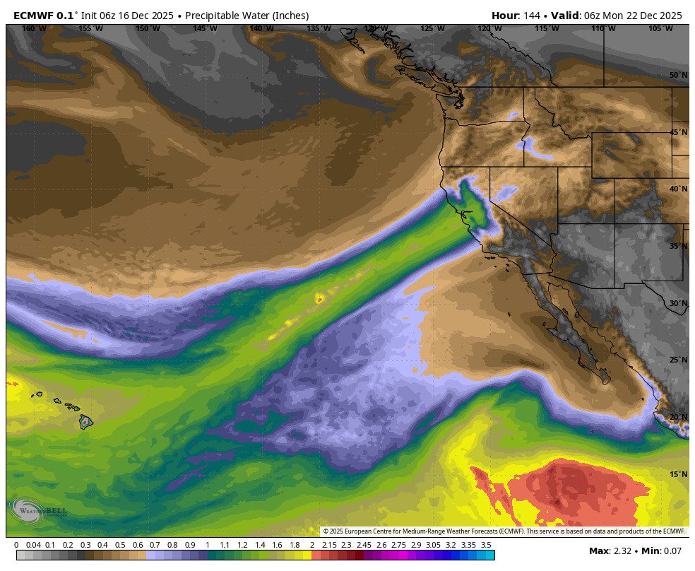
Weekend Atmospheric River:
The trend for the weekend is very wet. The latest forecast model runs are aiming an atmospheric river right at the northern Sierra and Tahoe Basin, possibly from Friday night through Sunday night. Previous forecasts were giving us a break Saturday afternoon and night, but now the trend is towards non-stop rain and much higher weekend totals.
The overall average this morning is around 4-5 inches of rain. The snow levels are expected to fluctuate between 8500 – 9750 ft. through the weekend, with any wet snow accumulations expected to stay mainly above 9000 ft. Only at the top of the tallest peaks or above the top of the mountain.
Ridgetop gusts up to 80-100 mph on Wednesday morning, up to 60-70+ mph Thursday into Friday, and back up to 80+ mph for the weekend. Highs in the 40s near the base and 30s on the upper mountain.
A Break Early Next Week?:
The latest operational model runs continue to show the possibility of the AR lifting north on Monday in response to a cold trough digging south along the West Coast next week. That could bring an end to the rain sometime on Monday into next Tuesday, the 23rd.
Colder Storms for Christmas?:
This deepening trough is forecast to push into the West Coast by the middle of next week through the end of the week. That’s going to allow colder air and storms spinning down from the north to dig farther south into CA as they move inland. They may still be tapping subtropical moisture with lots of precipitation, but the models have been suggesting that we are on the colder side of the storms, with a healthy snowstorm possible for Christmas Eve into Christmas Day.
The long-range models have been showing this for several days now, and tomorrow this storm will finally be within the 1-week storm window. We are always wary of storm forecasts beyond a week, but the confidence in a Christmas Eve snowstorm continues to increase each day it’s still there. With the very slow start to this season so far, this would be a Christmas Miracle by any sense of the term.
Wednesday, the 24th, is the day that the snow levels are finally forecast to drop to the base of the mountain. We’ll be watching this storm very closely over the next week and hoping that it dumps large amounts of snow on the mountain.
Long-Range Outlook:
The long-range models suggest that the trough pulls north a bit around the 27th, but then could reload and push south again through the end of December. If you have been following along, you know that beyond the 26th, I have been worried about the storm track shifting back to our north again, so this is a more positive trend if it continues.
Overall, the ensemble mean models show near-average to above-average precipitation continuing through the end of December, but some storms may not be as wet, and the storm track could shift back north at least a little. But as of now, they show storms continuing every 2-3 days or so.
This continues to look promising through the end of December. Let’s hope this pattern continues to hold in the forecasts and to reload through the end of the month.
BA
