This is the first forecast of the 2024-25 ski season! It’s Wednesday morning and we are starting to get a clearer picture of what could happen with the two storms expected to bring us some snow this week. The first storm Wednesday night into Thursday morning and the second storm Friday night into Saturday.
We will see partly sunny skies during the day on Wednesday with highs into the 40s for the lower elevations down near the base, and 30s for the higher elevations.
Storm #1:
A low-pressure system to our north will sweep a cold front through northern CA Wednesday night into Thursday morning with some rain & snow. The latest forecast model runs show precipitation reaching the northern Sierra near Tahoe around 10 PM – Midnight and continuing to push south into Thursday morning.
This front weakens as it moves through with only light amounts of precipitation expected by Thursday morning. Snow levels look to start out around 6000-6500 ft. and could dip more early Thursday morning before rising back up to 6000-6500 ft. by the end of the storm.
That is hovering right near the base of the mountain where we could see some wet snow but not expecting much in the way of accumulations. Up on the mountain, we could see a coating up to 2 inches of snow by Thursday morning.
Behind the storm, we should see clearing by midday Thursday and partly sunny skies into the afternoon. It will be colder behind the front with highs only in the 30s. Temperatures drop into the 20s Thursday night which could allow for some snowmaking.
Friday:
Friday we should start out the day with some sun, and then increasing clouds and winds during the afternoon ahead of the next storm. Highs into the 40s for the lower elevations and 30s for the higher elevations.
Storm #2:
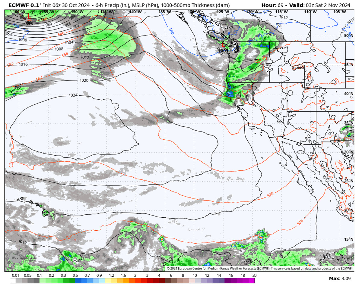
The latest model runs are a little slower with this system as it moves through which could keep the precipitation falling into the day on Saturday before clearing out by Saturday evening. This storm is expected to move a little slower and to have at least slightly higher precipitation rates and totals.
The snow levels could start around 6500 – 7000 ft. Friday evening before falling to 5200-5800 ft. Friday night. Then possibly hovering around 5500-6000 ft. through Saturday. That is a tiny bit lower than the Wednesday night storm and could bring some wet snow to the base for most of the storm.
We will have to continue to fine-tune the forecast over the next 2 days. Some forecast models would only bring up to 1-3 inches of snow in total while others would bring up to 1.5+ feet of snow. So quite a range. Using the latest model average, we could see 2-6 inches of new snow near the base, 3-7 inches near mid-mountain, and 5-10 inches up top by Saturday afternoon.
Sunday:
Behind the storm on Sunday, we should see sunny skies and cold with highs only in the 30s. Overnight lows in the teens and 20s Saturday and Sunday night should allow for some good snowmaking on top of the natural snow we pick up. Exactly what we need, and it’s only the beginning of November.
Long-Range Forecast:
The long-range models continue to show a high-pressure ridge building in near the West Coast next week. If we remain on the east side with the cold trough to our east, the temperatures may only warm into the 40s for highs, but the storms should be blocked through the end of the week. The ensemble mean models show below-average precipitation through at least the 9th.
Some long-range models show the next trough pushing south into the West around the 10th-11th which could open up the storm door. Others are slower but show troughing by the 13th-14th.
We will continue to watch the trends, but if the latest ensemble mean model runs are right, we could see a more active pattern before mid-month. Let’s hope for more snow for a good start to the new ski season!
BA


