Skip to content
Palisades Tahoe Logo Palisades Tahoe Logo Palisades Tahoe Logo
Explore
Main Menu
  • Explore Palisades Tahoe
  • Base to Base Gondola
  • Our New Name
  • Explore Legendary Lifts
  • Palisades Tahoe Blog
  • About Lake Tahoe
Plan Your Visit
Main Menu
  • Tickets & Passes
  • Lodging
  • Lessons & Guides
  • Deals & Packages
  • Rentals & Demos
  • Travel Here
  • Getting Around
Mountain Information
Main Menu
  • Snow and Weather
  • Lift and Grooming Status
  • Webcams
  • Hours of Operation
  • Trail Maps
  • Parking & Road Conditions
  • Snowfall Tracker
Events & Activities
Main Menu
  • Events Calendar
  • Aerial Tram
  • Activities
  • Dining & Apres
  • Shopping
  • Groups, Meetings & Weddings
  • Ski & Snowboard Teams
Winter Lodging Exteriors of the Village at Palisades Tahoe
Book Winter Early

Ikon Pass holders save up to 25% when you book with The Village at Palisades Tahoe this winter.

SAVE ON LODGING
Icon / FlashCreated with Sketch.
View All Offers

Snow Monday Night, Then Drier

  • By Bryan Allegretto
  • Weather
  • Apr 17, 2023

Monday:

Mostly sunny skies with increasing clouds later in the day. Ridgetop winds increasing to 70-80+ mph from the southwest by evening, which could continue to affect some upper mountain lift operations. Highs into the 40s at the base and 30s up top.

Monday Night Snow:

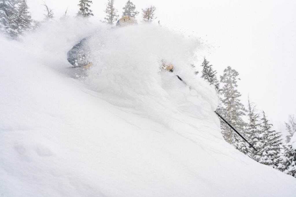
A band of snow moves through later Monday evening into early Tuesday morning bringing a few-several inches of snow to the mountain overnight. Temperatures drop into the teens and 20s overnight with fairly dry and powdery snow expected.

By Tuesday morning here are the expected snowfall amounts.

  • 1-5 inches at the base.
  • 2-6 inches at mid-mountain elevations.
  • 3-7 inches up top.

Tuesday:

Clearing Tuesday with a few clouds and mostly sunny skies expected. Highs dip into the 30s with 20s up top. Ridgetop winds from the WSW could gust up to 20-30+ mph.

Wednesday – Sunday:

Still chilly on Wednesday with mostly sunny skies. Highs in the 30s on the mountain to nearly 40 degrees at the base along with lighter winds.

Thursday through Sunday we expect mostly sunny skies and warming high temperatures. Highs could warm into the 40s for Thursday to nearly 50 degrees at the base, and then into the 50s Friday through the weekend as high-pressure builds in over the West Coast.

Long-Range:

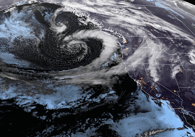
Another trough could dig in near the West Coast from around Monday the 24th through the 26th. That could cool temperatures a little and could allow some weak weather systems to move through the Pacific NW at times. Right now it looks like the moisture stays to our north and we could remain in a drier pattern. We’ll continue to watch the trends.

Beyond the 26th, the long-range models continue to suggest that high pressure builds back in over the West through the end of April. That could bring us a drier and milder pattern.

BA

Share this article
lake tahoe weather palisades tahoe weather forecast snowfall forecast
Bryan Allegretto
Bryan Allegretto

Recent Posts

  • Weather ·
  • December 8, 2023·

A Drier Pattern, Possible Storm Next Weekend

Drier Pattern Ahead: We have a cold morning Friday with temperatures in the 20s and teens which is good news…
Read more
  • Weather ·
  • December 7, 2023·

5-15 Inches of New Snow!

Snowfall Report: The wetter model forecasts were right as we saw over an inch of liquid fall on over the…
Read more
  • Weather ·
  • December 6, 2023·

Snow Later Wednesday into Thursday

Windy Wednesday: We will start the day with mostly sunny skies and gusty winds with ridgetop gusts up to 60-70+…
Read more

Social

Instagram Twitter Facebook Youtube

Contact

   Email Us
   1.800.403.0206

Our Partners

U.S. Forest Service Logo
1960 Olympic Valley Road
Olympic Valley, CA 96146

©2022 Palisades Tahoe

Alterra Mountain Company
  • Privacy Policy
  • Terms of Service
  • Photo Upload Terms of Use
  • Accessibility
  • Do Not Sell My Personal Information
  • Privacy Policy
  • Terms of Service
  • Photo Upload Terms of Use
  • Accessibility
  • Do Not Sell My Personal Information