Windy Wednesday:
We will start the day with mostly sunny skies and gusty winds with ridgetop gusts up to 60-70+ mph already. Highs will warm into the 40s and it won’t quite feel like it’s going to snow during the morning at the base. Then the clouds and winds continue to increase into the afternoon with ridgetop gusts up to 90+ mph over the exposed ridges, which should close some upper mountain lifts.
The Cold Front:
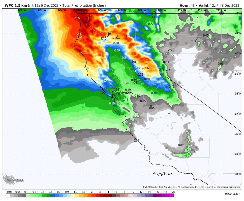
The weather will go downhill pretty quickly between 1-4 PM as the cold front and associated band of heavy precipitation approach the northern Sierra, and then it sweeps through with heavy rain and snow between 2-6 PM. Snow levels are going to be pretty high as the front starts to push precipitation across the area. Snow levels are expected to start up around 7500-8000 ft.
But with the drier air in place, evaporational cooling along with the heavier precipitation rates could drag them lower to near 7000 ft., and then colder air moving in should lower them near 6500-7000 ft. by 4 PM and possibly a bit lower. That makes the snowfall forecast tricky below 8000 ft. because it’s a question of how fast can snow levels fall during the heaviest precipitation with the front before we transition to lighter and more scattered showers for the rest of the storm.
For the upper mountain, we do expect several inches of snow through Wednesday evening, and snow to the base at some point during the evening.
Behind the Front:
Snow levels continue to fall Wednesday night and will drop below the base and stay there through Thursday night. Winds will still be gusty Thursday from the west up to 60+ mph over the exposed ridges and peaks. Highs will only be in the 30s, with 20s for the upper mountain. A secondary wave moves through Thursday afternoon-eveing increasing the chances for snow showers. Then we clear out by early Friday morning.
The latest model runs only show enough precipitation behind the front through Thursday evening for around 1-3 inches of additional snowfall during this period.
Total Snowfall Forecast:
The final snowfall forecast is tricky for the lower mountain and base with the snow levels starting high with the heaviest snow Wednesday afternoon-evening and then dropping into Wednesday night.
I’m going with a range of 2-6 inches for the base elevations depending on how fast we transition to snow Wednesday evening. For the mountain, I am forecasting 5-11 inches of snow, with the highest totals expected up top as usual.
Weekend Weather:
Behind the storms Friday we expect mostly sunny skies but cold. Highs only in the 30s for the lower elevations near the base, and 20s for the upper the mountain. But with lighter winds so it should be a nice crisp day.
High pressure continues to build in over the region through the weekend with mostly sunny skies expected each day. Highs warm into the 40s for the lower elevations on Saturday, and then 40s higher in elevation for highs on Sunday. It should be a beautiful weekend. Cold nights should allow for continued snowmaking.
Long-Range Forecast:
High pressure is expected to dominate our weather pattern through the end of next week. The weather we see over the weekend should continue through next week.
The long-range models continue to show a trough digging into the West Coast around mid-month but have slowed it by a day on the latest runs, with the trough over CA by the 16th. We continue to hope that a shift in the pattern happens and opens the door to a storm or two. The latest model runs continue to suggest that the storm door only opens briefly with high-pressure forecast to build back in over the West Coast by the 19th-20th.
There continues to be a storm showing up near the West Coast around the 15th-16th that could move through CA around the 16th-17th. Some model runs keep it to the north and weak, some move it through the Sierra with a decent shot of snow, and others have it becoming a cut-off low that stays off the coast.
We’ll continue to watch the trends for this period to see if we can get any more snow. Especially since we could go dry again behind any systems, and that is leading toward the holidays. Overall the ensemble mean models show below-average precipitation over the next two weeks.
BA


