Snowfall Report:
We picked up an inch of new snow up top Friday night and some rain at the base from the weak and warm system that started to move in.
Saturday – Saturday Night:
We will continue to see scattered showers on Saturday with gusty winds. There could be a few upper mountain lift closures with the winds gusting from the southwest up to 60-80+ mph, and possibly to 90+ mph at times. Highs in the 30s. Snow levels are forecast to come down slowly through the day, to around 6000-6500 ft. by evening (near to just above the base).
Saturday evening is when the next push of steadier precipitation is expected and then showers into Sunday morning. Snow levels should be near the base by early Sunday morning. Snow ratios will be low at the base with the rain mixing in Saturday. On the mountain, they could average 10-14:1 from 7000 up to 9000 ft.
We could see 1-4 inches of snow near the base by early Sunday morning, and an additional 3-7 inches on the upper mountain.
Sunday – Monday Weather:
Sunday into Sunday night we expect another lull in the steady precipitation. We still have a moist onshore flow with scattered showers expected. Snow levels will be rising a bit as some milder air moves in. They could be up around 6500-7000 ft. by afternoon-evening, with some rain showers near the base.
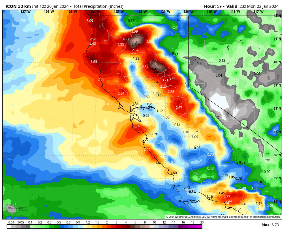
The winds look to be lighter on Sunday with ridgetop gusts from the southwest up to 30-40+ mph. Highs in the 30s for Sunday. Maybe a dusting to an inch or two of snow on the upper mountain during the day. Later Sunday night into Monday we expect the next wave of heavier precipitation to move into northern CA, and then diminishing Monday evening and clearing out Monday night.
Snow levels look to start coming down a little Sunday night as the steadier precipitation pushes in, down to around 6000-6800 ft. by later Sunday night into Monday morning. Then hovering in that range through the day on Monday. That means rain mixing in near to just above the base and low snow ratios.
For the upper mountain above 7000 ft. I expect mostly all snow, with low snow ratios around 9-13:1 from 7000 up to 9000 ft. We could see 1-4 inches of wet snow at the base by early Tuesday morning, and 5-11 inches on the mountain above 7000 ft.
Tuesday – Friday:
We clear out by Tuesday with mostly sunny skies expected. Highs into the 30s to near 40 degrees at the base.
Wednesday we still expect to get brushed by a weak system moving through to our north. We could see a few showers with highs in the 30s. Total precipitation amounts look to be very light. Snow levels could be up around 7000 ft. We could see a dusting to an inch of snow on the upper mountain, maybe up to 2 inches on the peaks.
Thursday and Friday we should see partly sunny skies with highs in the 30s for the upper elevations and 40s for the lower elevations. A few model runs try to brush us with some clouds and scattered showers from a system moving through to our north on Friday.
Long-Range Forecast:
Overall we’re expecting a drier and milder pattern through the last week of January as high pressure builds later this week and stays over the West. We should see partly-mostly sunny skies most days Thurday through next weekend and into the week of the 29th. Highs into the 40s.
By the end of the month, the long-range models are still showing the pattern starting to change, with troughing pushing in over the West Coast during the 1st few days of February. That may re-open the storm door during the 1st week of February. The ensemble mean models are in fairly good agreement that we could see near to above-average precipitation over at least the first 3-4 days of the month.
We’ll continue to watch the trends on this as we get closer.
BA


