Palisades Tahoe Logo Palisades Tahoe Logo Palisades Tahoe Logo
Explore
  • Explore Palisades Tahoe
  • Our New Name
  • Explore Legendary Lifts
  • Palisades Tahoe Blog
  • About Lake Tahoe
  • About Us
Plan Your Visit
  • Tickets & Passes
  • Lodging
  • Lessons & Guides
  • Deals & Packages
  • Rentals & Demos
  • Travel Here
  • Getting Around
Mountain Information
  • Snow and Weather
  • Lift and Grooming Status
  • Webcams
  • Hours of Operation
  • Trail Maps
  • Parking & Road Conditions
  • Snowfall Tracker
Events & Activities
  • Events Calendar
  • Activities
  • Dining & Apres
  • Shopping
  • Things To Do In Lake Tahoe
  • Groups, Meetings & Weddings
  • Ski & Snowboard Teams
IKON PASS HOLDER LODGING DISCOUNT

Ikon Pass holders save up to 25% on slopeside lodging at The Village at Palisades Tahoe.

SLOPESIDE LODGING
Icon / FlashCreated with Sketch.
View All Offers
  • Weather

Rain & Snow Thursday into Friday

  • Mar 18, 2021
  • 8:49 am

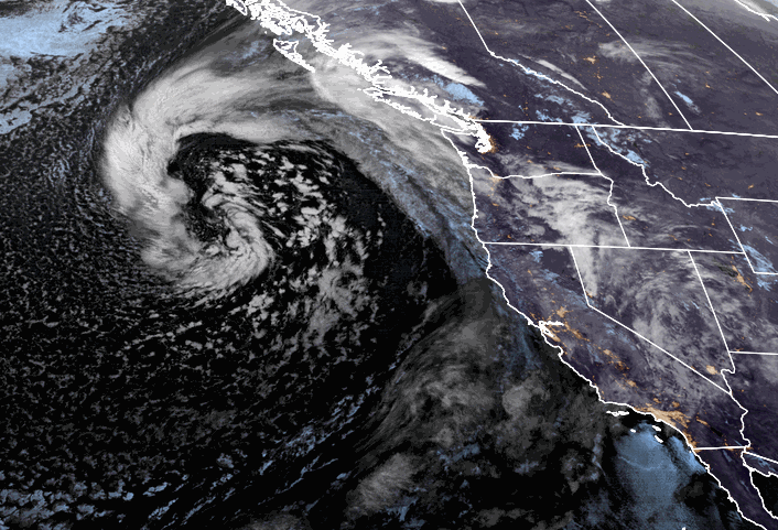
Thursday – Friday Storm:

The next storm will push showers into the region later Thursday morning and increasing through the afternoon. Ridgetop gusts increasing to 50-60+ mph from the southwest through the afternoon. Snow levels will be rising Thursday up to around 7000-7500 ft with some rain on the lower mountain, possibly up to 8k briefly at times.

We should see a period of heavier precipitation Thursday evening into Friday morning with falling snow levels lowering to near to just above the base around 6000-6500 ft. Then lighter showers possible Friday afternoon into Friday night becoming more scattered and ending by Saturday morning. Snow levels hovering between 6000-7000 ft. through Friday, near to just above the base. Then falling below 5000 ft Friday night as the storm begins to move out. Ridgetop winds could continue to be gusty through Friday gusting to 60-70+ mph up top.

Rain at the base turning to snow or a mix Thursday night into Friday and ending as snow Friday night. Mostly snow expected above 7000 ft through the storm. Totals by Saturday morning could be between 1-5 inches of wet snow at the base and 5-15 inches on the mountain from bottom to top.

The Weekend:

We should see partly-mostly sunny skies and lighter winds for the weekend. A few scattered snow showers possible Saturday. Highs in the 30s with lighter winds. Warming into the 40s at the base Sunday.

Long-Range:

The next storm moves through to our northeast on Monday with some cooler air and breezy winds. Possibly a few light snow showers brushing us. Highs in the 30s on the mountain to near 40 degrees at the base.

Then mostly sunny Tuesday into Wednesday. Highs warming into the 40s at the base Tuesday and then 40s on the mountain to around 50 degrees at the base Wednesday.

We could see another system move through to the northeast next Thursday similar to the Monday system. That would bring another shot of cooler air, breezy winds, and maybe a few snow showers.

Right now the pattern looks much drier overall starting Saturday through the 30th. Some long-range models suggest we possibly transition back to a more active pattern around the end of the month into the first week of April.

BA

lake tahoe weather snowfall forecast Squaw Weather Forecast
Bryan Allegretto
Bryan Allegretto

Share this article:

Recent Posts

  • Weather ·
  • May 26, 2022·

Colder with Unsettled Weather for Memorial Day Weekend

It’s the last weekend of the season and we could see a few flakes fall on the mountain! Thursday –…
Read more
  • Weather ·
  • May 17, 2022·

Quick Cooldown Thu-Fri, Then Milder Weather

A cool trough moves through Thursday – Friday. Highs dip down into the 60s at the base Thursday and 50s…
Read more
  • Weather ·
  • May 11, 2022·

After 15″ of Snow, A Return to Spring

Snowfall Report: We have had a cold and wintry first half of the week with several systems that rotated through…
Read more

Social

Instagram Twitter Facebook Youtube

Contact

   Email Us
   1.800.403.0206

Our Partners

U.S. Forest Service Logo
1960 Squaw Valley Road
Olympic Valley, CA 96146

©2022 Palisades Tahoe

Alterra Mountain Company
  • Privacy Policy
  • Terms of Service
  • Photo Upload Terms of Use
  • Accessibility
Menu
  • Privacy Policy
  • Terms of Service
  • Photo Upload Terms of Use
  • Accessibility