Skip to content
palisades tahoe
Explore
Main Menu
  • Explore Palisades Tahoe
  • Discover Palisades Tahoe
  • Our Name Change
  • Explore Legendary Lifts
  • Palisades Tahoe Blog
  • About Lake Tahoe
  • Mountain Safety
Plan Your Visit
Main Menu
  • Lodging
  • Tickets & Passes
  • Lessons & Guides
  • Deals & Packages
  • Rentals & Demos
  • Travel Here
  • Ikon Pass Benefits
Mountain Information
Main Menu
  • Weather
  • Lift Status
  • Webcams
  • Hours of Operation
  • Trail Maps
  • Parking & Road Conditions
  • Snowfall Tracker
Events & Activities
Main Menu
  • Aerial Tram
  • Events Calendar
  • Activities
  • Dining & Apres
  • Shopping
  • Groups, Meetings & Weddings
  • Ski & Snowboard Teams
Summer High Camp Tram with wildflowers.
Basecamp for Lake Tahoe
Palisades Tahoe is the beating heart of Lake Tahoe adventure. Plan your trip with us today.
PLAN YOUR VISIT
Icon / FlashCreated with Sketch.
View All Offers

Partly Sunny Weekend, The Next Storm Monday Night

  • By Bryan Allegretto
  • Weather
  • Jan 30, 2021

Snowfall Report:

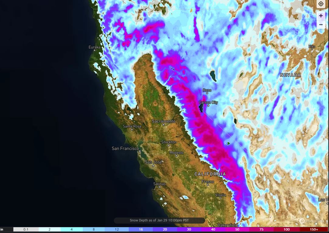
A final 1-3 inches of snow fell on the mountain in the past 24 hours. That brings the 4-day storm total on the upper mountain 67 inches, the 1-week total to 82 inches, the January total to 99 inches, and the season total to 184 inches! The snow depth map is shown above.

The Weekend:

We will see drier weather through the weekend and into Monday as the next storm stalls to the north. Partly sunny skies, lighter winds, and highs in the 30s on the mountain Saturday. Partly sunny Sunday with some clouds & ridgetop wind gusts increasing to 50+ mph.

Sunday the next storm is just to the north we could possibly see a stray shower or two that reaches the mountain.

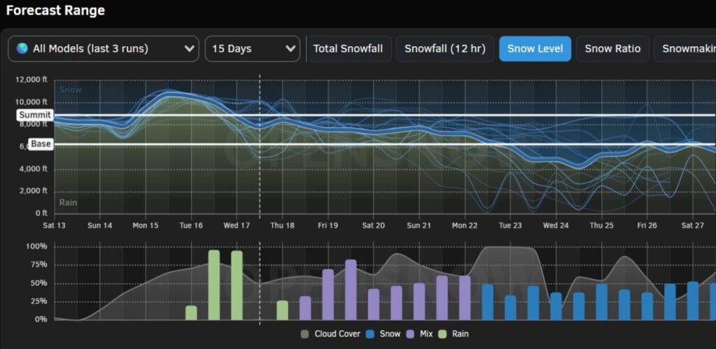
Monday Night – Tuesday Storm:

We could see partly sunny skies Monday morning with increasing clouds and wind. Ridgetop winds increasing to 70+ mph. The next storm moves into northern CA Monday evening and could last into Tuesday evening before ending by Wednesday morning.

We may see light snow showers reach the mountain later Monday evening, with the steadier snow holding off until after midnight Monday night into Tuesday morning. Then the heaviest snow is expected during the day on Tuesday as the cold front moves through.

Snow levels could start above the base around 6500-7000 ft. Monday afternoon/evening, but then falling below the base Monday night through Tuesday. We could see 8-14 inches of new snow at the base, and 14-20 inches on the mountain by Wednesday morning.

Long-Range:

We will see a drier pattern build in starting Wednesday through the end of the week. Expecting mostly sunny skies with highs in the 30s.

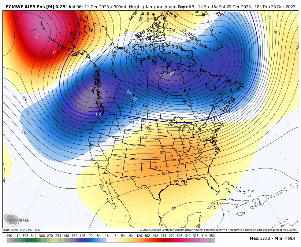
The long-range forecast models suggest we could start to see some colder systems moved down from the north the 2nd week of February starting around the 8th. More on that as we get closer.

BA

Share this article
Picture of Bryan Allegretto
Bryan Allegretto

Recent Posts

  • Weather ·
  • December 13, 2025·

Rain Tuesday Night into Wednesday

We are finishing out our 3.5-week dry spell this weekend into the start of next week. Then a more active…
Read more
  • Weather ·
  • December 12, 2025·

Unsettled Pattern Next Week

Another morning of subfreezing temperatures at the base, with the snowmaking crew able to make snow around the base areas.…
Read more
  • Weather ·
  • December 11, 2025·

Confidence Increasing in a Stormier Pattern

Myself and everyone here on the OpenSnow forecaster team are trying to hold back any excitement around the pattern change…
Read more

Social

Instagram Twitter Facebook Youtube

Contact

   Email Us
   1.800.403.0206

Our Partners

U.S. Forest Service Logo
1960 Olympic Valley Road
Olympic Valley, CA 96146

©2025 Palisades Tahoe

Alterra Mountain Company
  • Privacy Policy
  • Terms of Service
  • Photo Upload Terms of Use
  • Accessibility
  • Do Not Sell My Personal Information
  • Privacy Policy
  • Terms of Service
  • Photo Upload Terms of Use
  • Accessibility
  • Do Not Sell My Personal Information