

Myself and everyone here on the OpenSnow forecaster team are trying to hold back any excitement around the pattern change Christmas week that the models have been showing the last few days. But each day they agree and continue to show this pattern, the confidence is creeping upward.
We are only 4-5 days out from the first storm that could bring us rain, and about 8-9 days out from a possible wetter storm with slightly lower snow levels. So we do finally have storms within the 10-day window after a 3+ week dry spell.
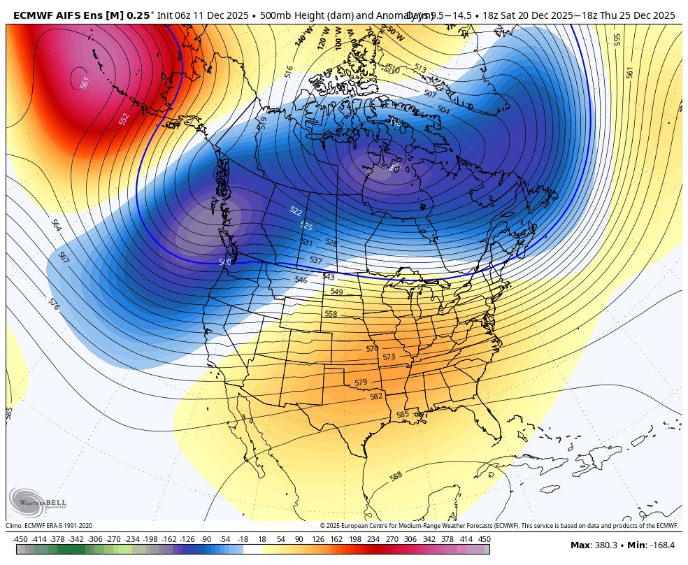
The potential for a colder and snowier pattern is still 10+ days out, so we still don’t want to lock it in or hype it up until we get closer. But the models are in great agreement on the pattern and consistent for the last few days now. Let’s look at the shift in 5-day increments.
The 15 Day Shift:
Thursday through the weekend, we have a strong high-pressure ridge over the West Coast with the dry and mild pattern continuing. Mostly sunny days continue with highs in the 50s. The latest model runs keep us dry into Monday, with the first chance of rain holding off until Monday night or Tuesday.
As we go through the week of the 15th, the ridge weakens and flattens with the trough to the north pushing a bit farther south, and more of a zonal flow into the Pacific NW and northern CA. We will have the chance to catch the southern edge of mild storms for most of the week.
The first storm could bring showers between Monday night – Tuesday, with a chance of rain showers each day through Friday or Saturday, the 19th-20th. Some model runs try to push in a wetter storm on Friday with slightly lower snow levels, so we’ll keep an eye on that.
Then, beyond the 20th through Christmas, the long-range models and ensemble mean model runs are in good agreement that a deeper trough digs in over the West Coast. That is where we are 10+ days out still, but starting to build some confidence that this pattern change could happen.
This pattern could open the door to wetter storms, maybe AR’s involved at times, and colder air from the north with lower snow levels as well. If it all works out just right, we could see a shift over the next two weeks leading up to Christmas that brings us a miracle of a healthy dumping of snow Christmas week.
Fingers crossed, I’ll keep you updated daily…
BA
