Snowfall Report:
So far 1-4″ of drier snow fell with this storm during the early morning hours Thursday from bottom to top.
Thursday – Thu Night Systems:
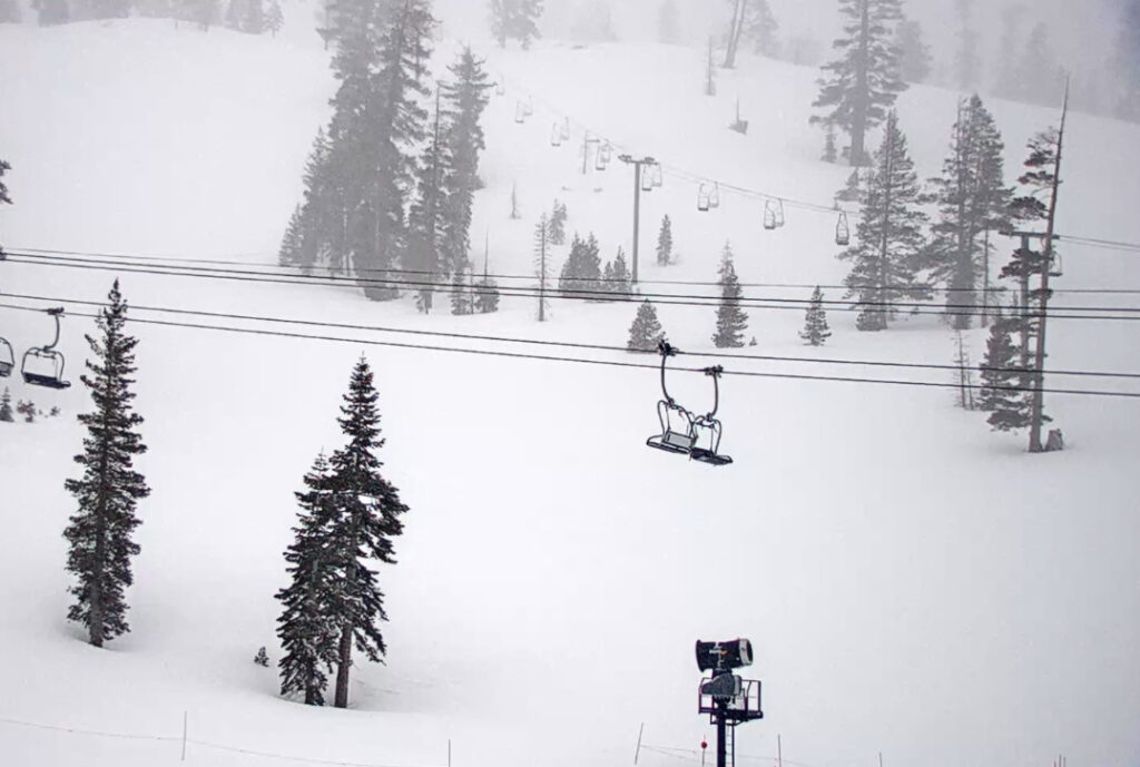
Snow showers continue Thursday morning and then could taper off some Thursday afternoon between waves. Ridgetop winds are gusting up to 40-50+ mph this morning from the southwest. They could drop off some during the afternoon. So the skiing could be fairly good for Thursday. We could see another inch or two Thursday morning.
The next wave brings increasing winds, precipitation rates, and snow levels Thursday night into Friday morning. Snow levels should be near the base Thursday evening, then rising up to around 7000-7500 ft. by midnight and to around 7500-8000 ft. by Friday morning. That means snow turning to rain from the base up to 7500 ft. overnight.
Snowfall forecasting for the lower mountain with the snow levels rising is always tricky. We could see a few inches on the lower mountain before the snow turns to rain and starts to erase that by Friday morning. The upper mountain above the snown line could see 5-10 inches of new snow by Friday morning.
Friday – New Year’s Eve Storms:
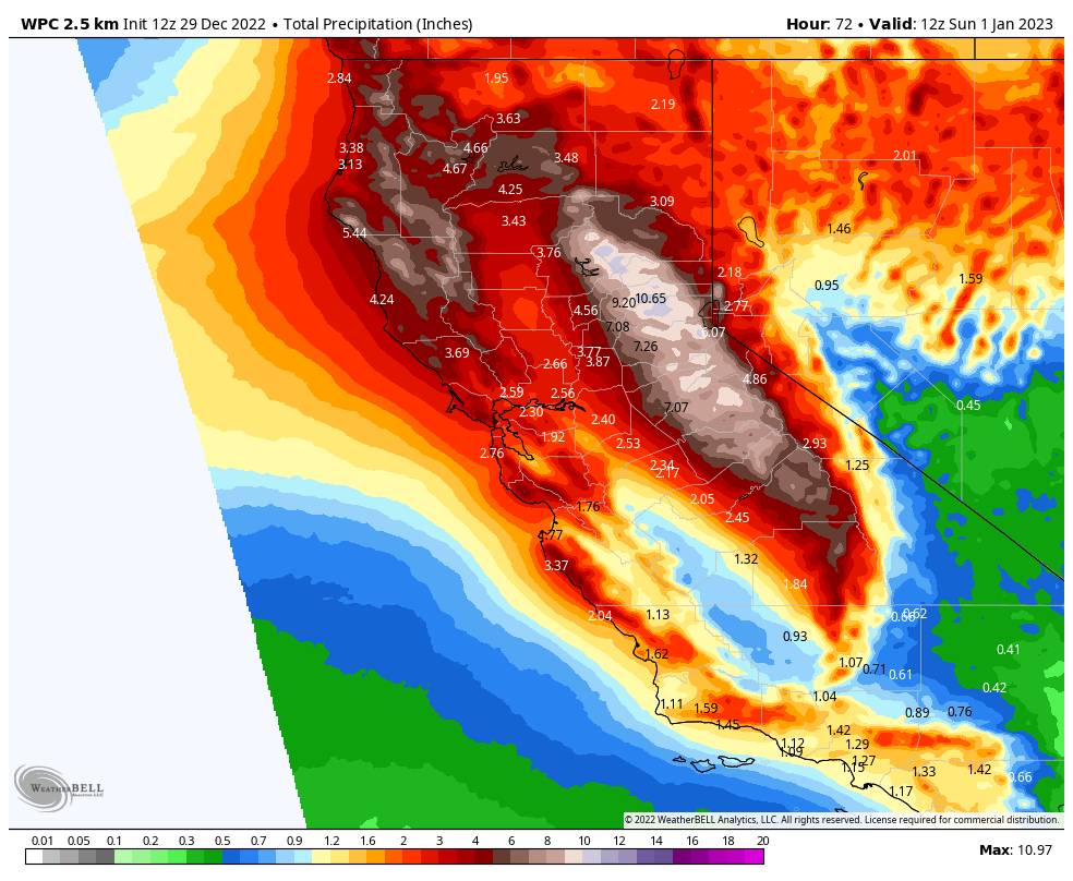
The next wave moves in Friday continuing the rain & snow with snow levels continuing to rise. Then a strong atmospheric river will be pointed at the Tahoe region Friday night into Saturday bringing very heavy rain & high elevation snow. Highs in the 30s both days. Ridgetop winds gusting up to 100+ mph from the southwest up top both days which should close down several upper mountain lifts.
Snow levels rise to around 8000-8500 ft. by midday Friday and could peak around 8500-9000 ft. Friday evening through midnight. That means we could see heavy rain on most of the mountain for a period. Then colder air starts to work in with snow levels down to around 7900-8400 ft. by Saturday morning, 7400-7900 ft. by midday, 6500-7000 ft. by Saturday evening, and dropping below 5000 ft. Saturday night.
That means rain changes to snow from top to bottom through the day on Saturday and reaches the base by sometime Saturday evening. Those snow level forecasts are our best calculation based on all of the weather data we have available, but they could be slightly higher or lower at times throughout the storm. A wet and windy storm is expected until later Saturday/Saturday night when it gets colder & winds drop.
Snow showers are expected to continue Saturday night with some light snow for the base and several inches of drier snow possible on the mountain at the end. Forecasting snowfall will be very tricky with the rising and falling snow levels. Also, some of the forecast amounts will fall before a change to rain, and then some after the change back to snow.
By Sunday morning we could see additional snowfall amounts of:
- 2-5 inches at the base. (higher if snow levels fall faster than forecast)
- 6-29 inches at the mid-mountain elevations. (a big range with lower amounts down lower and more the higher you go up with the fluctuating snow levels.)
- 29-36 inches up top. (above 8000 ft.)
Of note is that the forecast on our conditions page is for mid-mountain which is why it shows the lower end of the mid-mountain forecast shown above.
I’m not sure what will happen with the New Year’s Eve plans for the resort, but we should see the winds dropping and snow falling to the base through Saturday evening.
New Year’s Day:
We have a break between storms for Sunday (New Year’s Day). We should see mostly sunny skies by afternoon along with lighter winds. Highs into the 30s at the base and 20s up top.
More Storms Next Week:
The next storm is expected to move in Monday. It looks like a colder and weaker system, similar to the Thursday storm, with maybe a few inches of new snow on the mountain.
A possible break for Tuesday the 3rd before another strong storm could bring snow Tuesday night into Thursday the 5th. The snow levels look lower with this storm right now than with the storms this week. We’ll have more details on the storms next week as we get closer.

Long-Range:
Storms could continue into the weekend of the 7th-8th, and possibly into the week of the 9th.
We’ll keep you updated on the latest trends as we get closer…
BA